In brief: Tropical Storm Barry is a disorganized mess that will be inland over Mexico later today as a heavy rain producer. Another area to watch has now been formally identified in the NE Gulf or SW Atlantic. Tropical Storm Flossie is expected to become a hurricane in the Pacific. And we have some new information on the loss of critical satellite data today, which is important to include in our understanding of what’s happening.
Tropical Storm Barry
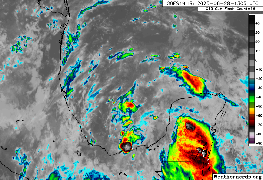
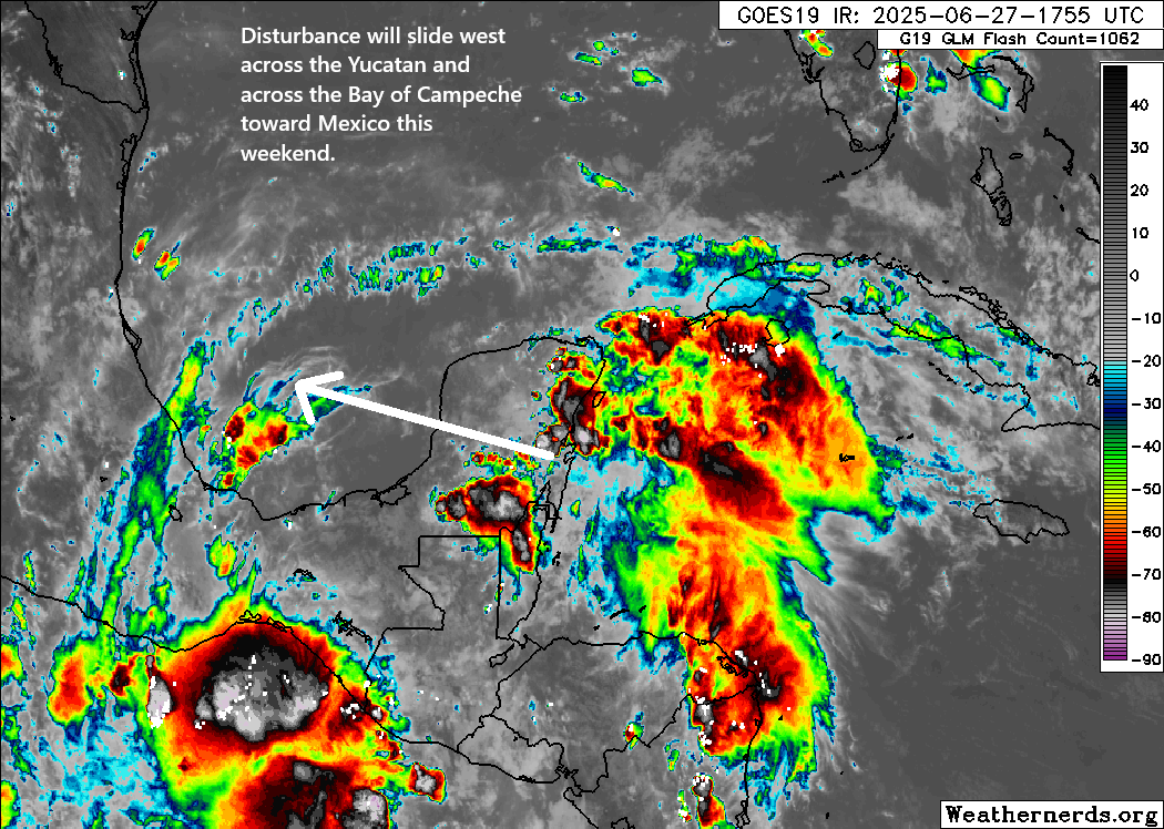
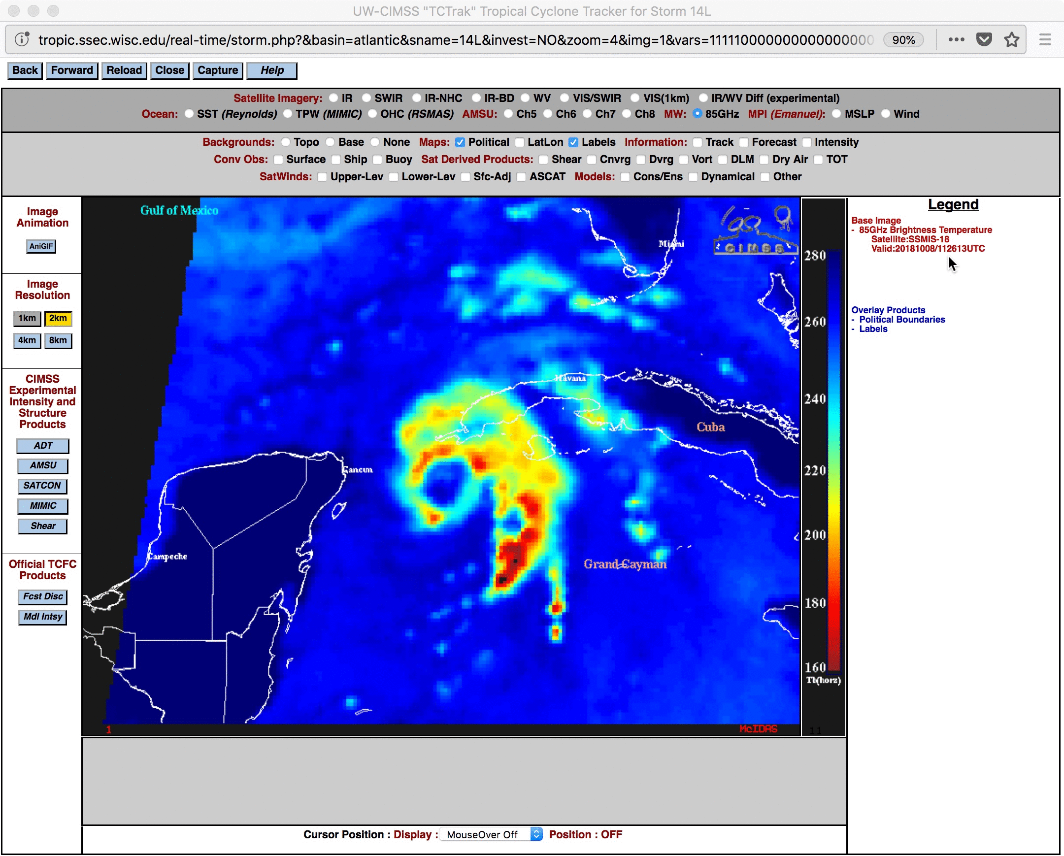
This post from hurricane researcher Andy Hazelton about sums up newly formed Tropical Storm Barry.
Barry is one of those “tropical storm in name only” systems. It’s about as disorganized a storm as we’ve seen lately.

Based on observations of wind direction and speed from an Air Force Reserve Reconnaissance in the system this morning, Barry got the upgrade. So it’s not like they’re just making this up out of thin air. But I think it’s safe to say than 100 years ago, it would be unlikely that this storm would have gotten a name.
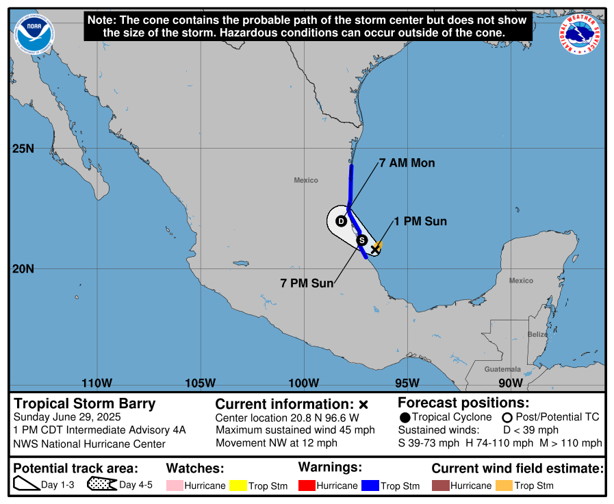
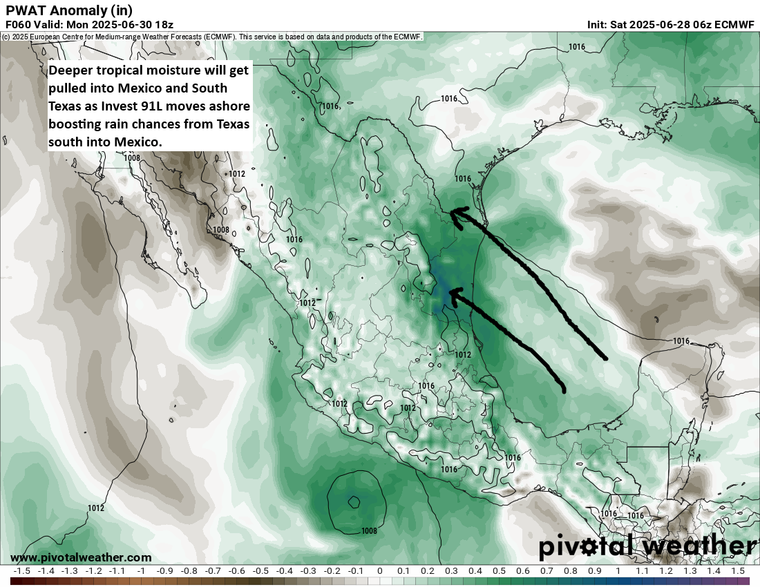
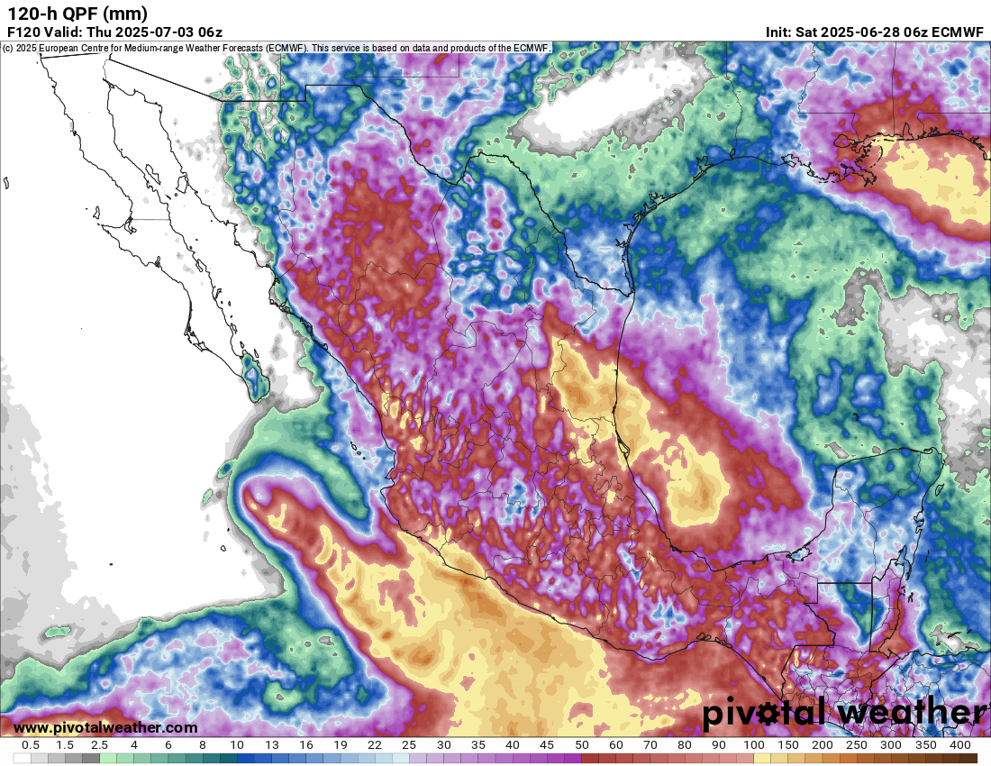
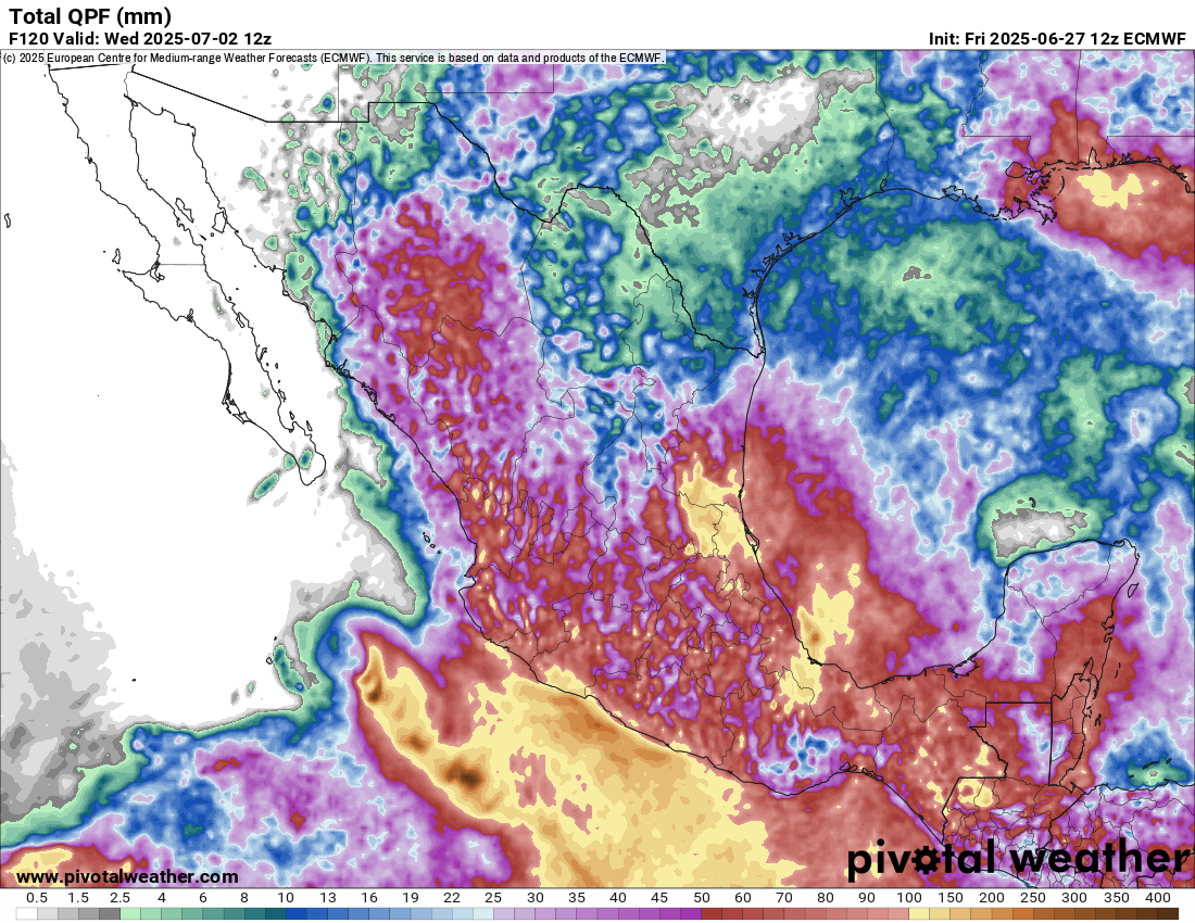
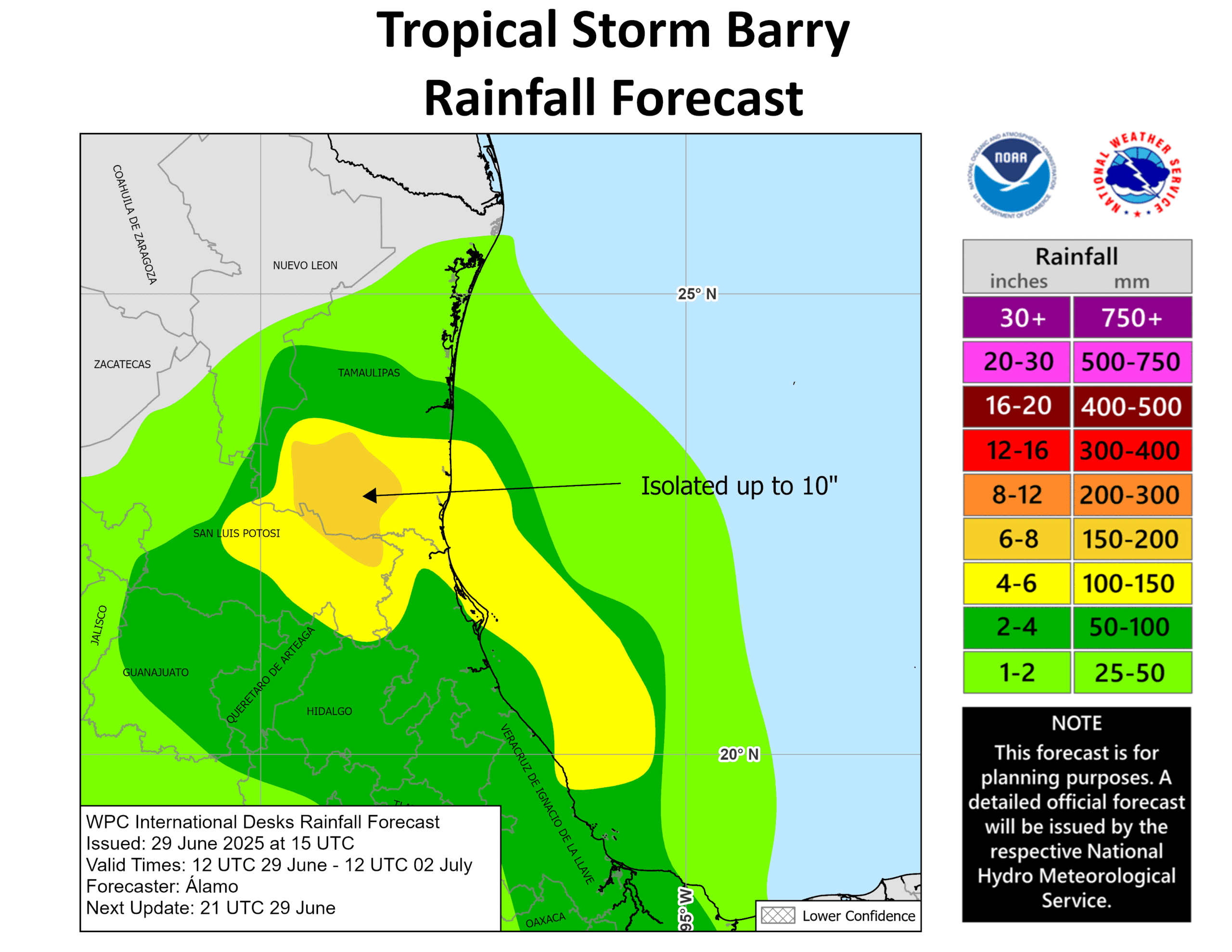
Whatever the case, Barry will scoot inland tonight. We’ll see if both Andrea and Barry combined can add up to 24 hours of cumulative tropical storm intensity for the season. Heavy rain is expected in Mexico from Barry with flooding possible.
Otherwise, Barry should be fairly efficiently wiped out once over land.
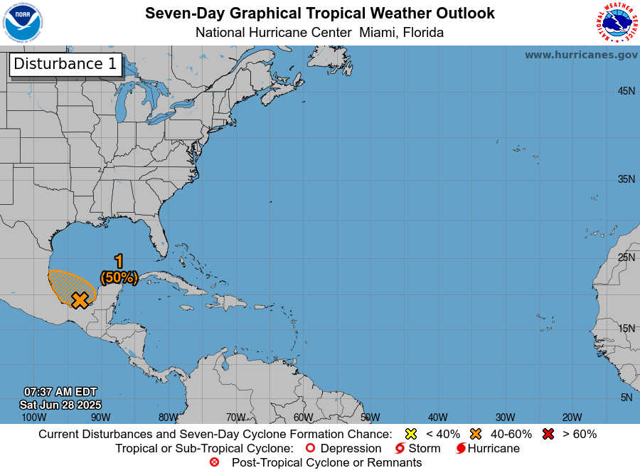
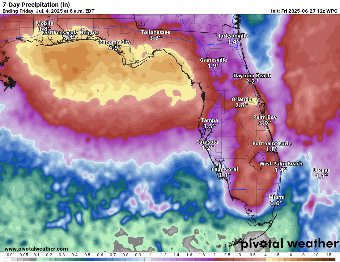
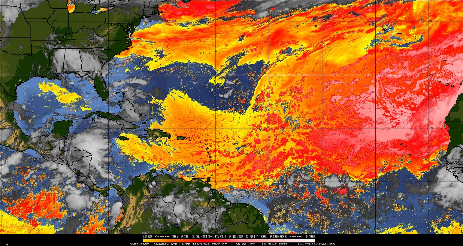
Northeast Gulf of Mexico or Southwest Atlantic
Models continue to hint at an area of disturbed weather emanating from a decaying cold front somewhere between the northeast Gulf and southeast Atlantic later this coming week.

Models are not exactly eagerly advertising a system here, so 20 percent odds of development seem more than reasonable at the moment. That said, there has been a consistency over several days now that suggests some sort of system could develop in that area over the July 4th weekend. In most cases, ensemble agreement is modest at best, intensity looks modest at best, and there is still more support for nothing formal than something even at this point.
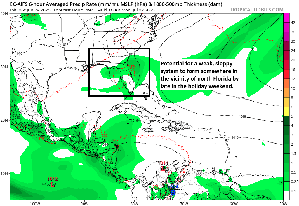
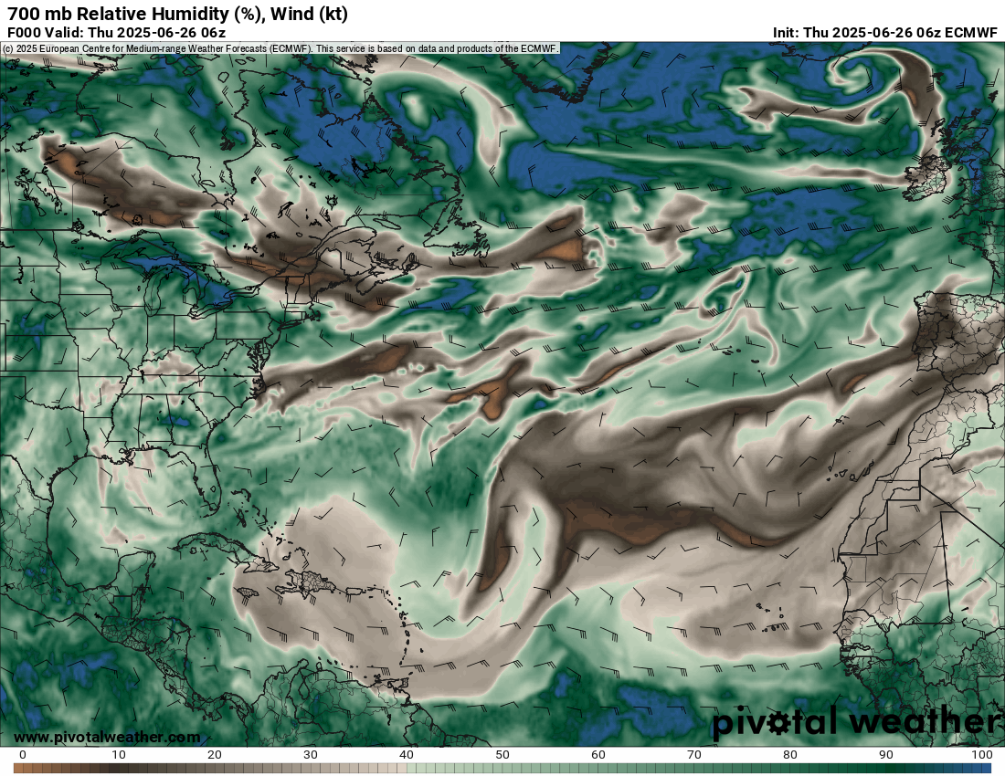
After last season’s successes, we’ve taken to integrating some of the AI forecast models more into identifying some of these possible risks in the medium-term, and in this case the European AIFS model seems to have modest support for a somewhat disorganized system near northern Florida. Other AI models are similar. The ICON (which also performed well in 2024) is a little more all over the place, but it also shows development risks in that same general area.
Bottom line: Something could develop, but right now the ceiling seems fairly low. We’ll continue to monitor through the week as models should hopefully latch onto expectations more.
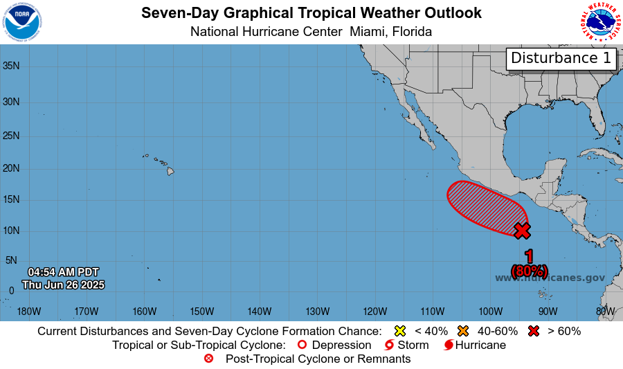
Pacific Tropical Storm Flossie
In the Eastern Pacific, the storm we had mentioned as likely yesterday is now Tropical Storm Flossie today.
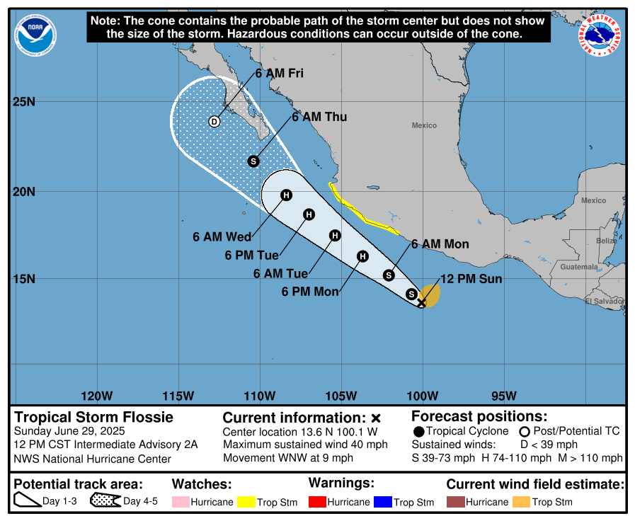
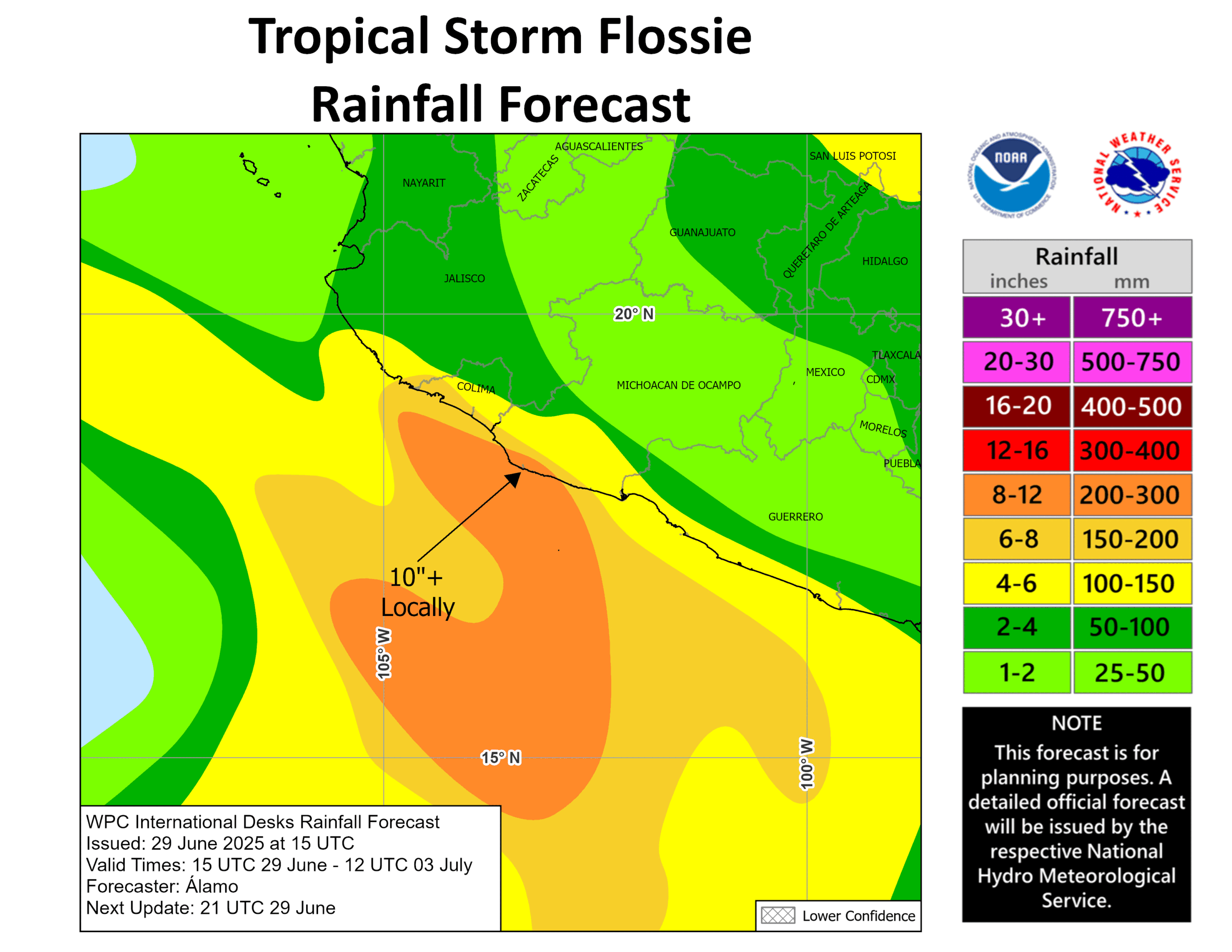
Flossie should pass far enough off the Mexican coast to avoid most hurricane impacts onshore. That said, a tropical storm watch is posted along a good chunk of the coast. And heavy rain is certainly a concern between Guerrero and Jalisco, where upwards of 10 inches (250 mm) may fall locally.
Behind Flossie there is another system that may develop well offshore of Mexico later this week. Busy busy continues!
Update on SSMIS data
Back on Friday I discussed the news about the DoD satellite data that was about to be abruptly on Monday. That is still happening, but the reality of why it is may be a bit more nuanced than just data being cut off. I just want to be clear that when we live in a questionable information environment, this is what tends to happen (and I even said it on Friday that something gets declared, there’s outrage, and then it’s pulled back). The transparency we’ve gotten from elected officials has been on the decline for years and certainly seems to be at its low right now. So in that “vacuum,” we can only really speculate. And while we all have our own opinions on the current state of affairs, it’s of utmost importance to be clear about what’s going on.
Anyway, a LinkedIN post from Jordan Gerth (you should not need a LinkedIN account to view this), who is a satellite expert that I know personally and have very high esteem for suggests that, while this is certainly a suboptimal decision, it is well within the realm of what was expected at some point. It’s just unfortunate that it’s hitting when it is and with such little advance notice. This is an important perspective to include in this story, and I encourage you to read his brief comments. It surely does not take away from the true fact that the overall weather infrastructure of the country has been degraded in the last 6 months, but with this particular decision, the blame does not fall at the feet of anyone in particular. It still creates a very big problem we need to manage this year and possibly beyond until we can get more instrumentation into space.