In brief: Tropical Storm Andrea formed yesterday — and dissipated yesterday. Heat records were shattered on Tuesday in the East, but the heat will slowly fade away now. Flooding risks continue in New Mexico, and more rain is likely on the way for the Southwest next week.
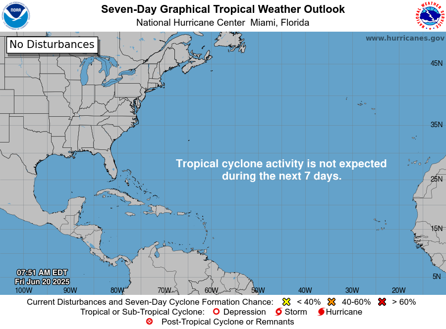
Atlantic
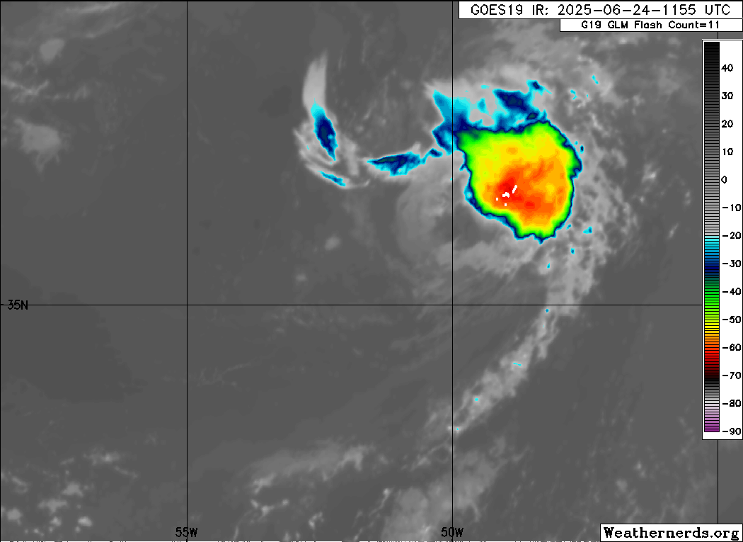
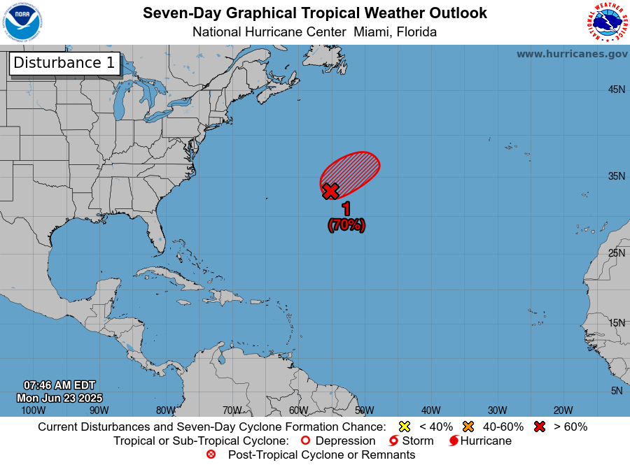
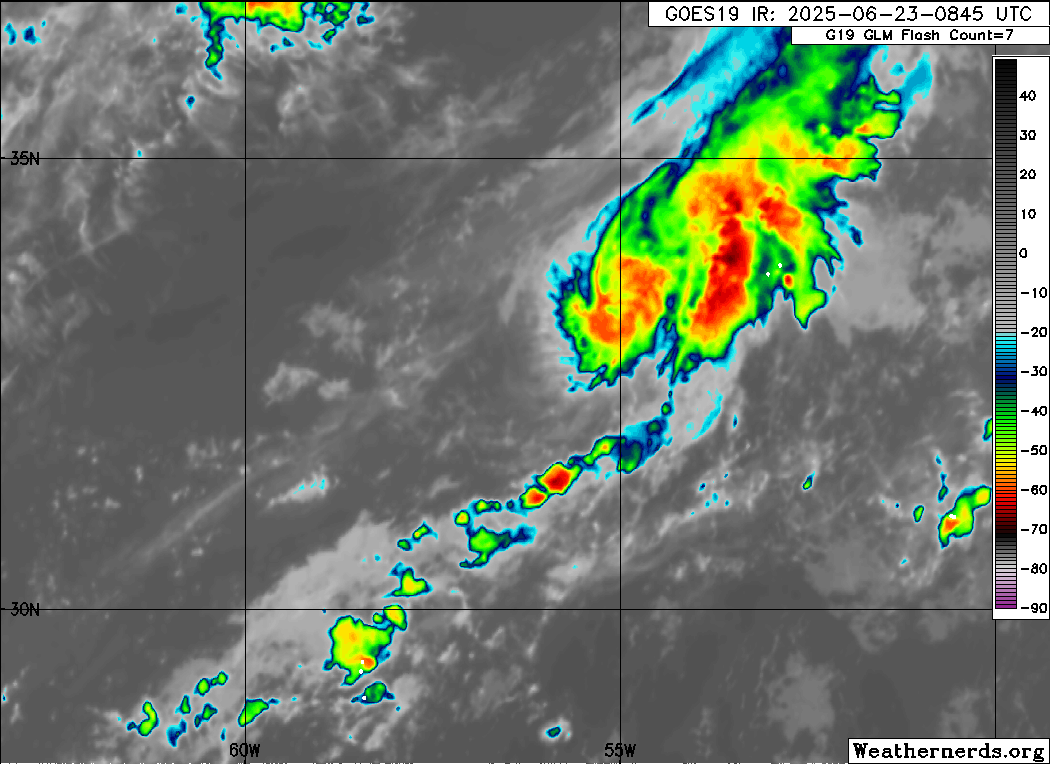
This morning, we start with a tribute to Tropical Storm Andrea. It formed yesterday morning around 10 AM Central Time. It left us a full 12 hours later. It fought a courageous battle but was ultimately no match colder water temperatures, drier air, and wind shear. Andrea set an example that all other tropical systems should seek to follow between now and November. For that, we are grateful.

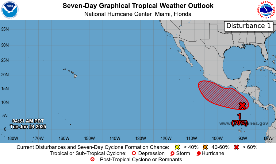
In all seriousness, with Andrea coming and going, the Atlantic looks to remain quiet for the next week or more. The Pacific will awaken again this weekend or so.
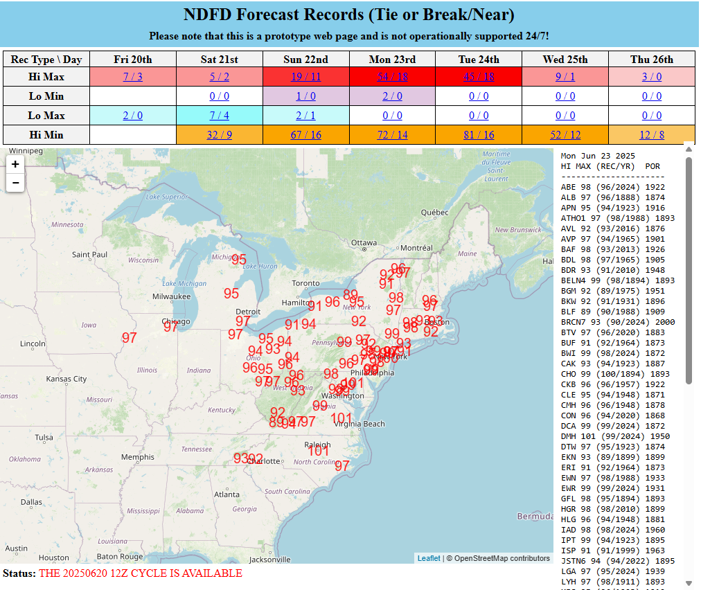
Heat records obliterated
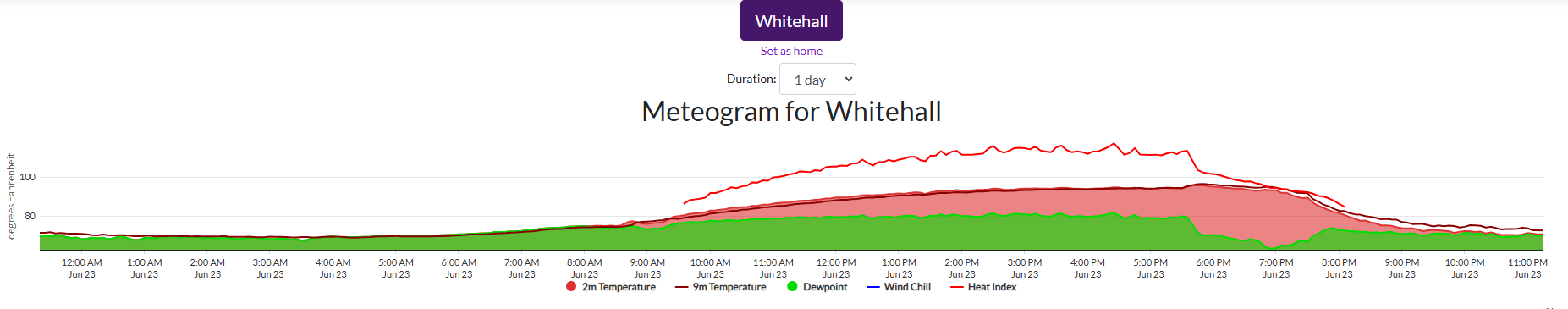
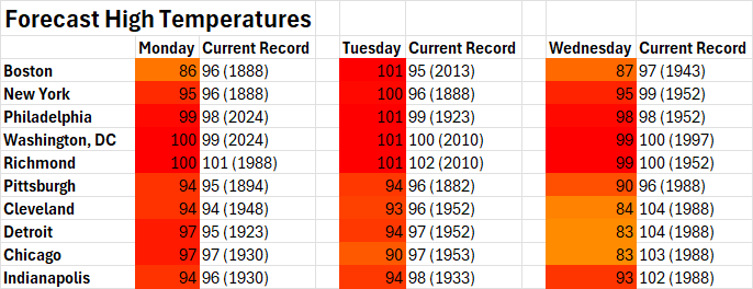
Let’s just talk for a moment about the heat yesterday in the East. On Monday, we saw outrageous dewpoints. Yesterday was about temperatures. State temperature records for June were tied or broken in Vermont, Maine, New Hampshire, Massachusetts, Rhode Island, Connecticut, and Maryland.
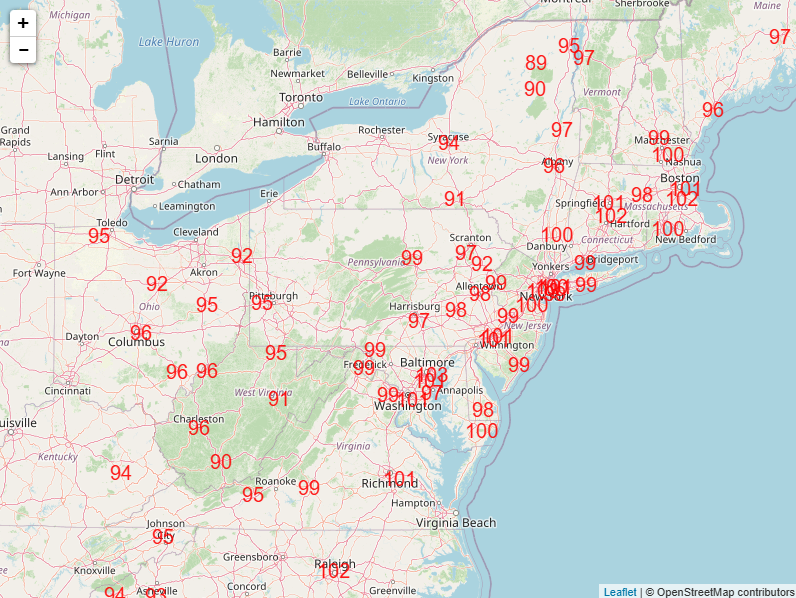
For Boston, 102° was their hottest June day on record and 4th hottest day overall on record. Providence saw their hottest June day on record and 6th hottest overall day on record. It wasn’t just the mayoral primary heating up in New York City. Central Park’s 99 degrees was a record for the date, but it fell short of June’s temperature record of 101°. LaGuardia’s 101° ties the June record. 102° at JFK Airport was tied for 3rd hottest all-time and set a new June record. The 103° in Newark, NJ ties for 12th hottest on record and ties the all-time June record. Shout out to my hometown of Atlantic City, tying for 6th hottest day on record at 102°. The hottest day on record was in June of 1969. Philly hit 101°, while Baltimore and DC were comparatively cooler at 98° and 99° respectively.
The heat will begin to ebb now. Another round of multiple temperature records are possible in the Northeast Corridor again today, but they will fall short of yesterday in most cases.
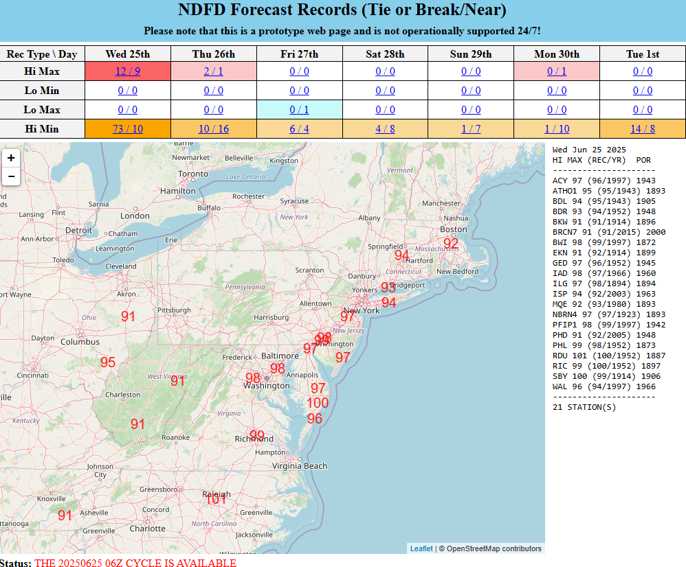
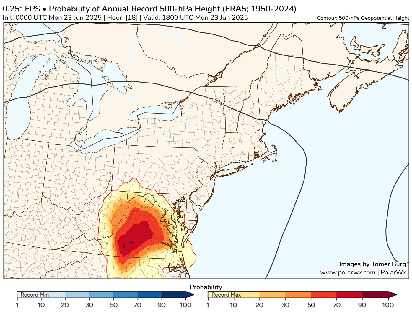
Notice how nationally (at the top of the image above) the number of records threatened drops off dramatically after today. The number of nighttime low warm records is pretty wild, but that’s worthy of another post on another day.
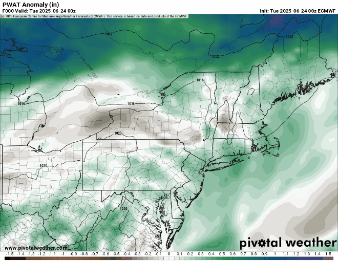
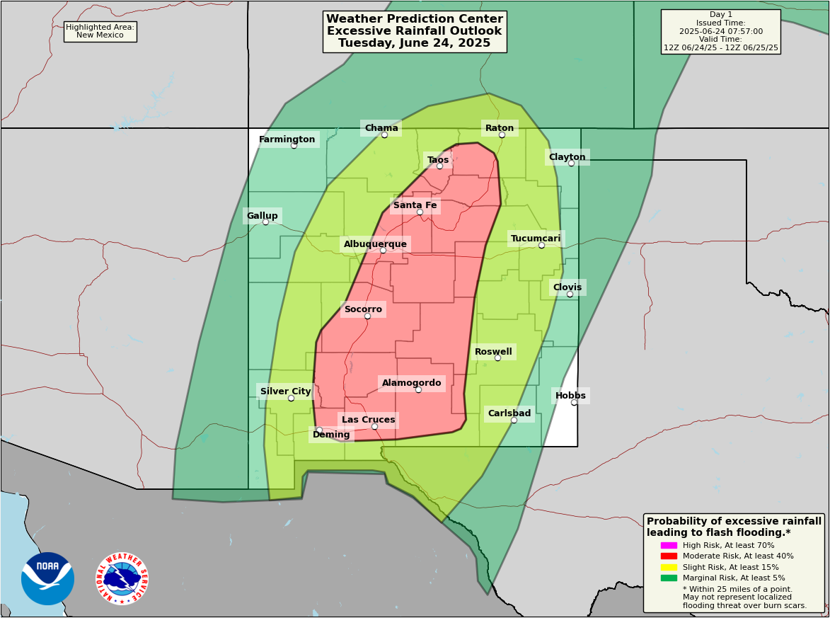
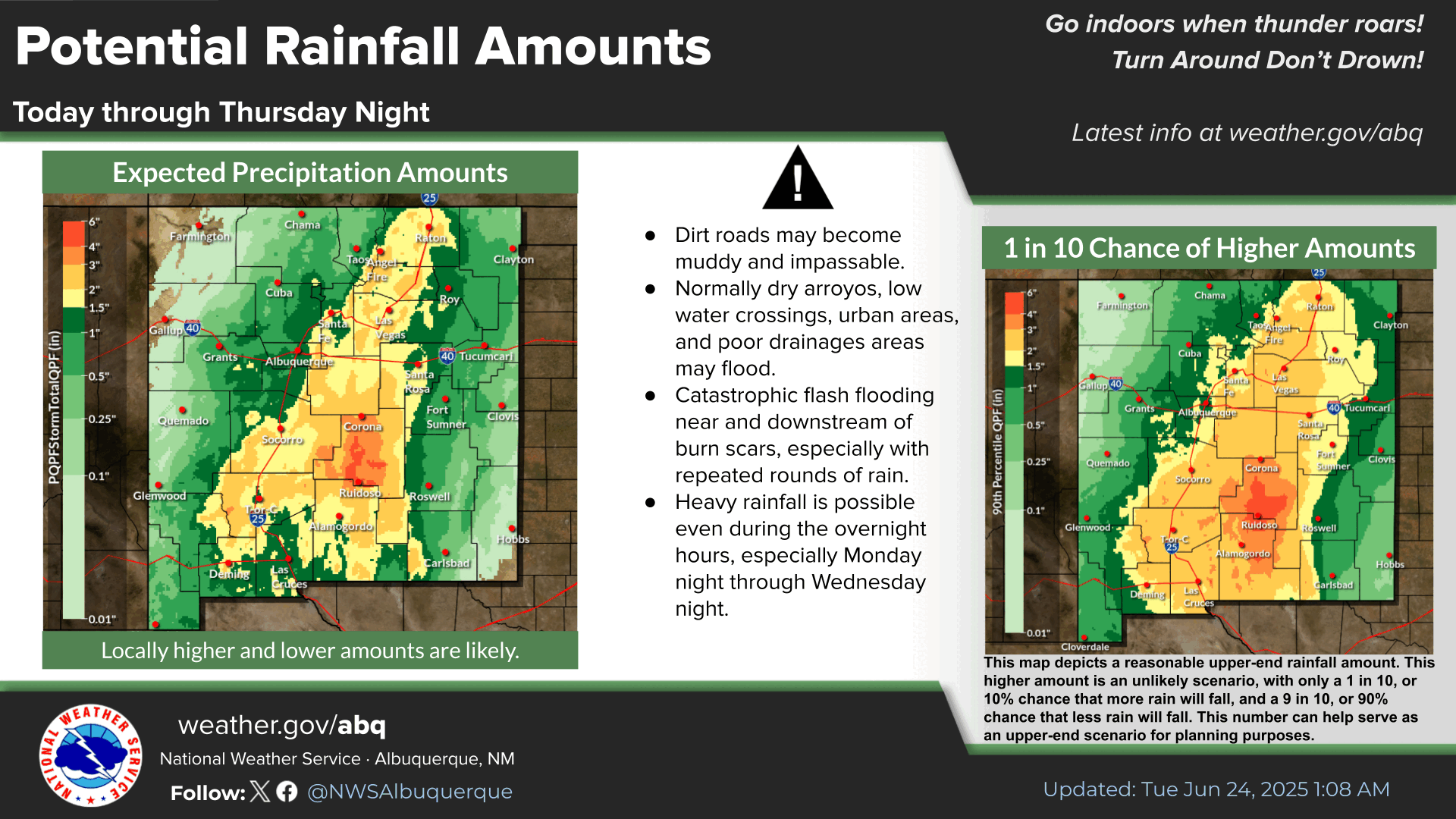
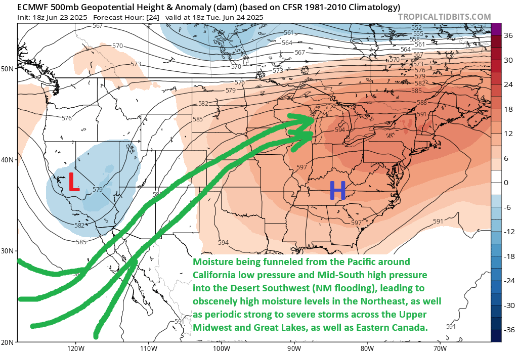
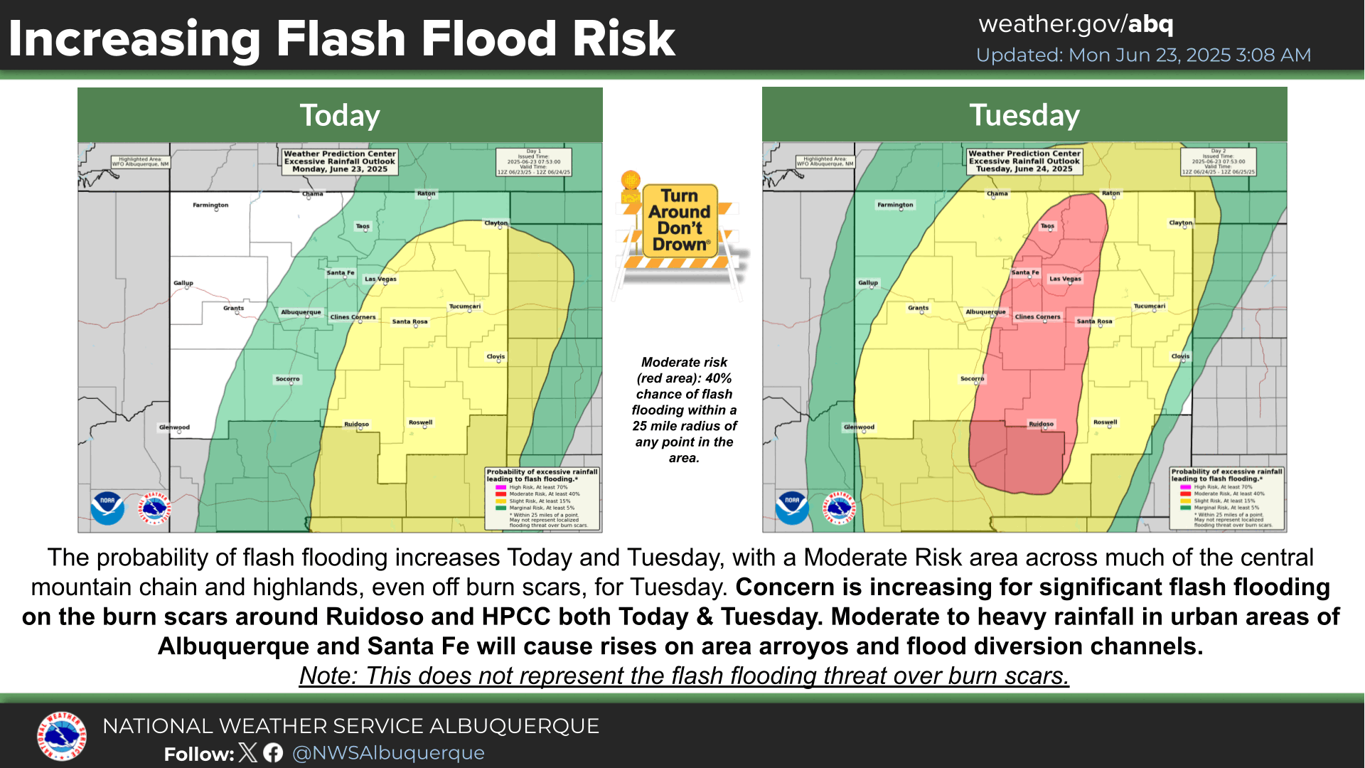
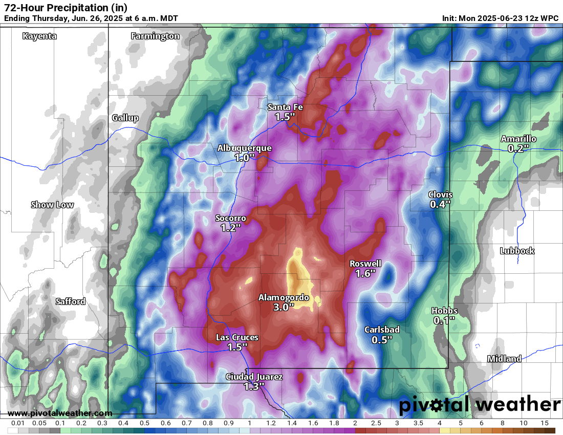
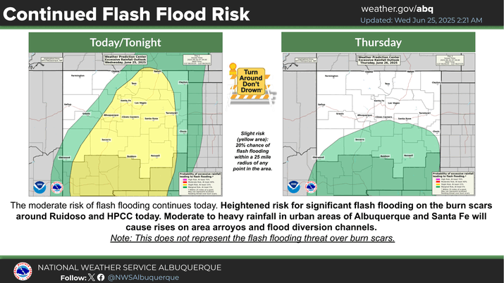
Desert Southwest soaking
Parts of New Mexico have received 3 to 6 inches of rain in the last 24 to 48 hours, triggering multiple flash flood warnings across the state on Tuesday.
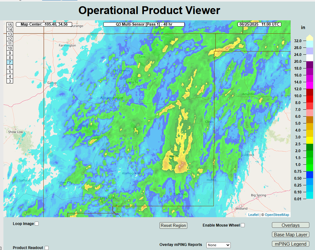
Additional showers and thunderstorms are likely today but hopefully in a more isolated fashion. Several more inches of rain may fall in parts of the state however before all is said and done.
Looking farther out in time, it looks like monsoon season is really going to begin to flex in the Southwest next week, with heavy rain possible again in New Mexico but also perhaps parts of Arizona and West Texas.
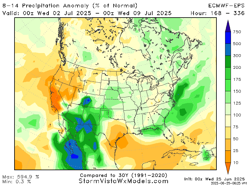
Keep in mind that 300 percent of normal in the Desert Southwest equates to about an inch or so of rain. So from that standpoint, it’s not a ton. That being said, some operational modeling does hint at higher totals than this. This far out, you’re just looking for a signal, and that signal is clearly pointing to an uptick in rainfall there.
Where does heat go next?
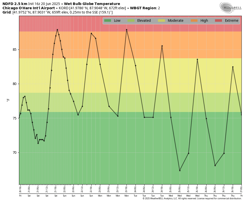
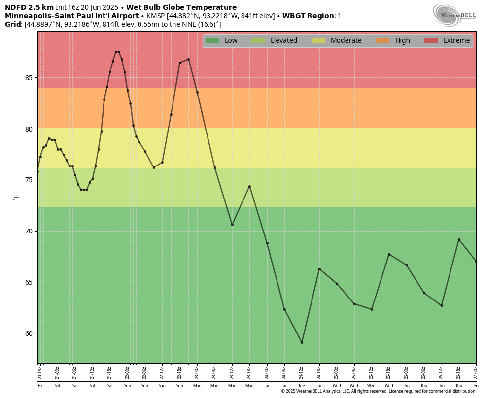
Heat will fade in the East, as we noted above. So where does it go next? Well over the next week or so, any heat should be transient in nature, meaning it’ll come and go in spots. Some places that may see an uptick in stronger heat include the Upper Midwest (Minneapolis could push into the 90s this weekend). The interior Northwest could see a burst of heat next week, with Spokane pushing the mid-90s by Monday or Tuesday. Thereafter, it may be Texas that sees the heat too.
Summer doing summer things after an extreme late June for parts of the country.