In brief: Hurricane Erick is expected to make landfall early Thursday morning in the state of Guerrero, east of Acapulco in Mexico as a major hurricane. Heavy rain, bad surge, and powerful winds will impact the Mexico coasts of eastern Guerrero and Oaxaca. In the U.S., a major heat wave will rev up this weekend and next week in the East.
Hurricane Erick
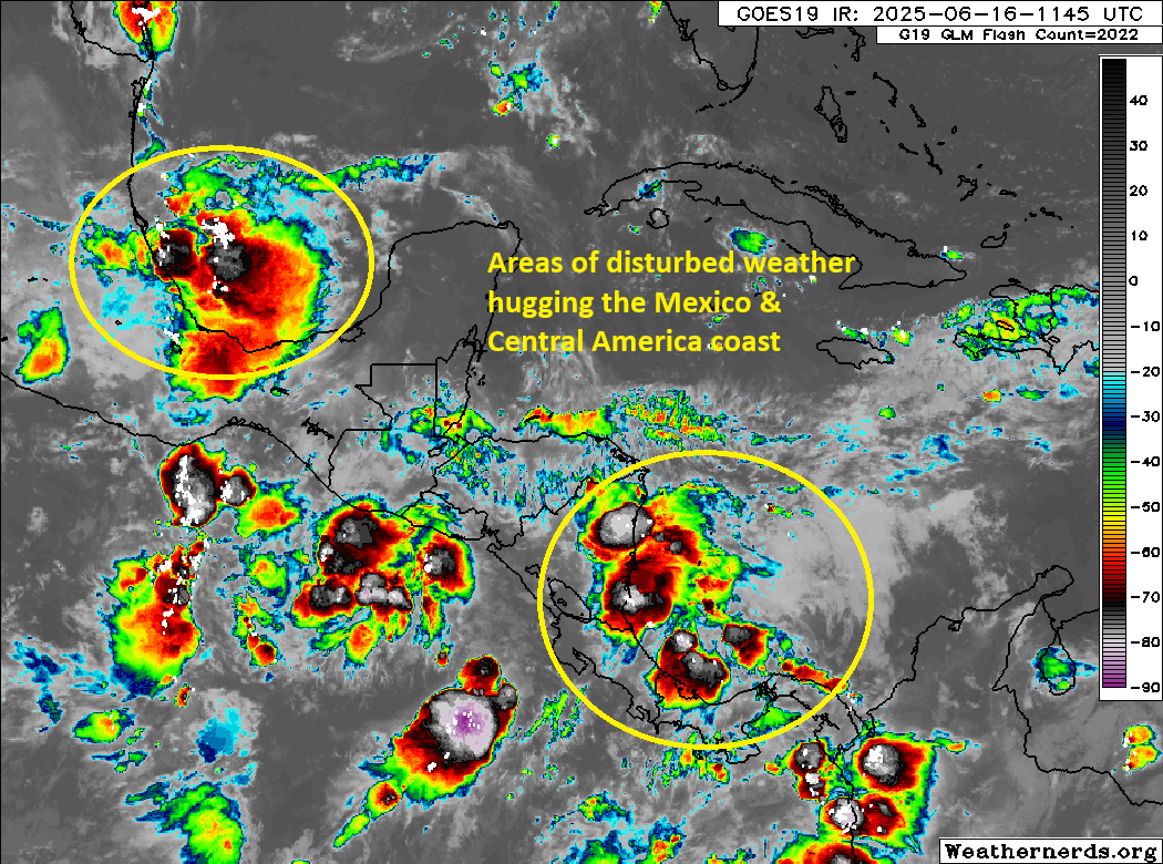
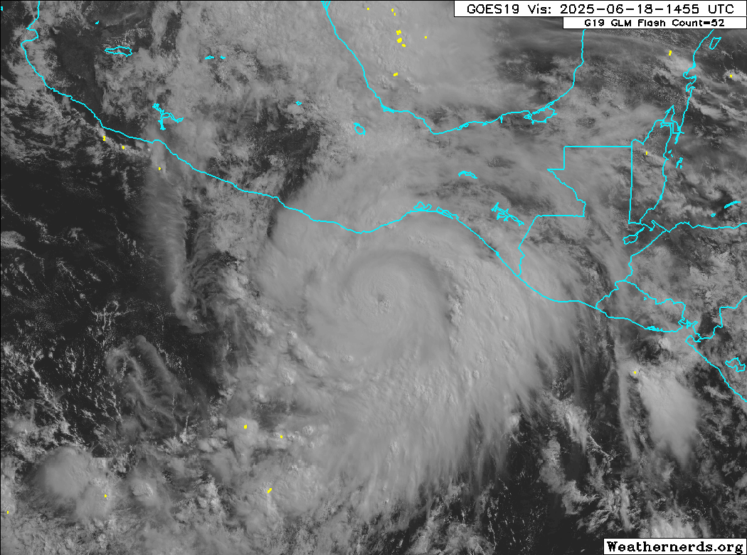
One look at Erick on satellite this afternoon, and you can see that this thing is well put together.
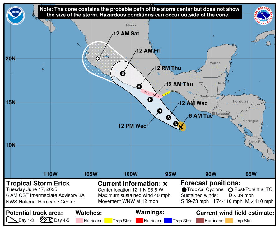
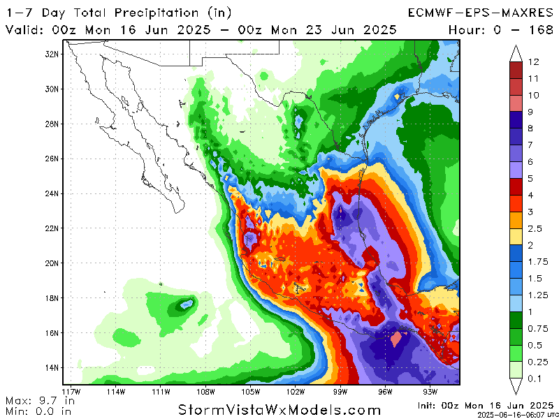
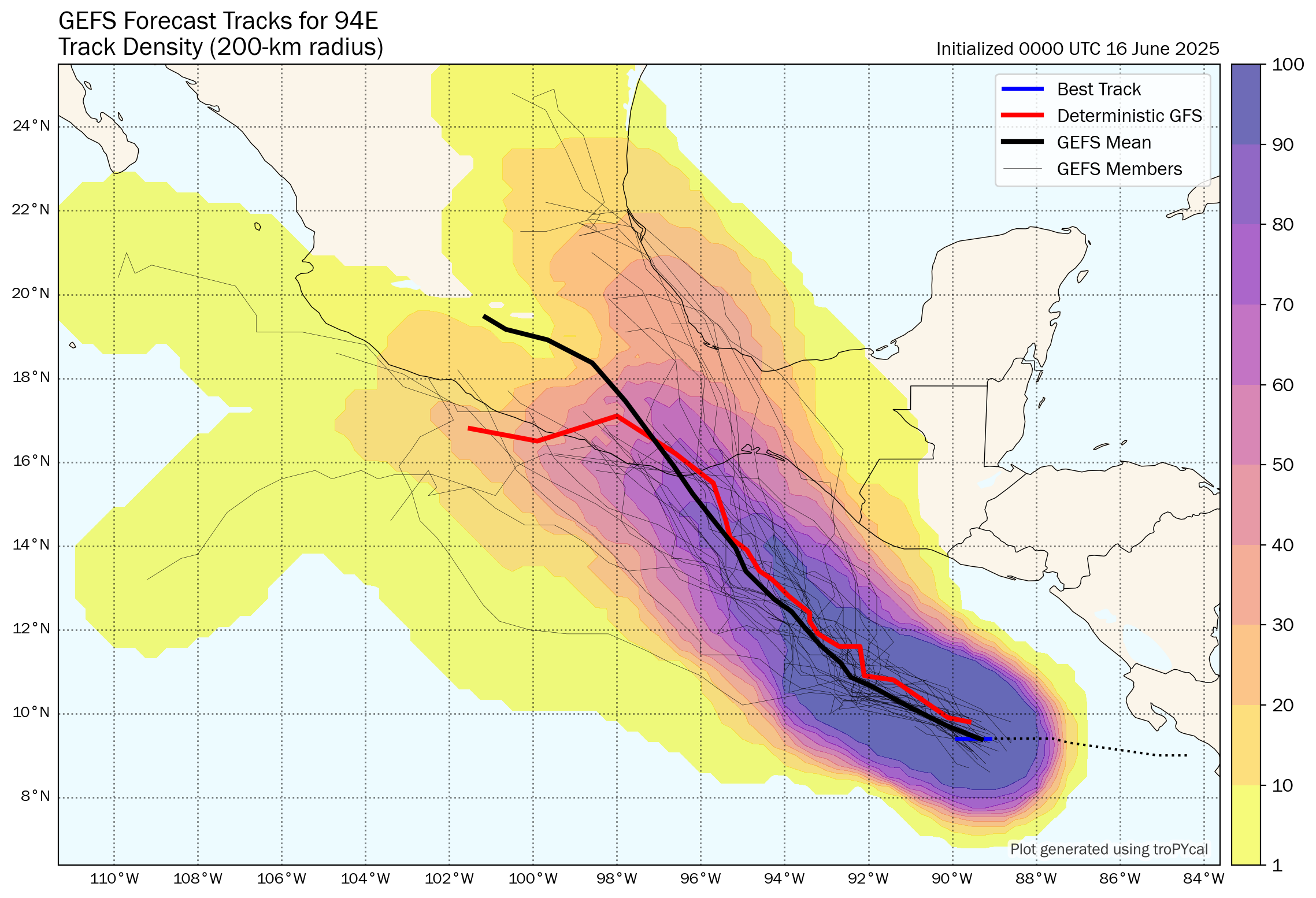
Erick was a 50 mph tropical storm this time on Tuesday, and it’s now a 100 mph hurricane. While there is still some uncertainty on how high Erick’s ceiling is, the track is coming into pretty clear focus now. Erick should make landfall later tonight in eastern Guerrero in Mexico, with significant impacts there (east of Acapulco) and in Oaxaca. Hurricane warnings extend from Acapulco to Puerto Angel, with hurricane watches west of Acapulco and tropical storm warnings on both sides of the hurricane warnings.
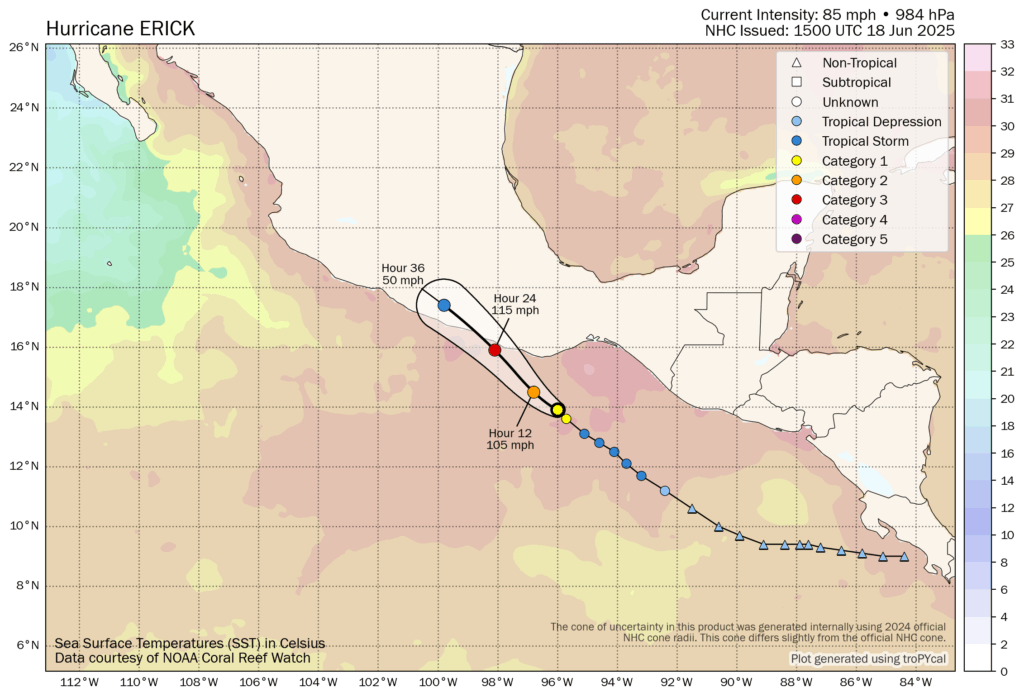
Erick is rapidly intensifying, and several models are pushing Erick into major hurricane status by tonight. Given that satellite loop above and the conditions ahead of Erick near the coast of Mexico, I see no reason why Erick won’t be at least a low-end Cat 3 when it makes landfall tonight.
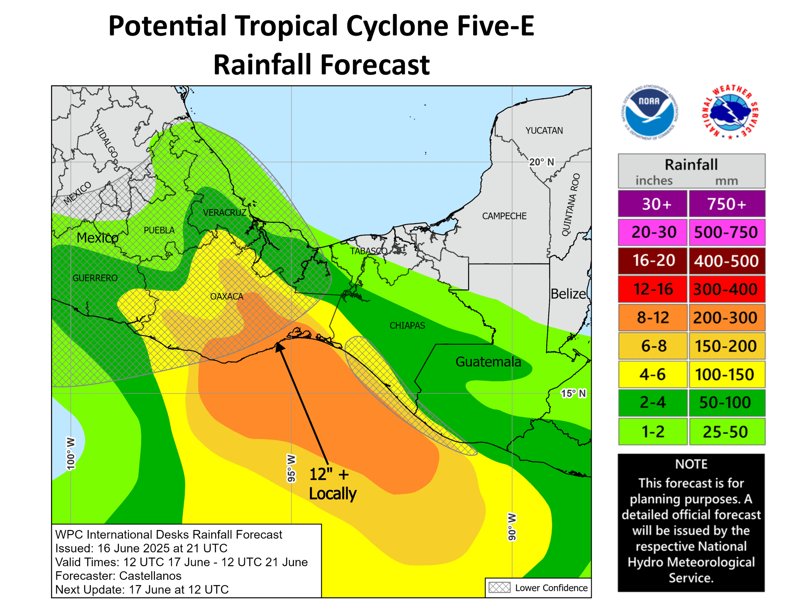
Obviously, Erick will bring a high end hurricane impact to the coast of Mexico tonight near and especially east of where it comes ashore, which includes much of Oaxaca. But impacts will go far beyond just wind and surge. In fact, rainfall forecasts call for a total of 16 to 20 inches (400-500 mm) of rain in coastal Oaxaca.
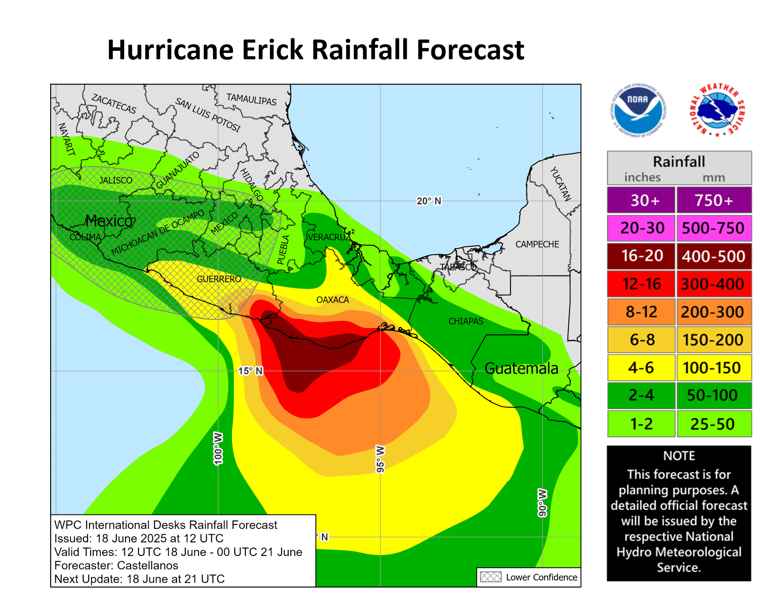
This will be a very bad night in coastal Oaxaca and portions of coastal Guerrero. Thought with folks there as the first big storm of the 2025 season bears down on Mexico.
Erick will dissipate over Mexico as it lifts north inland over the mountains.
Eastern U.S. heat wave upcoming
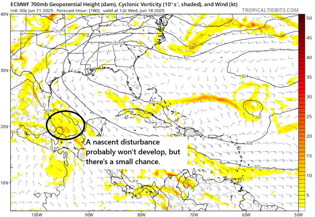
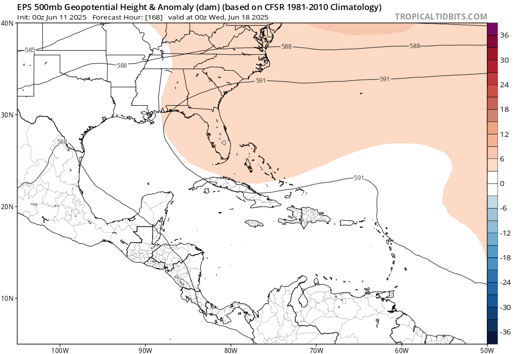
With the rest of the tropics quiet at this time, we’ll take a quick look at the upcoming heat wave that’s expected to unfurl over the Eastern United States. An extremely impressive and large area of sprawling high pressure is going to intensify and expand over the eastern half of the country this weekend and next week.
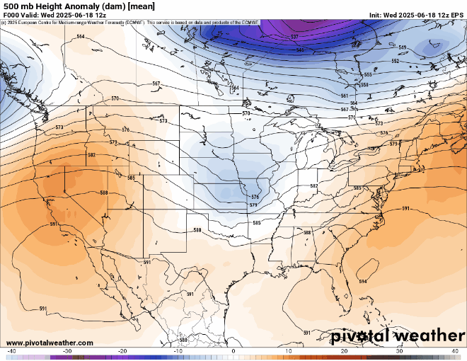
In some areas, it’ll be interesting to see just how strong this ridge gets, with the Euro ensemble suggesting that there’s a non-zero chance that upper level heights will reach all-time records.

This type of heat event will likely threaten a number of records in the Midwest, Northeast, and Mid-Atlantic next week. In fact, you can see based on current NWS forecasts (which are often somewhat conservative 6 to 7 days out), we’ve got several dozen record warm minimums forecast or threatened and several record highs as well.
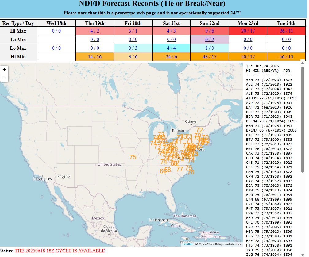
It’s the nighttime minimum temperatures that never cool off that can separate a bad heat wave from an unbearably bad one. So seeing this many forecast records this far ahead of the event is impressive and concerning. Heat precautions will be advised next week in the East!
The pattern should relax some later in the week.