Headlines
- Tropical Depression 4 is now Tropical Storm Debby.
- Debby is expected to track toward the Panhandle or Big Bend of Florida as a strong tropical storm or intensifying Category 1 hurricane Monday.
- Copious amounts of rain will follow Debby into Georgia and South Carolina where significant flooding may unfold.
- Debby’s exact track beyond Monday or Tuesday is highly uncertain.
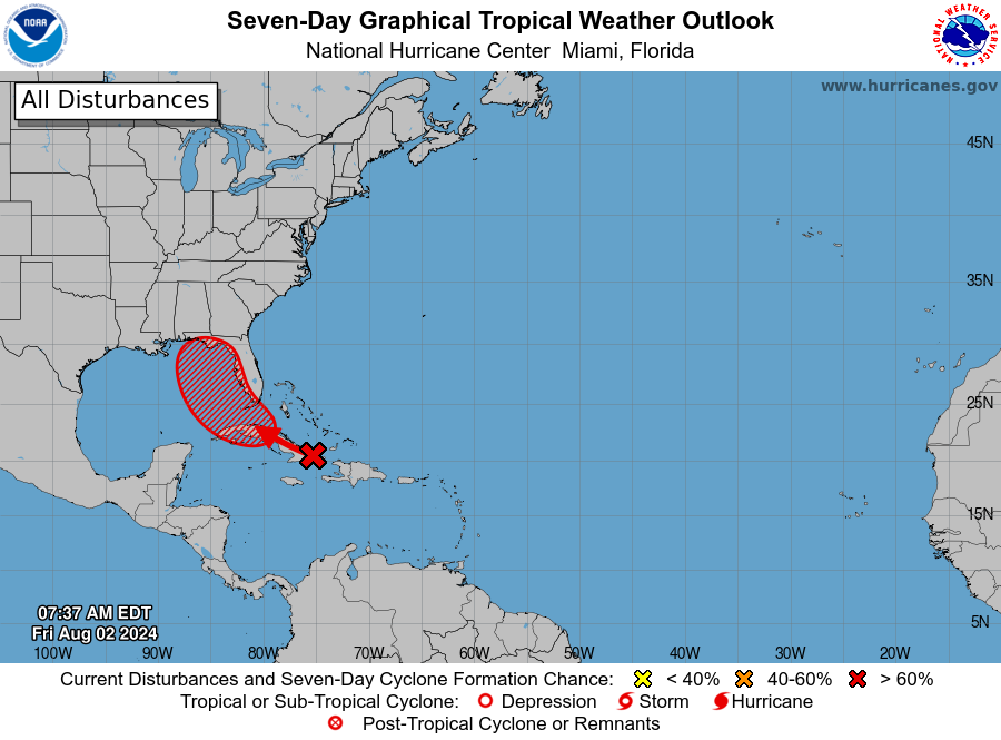
- There is another wave beyond Debby worth monitoring next week.
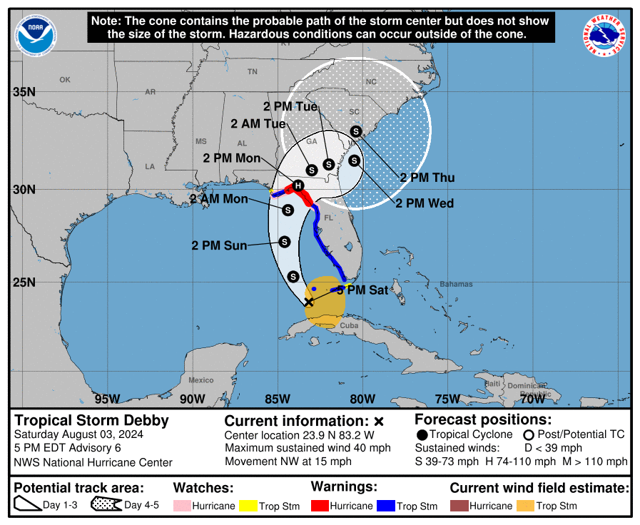
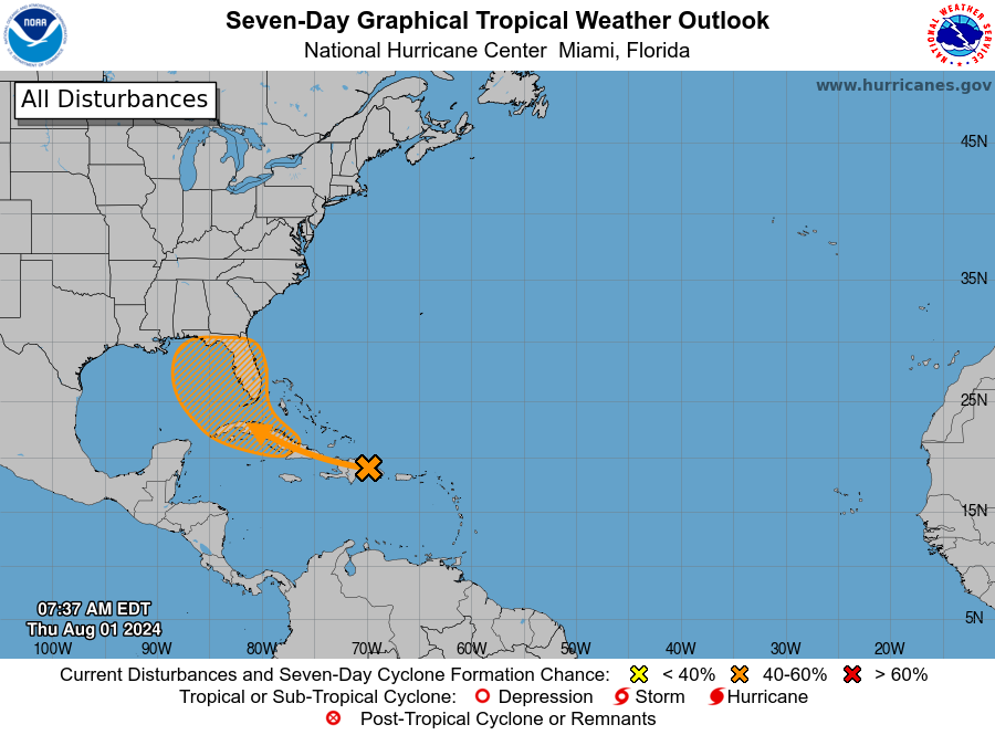
Tropical Storm Debby: 40 mph, NW 15 mph
Well, here we go again on the west coast of Florida, with another system that will generate some headaches in terms of track. This afternoon, newly minted Tropical Storm Debby looks reasonable. The center shows up nicely on visible satellite, and there is plentiful thunderstorm activity surrounding all sides of the system. As this lifts northward into the Gulf and gets out of the way of Cuba, I suspect we’ll begin to see some consolidation and steady intensification of this one.
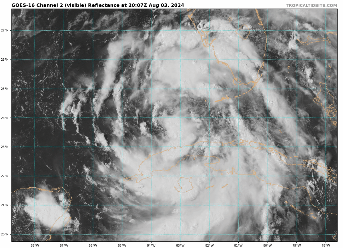
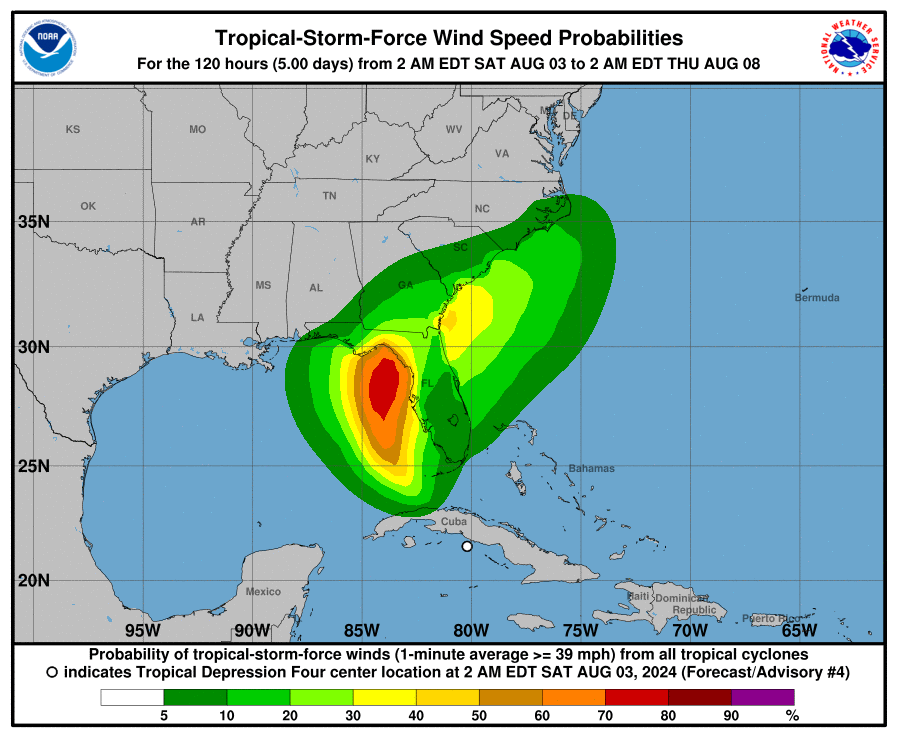
The current intensity has it sitting around 40 mph maximum sustained winds, hence the upgrade to a tropical storm. Debby is large in size, (not quite a “Little Debby”) which means it may take a little effort to strengthen. Debby should become a formidable tropical storm, if not a category 1 hurricane before coming ashore. Hurricane warnings are now posted from the Suwannee River to the Ochlockonee River on the Florida Gulf Coast. Tropical Storm Warnings are posted for the west coast of Florida into the Keys. Storm Surge Warnings are in effect between Aripeka north to Indian Pass.
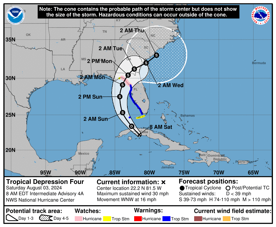
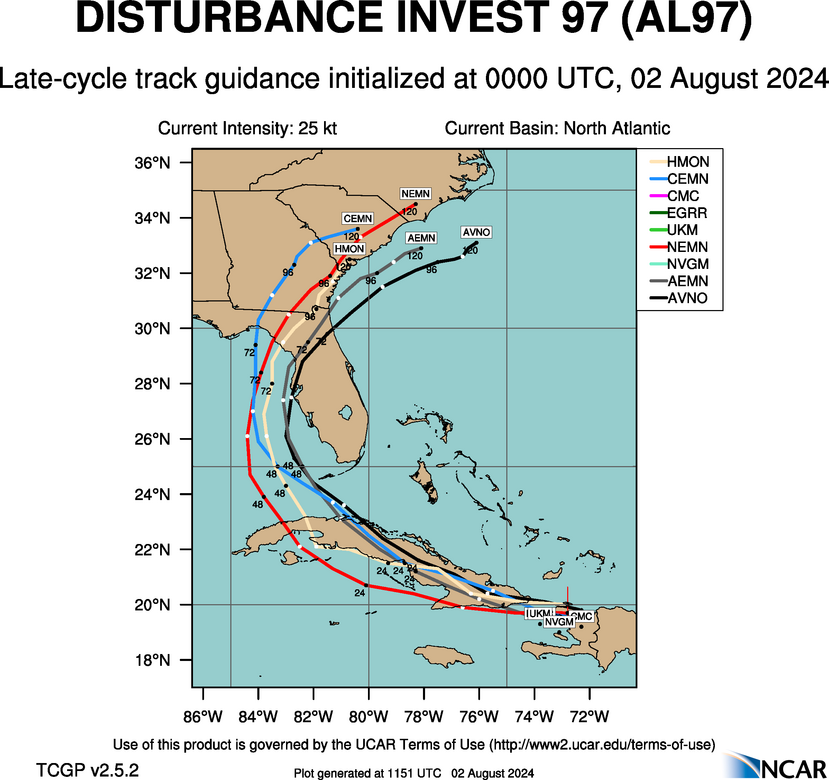
Debby’s track
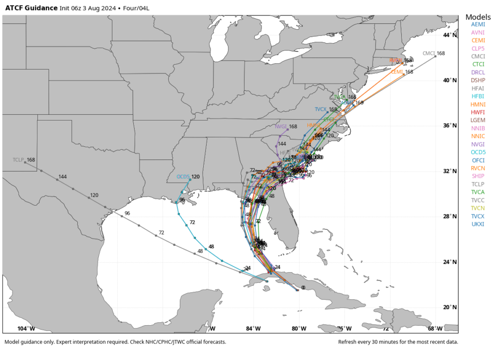
Debby will be steered north and northeast in between two ridges and in the direction of a trough over the East Coast. Arguably, the track forecast for Debby has the least uncertainty over the next 48 hours or so, and most modeling is in good agreement on that.
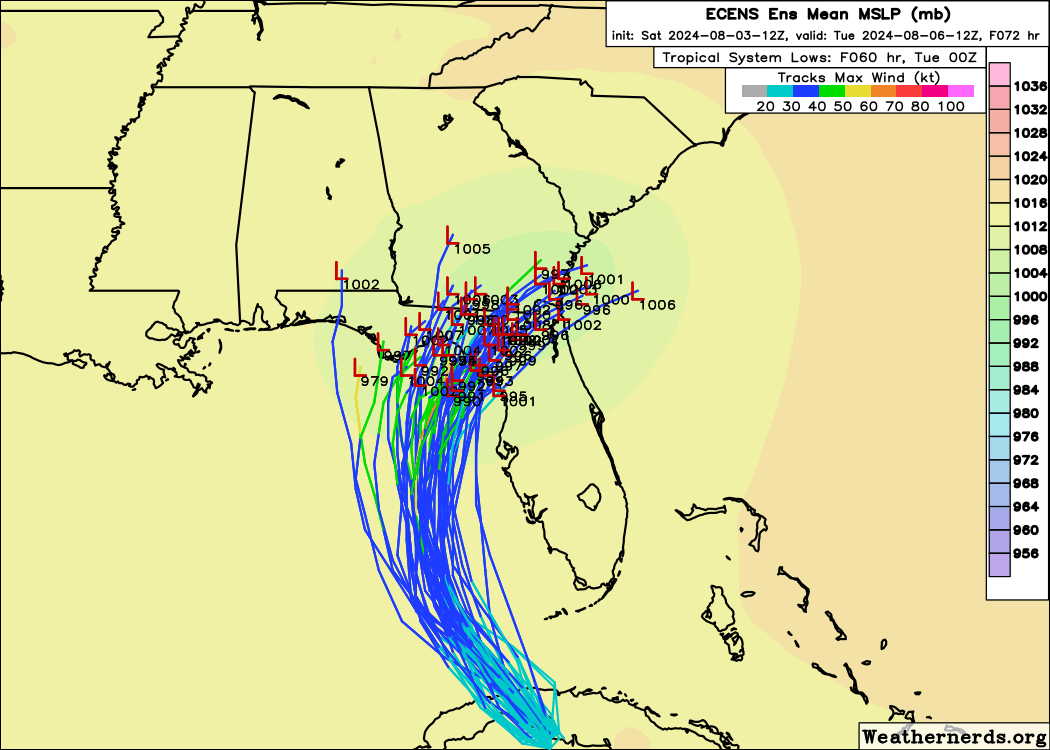
After Debby comes ashore somewhere in the Big Bend or Panhandle, that’s when forecast confidence begins to nosedive a bit. A generally slow east or northeast drift to Debby’s motion should set in. But exactly whether or not that gets Debby back offshore and with an ability to try and restrengthen off the Georgia or South Carolina coasts remains to be seen. Expect a very erratic motion to Debby after Monday.
Debby’s intensity
As noted above, there is some chance that Debby can become a hurricane before it comes ashore in the Big Bend or Panhandle Monday morning or so. The obvious comparison for this storm will be Idalia from last year. Idalia made landfall as a weakening category 3 hurricane with 125 mph maximum sustained winds. Debby is likely to make landfall not far from where Idalia did but as a strengthening tropical storm or category 1 hurricane. Much like we witnessed in Houston and coastal Texas last month with Beryl, there are elements about strengthening category 1 storms that are often underplayed ahead of time. Folks in the Panhandle and Big Bend should be taking Debby seriously and listen to local officials in terms of evacuation orders or preparedness recommendations.
After landfall, Debby will lose some of its intensity, though some locally strong winds are possible across south Georgia or North Florida as it turns east. Again, the big wild card right now is what Debby does when it approaches the Georgia coast and makes an effort to get offshore.
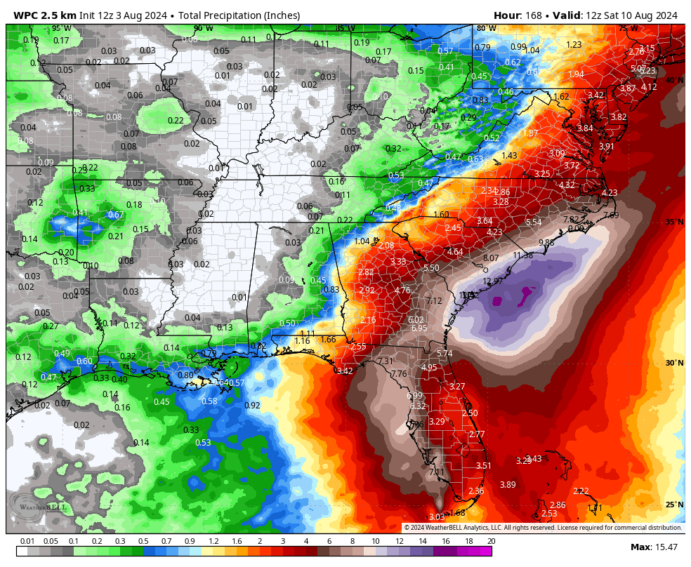
Debby’s rainfall
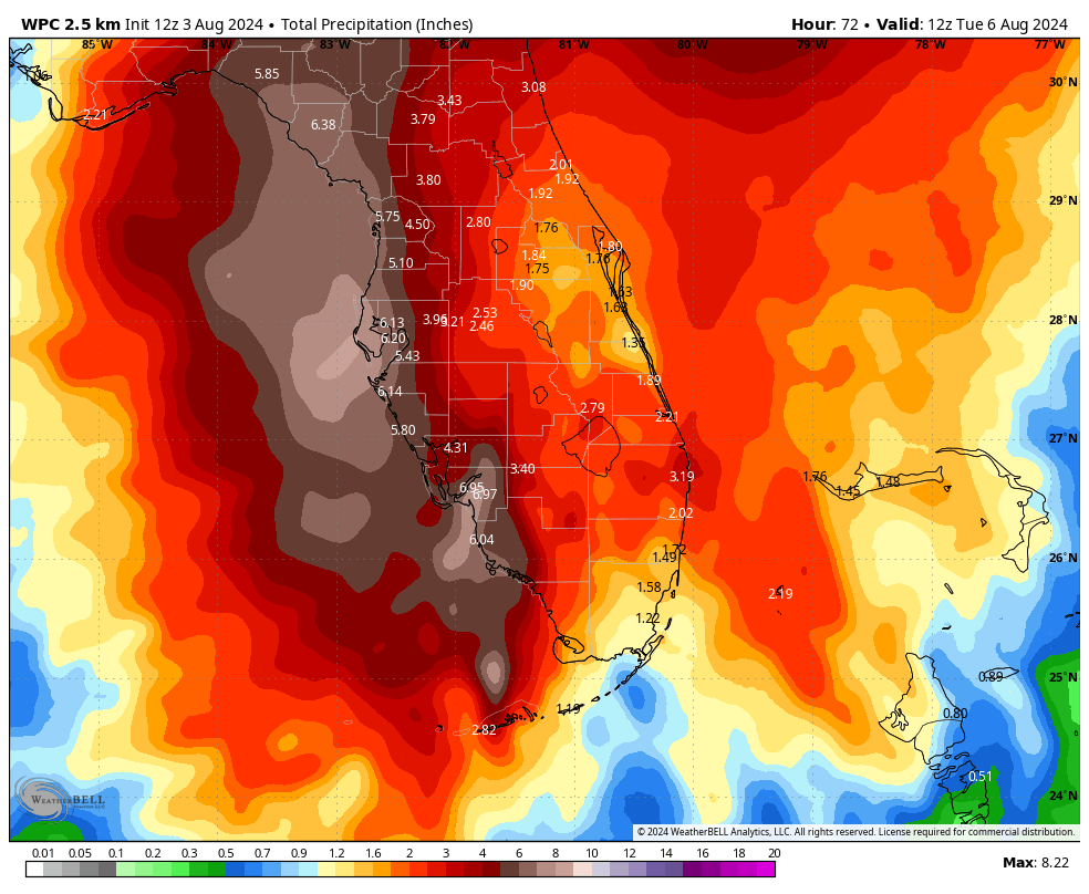
While folks on the Florida coast need to be preparing for a strengthening category 1 hurricane, people across North Florida, Georgia, and the Carolinas need to be preparing for a potentially major rain and flooding event.
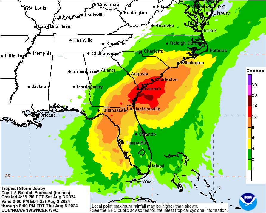
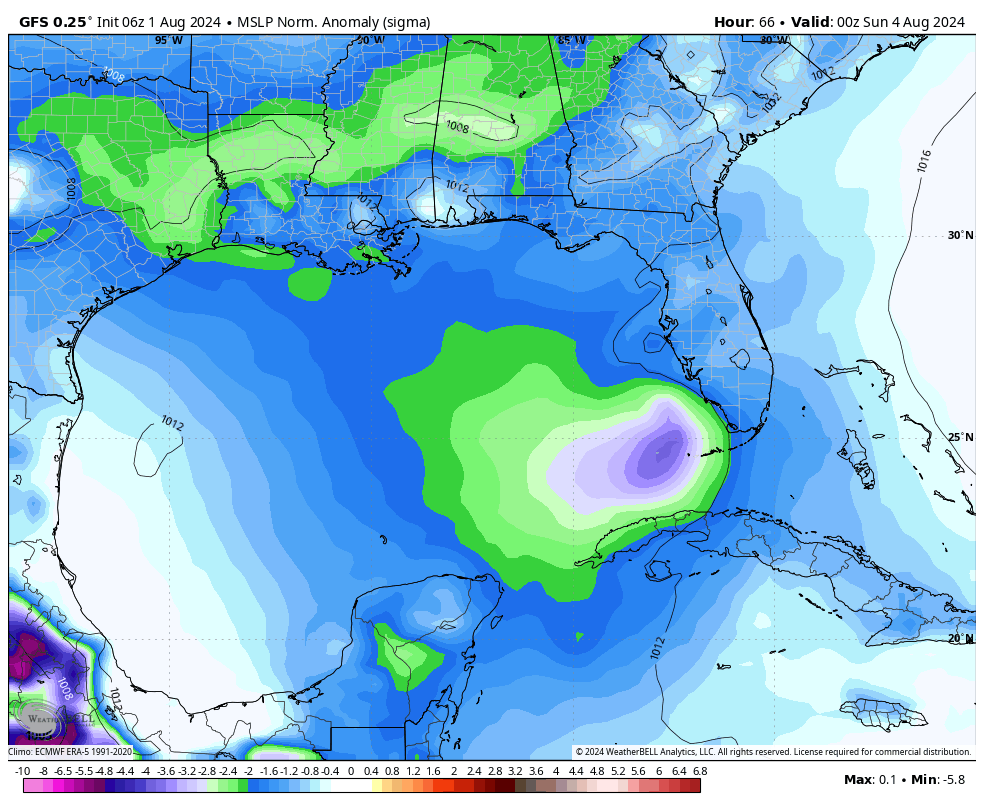
The very latest rainfall forecasts is suggesting anywhere up to 12 to 20 inches of total rain from Debby on the coast of Georgia and South Carolina, including Savannah, Hilton Head, and Charleston. This has the potential to also produce a wide swath of 8 to 12 inch rains in the Lowcountry of South Carolina and much of southeast Georgia (as well as parts of North Florida) also. Combine this with rough seas and high tides, and we could be looking at an especially dangerous, damaging flooding scenario in coastal spots and a significant, locally damaging flooding event away from the coast. Heavy rain will extend up to North Carolina at times as well, but we are really concerned with South Carolina and Georgia first in this scenario. Slow moving tropical systems loaded with abnormally high amounts of atmospheric moisture are never a good combination. Please take this threat extremely seriously in those areas.
How long the rain lasts and how far north it gets remain questions to monitor over the next few days.
So, in summary:
- A strong tropical storm or intensifying category 1 hurricane is likely to turn into the Big Bend or eastern Panhandle of Florida by Monday.
- Debby will slow down as it tracks across Georgia and North Florida, delivering copious amounts of rain to Georgia and South Carolina.
- A major flooding threat exists, particularly along the coast, including Savannah, Hilton Head, and Charleston.
- Debby’s future remains a bit uncertain beyond that, and folks in North Carolina should continue to monitor the system’s progress in the days ahead as well.
Some quick miscellany
First, we have people wondering why we are on Debby and not Chris. Well, if you blinked, you missed Tropical Storm Chris. It formed for about 8 hours before coming ashore in Mexico in early July. This occurred while Beryl was hammering the Caribbean, so it obviously got lost in the shuffle.
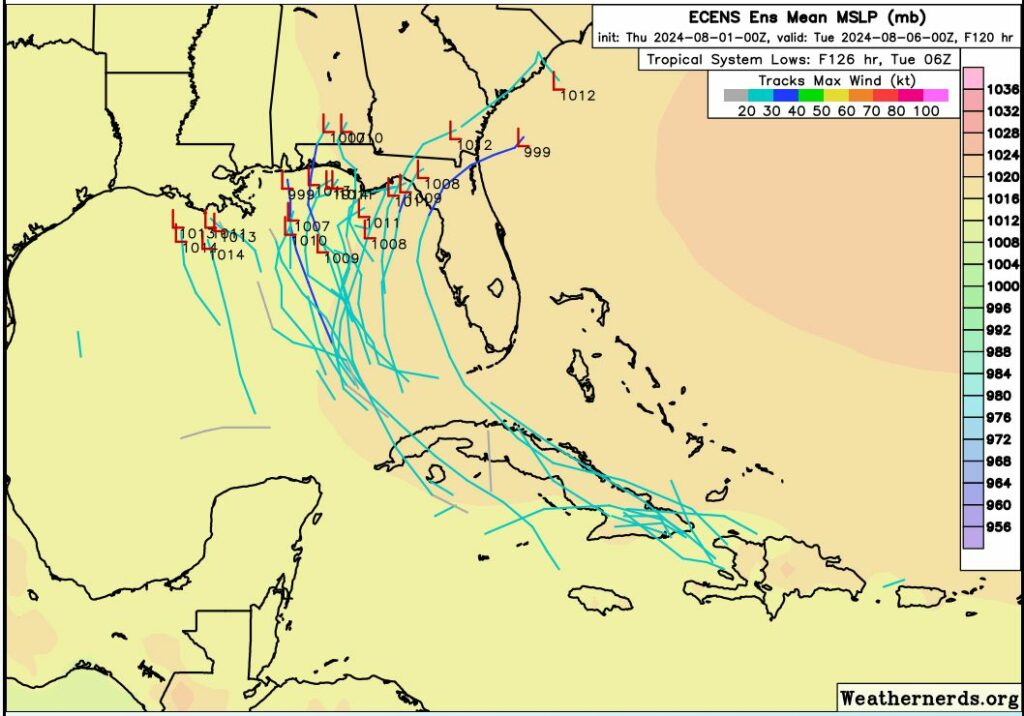
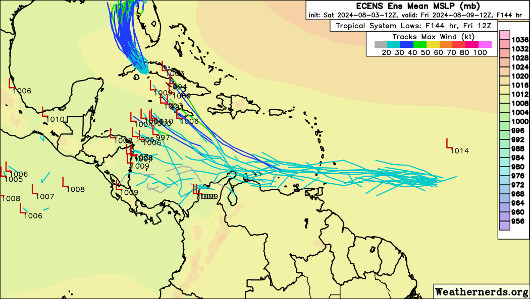
Second, we are monitoring another tropical wave behind Debby. This system has shown up on various deterministic/operational model guidance at times as a formidable Gulf storm. Remember, we try not to use deterministic guidance 10 days or so out, as it is prone to wild and extreme variability run to run. Looking at ensemble guidance is more useful, and in this case, we have decent European ensemble agreement on something in the western Caribbean or near Cuba again in about 6 days.
For now, we’ll wait for Debby to get out of the way and then focus on that as well.