Today’s headlines
- Snow continues to pile up in the Sierra, while heavy snows will expand into the interior West as well through the weekend.
- Numerous record highs possible this weekend in the Plains and Midwest.
- Strong winds and drier air will produce critical fire weather days in the Texas and/or Oklahoma Panhandles Saturday and Sunday.
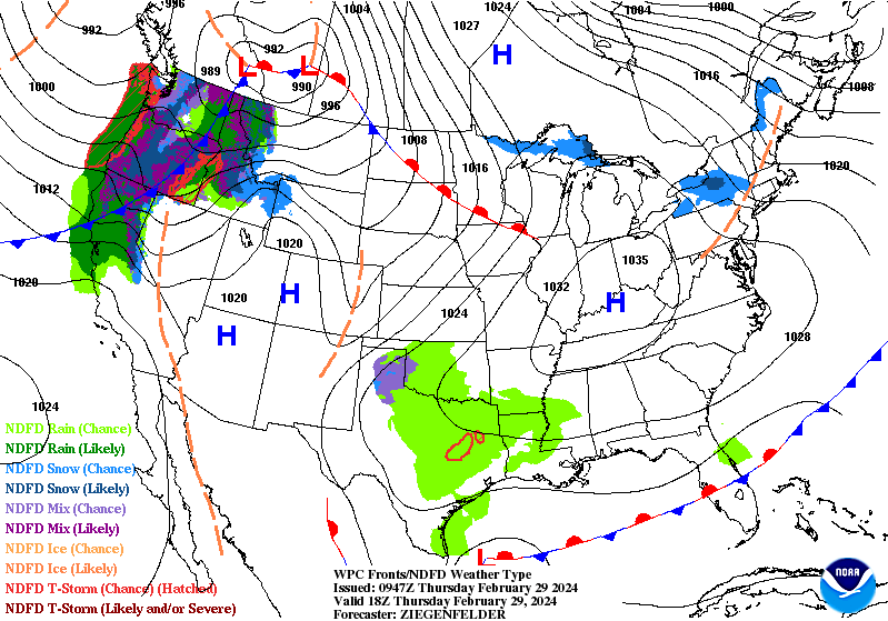
Western snow will pile up
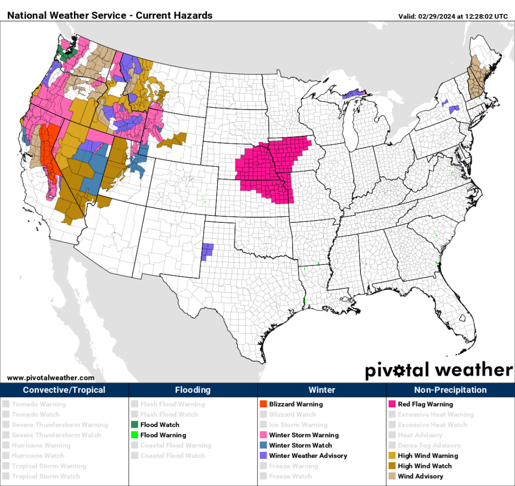
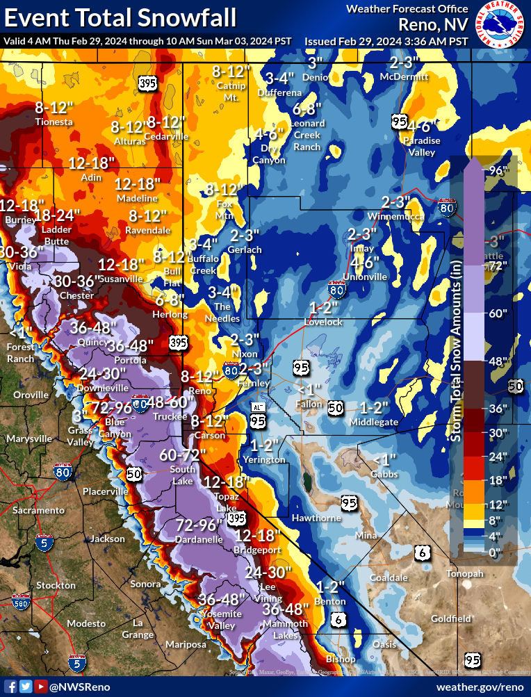
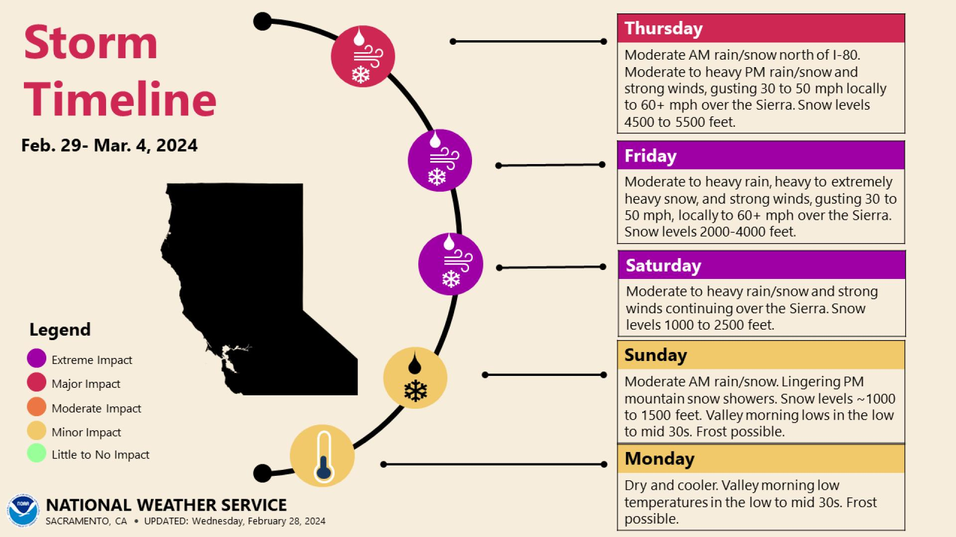
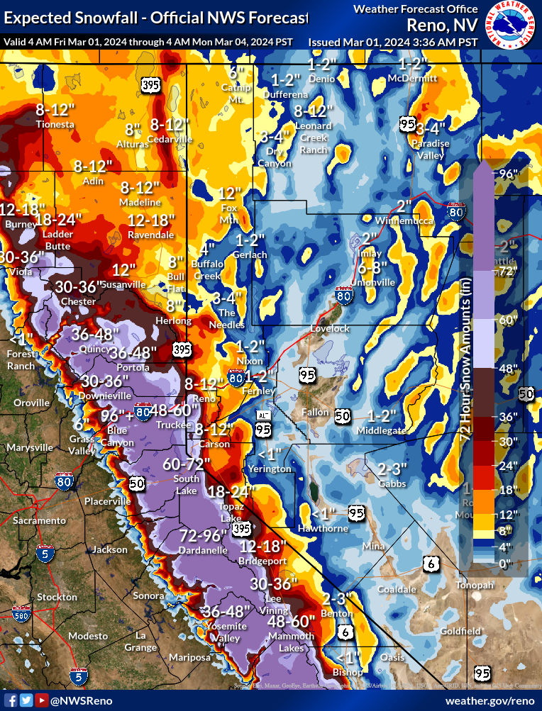
The multi-day snowstorm in the Sierra is underway with blizzard warnings and travel advisories hoisted in much of that area.

Additional snow will be measured in feet as the storm continues today and tomorrow. Conditions should begin to improve in the Sierra on Sunday with less intense and sustained snow. Snow showers and snow levels down to perhaps as low as 1,000 feet will continue Sunday and possibly Monday as well.
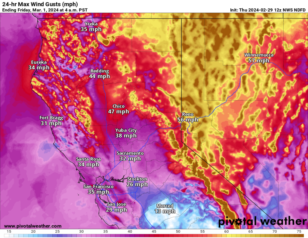
The combination of wind and mountain snow across the West will continue to be an issue into the weekend. The NWS winter storm severity index maxes out at extreme levels in Wyoming and major levels in parts of the Wasatch in Utah.
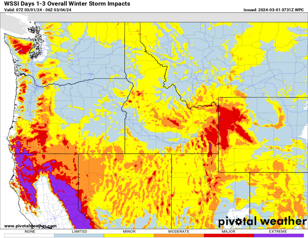
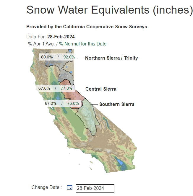
Overall, just a really impactful and beneficial storm for Western U.S. snowpack and water concerns; a little rough in the near term but good news over the longer term.
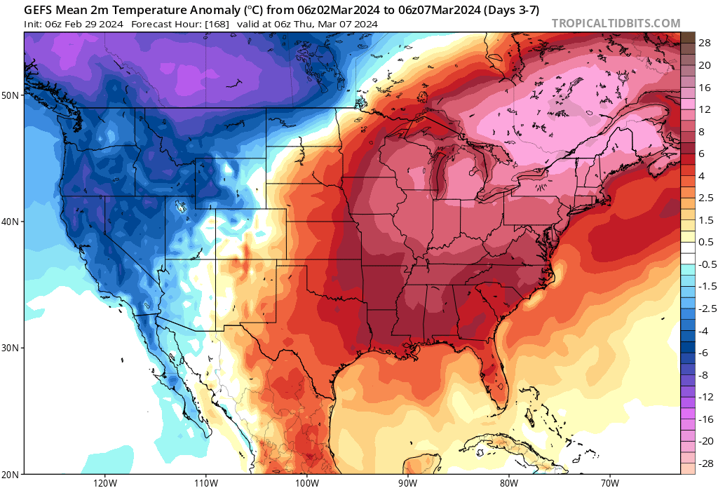
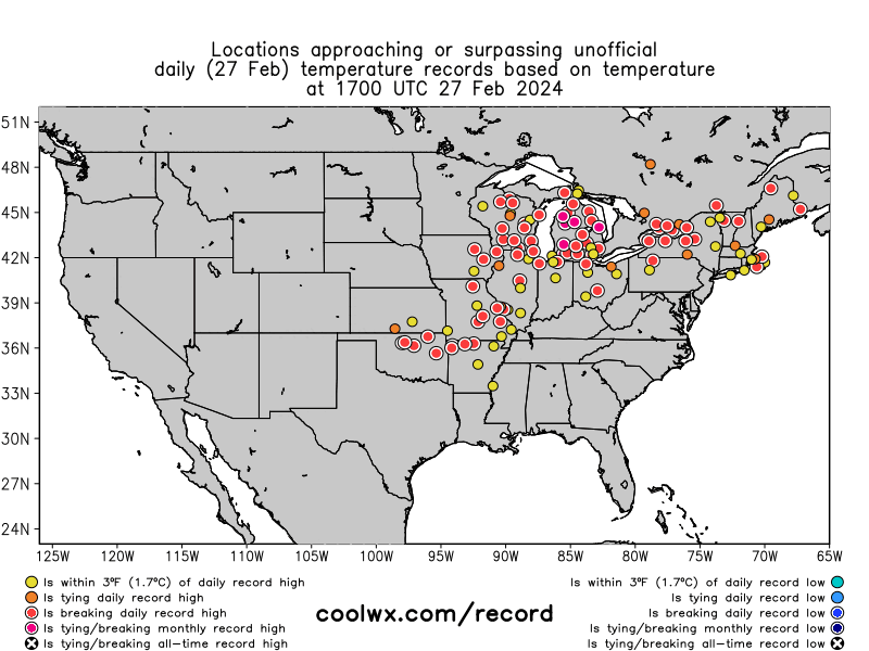
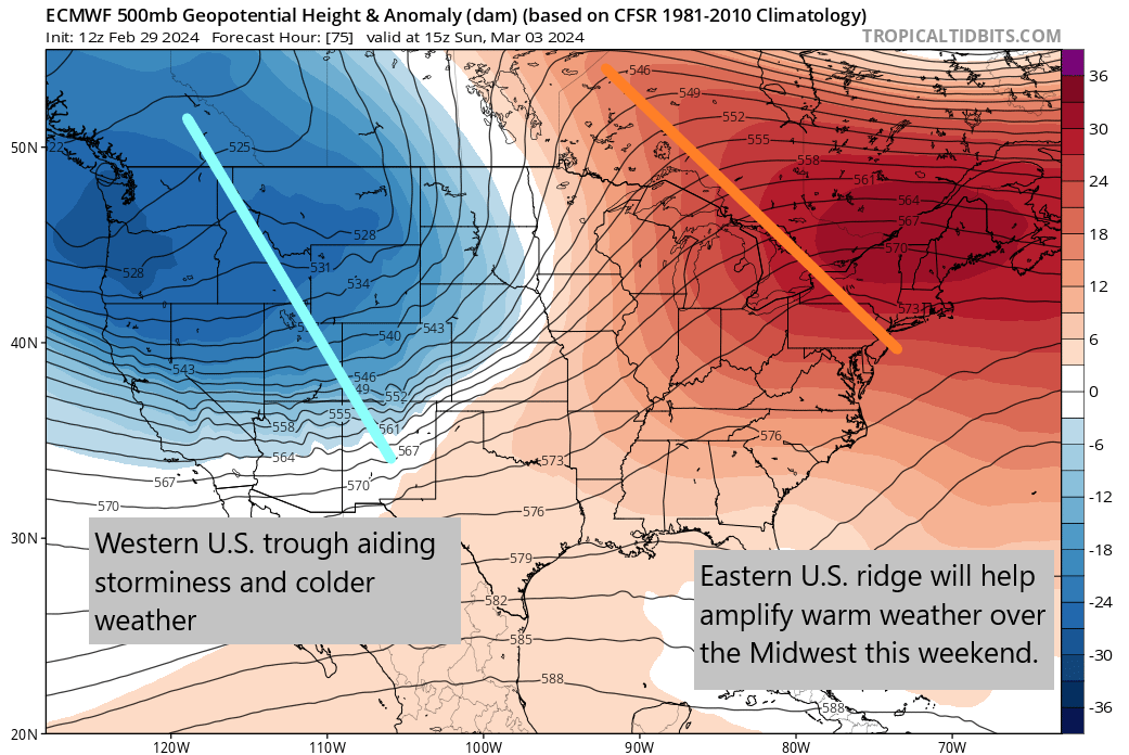
Record warmth overtakes the Midwest — again
What goes down, must come up. With a deep trough in the West helping to aid storminess and snow, there is a subsequent broad ridge over the Central and Eastern U.S. this weekend. That setup is one that is conducive to warm weather, and indeed numerous locations are forecast to come near record highs on Saturday and Sunday.
A few notable ones will occur in Wisconsin with Wausau expected to be 68 degrees on Sunday and La Crosse at 74 degrees. The previous records at those locations on Sunday are 52° and 66° respectively. Admittedly, the Wausau record is extremely low hanging fruit, but even La Crosse is an impressive record considering the previous mark was set in 1894.
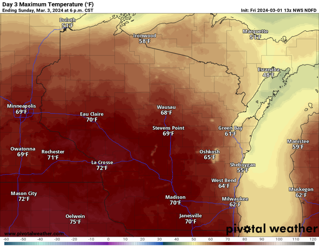
Both La Crosse and Wausau have already set or tied 6 to 7 record high temperatures so far this year. Add another one or two to that now. We’re probably not done with the abnormally warm weather either.
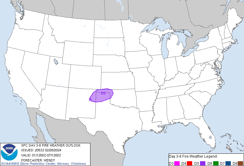
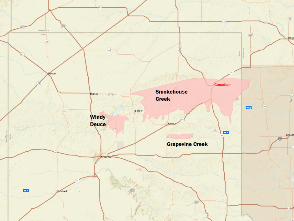
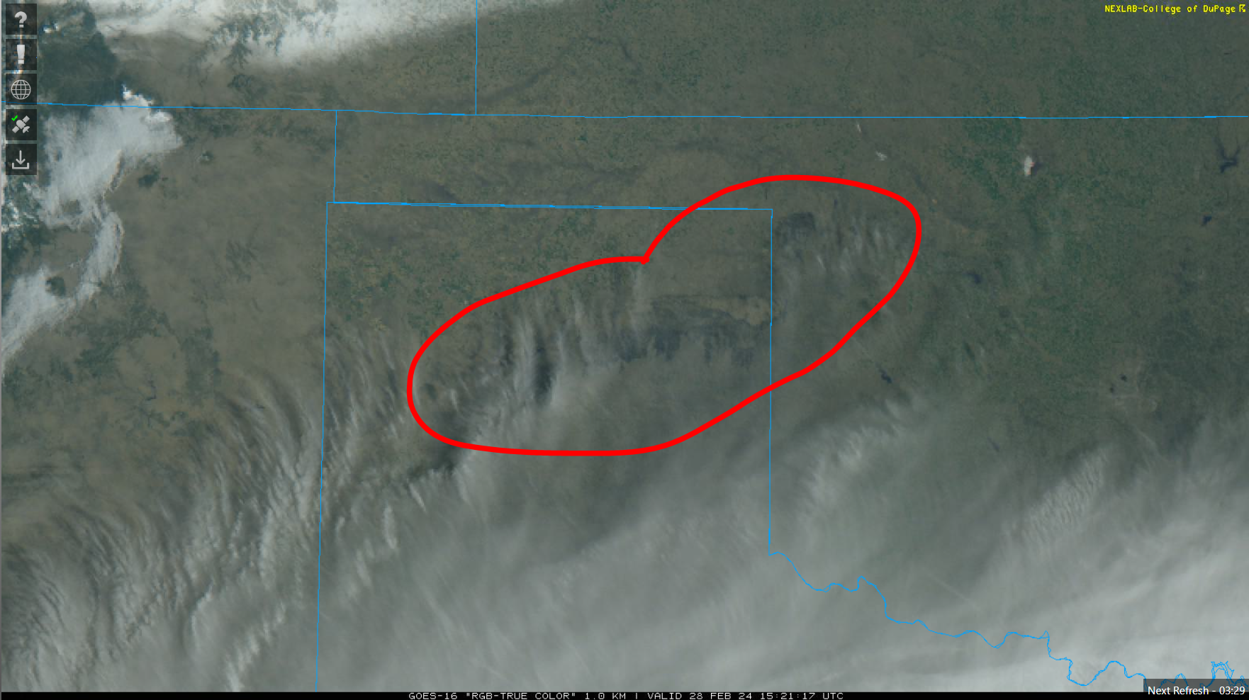
Fire weather risks increase again in the Texas Panhandle
The Texas Panhandle saw snow yesterday, just two days after the hellacious wildfire that has consumed over a million acres and become the largest wildfire in Texas history. That moisture was modest at best, so it did not do much other than help accelerate some containment efforts. Unfortunately, this weekend will bring another round of windy, dry weather to the Panhandle, and that could produce a critical fire weather day on both Saturday on Sunday.
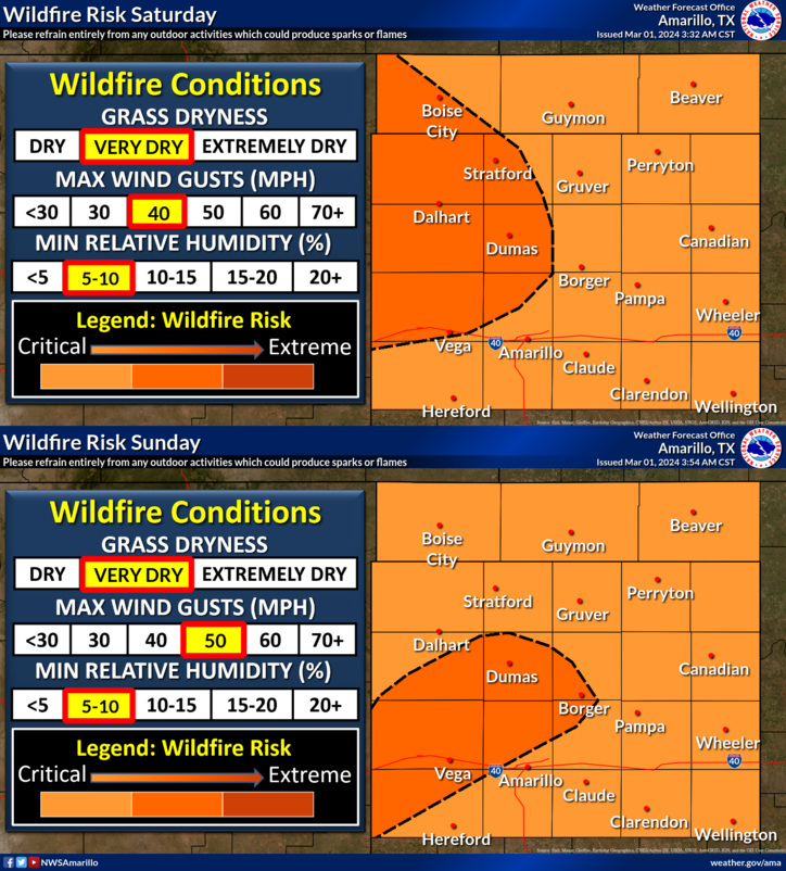
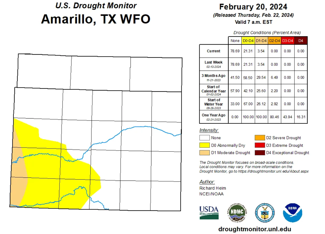
Conditions should not be quite as extreme as were witnessed earlier this week, but the ongoing fires plus risk of any new fire starts with resources stretched to their maximum makes this weekend a more vulnerable one than usual for this region. While rainfall is above normal for the winter season in this part of Texas, that isn’t saying much given that “normal” is pretty low already. A storm or two would go a long way toward helping the situation in the Panhandle.
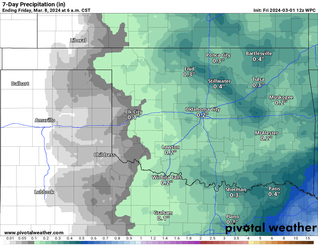
Unfortunately, at least over the next week or so, any rain chances look paltry at best in this region. Hopefully we can turn the corner later this month.