In brief: As Tropical Storm Fay fades away, attention will turn to New England and the Mid-Atlantic, where a potentially moderate to strong nor’easter will impact that region. Interestingly, there is also real potential that this nor’easter could transition to a tropical storm as well. We explain below.
Thanks for letting me take a couple days off here in the middle of peak season, both our readers and the tropics themselves. But things look busier now in interesting places. Let’s step through things.
Tropical Storm Fay
First, we have Tropical Storm Fay wandering out in the middle of the open Atlantic, no threat to land. It had been a threat to the 2026 hurricane-free record we’ve been carrying.
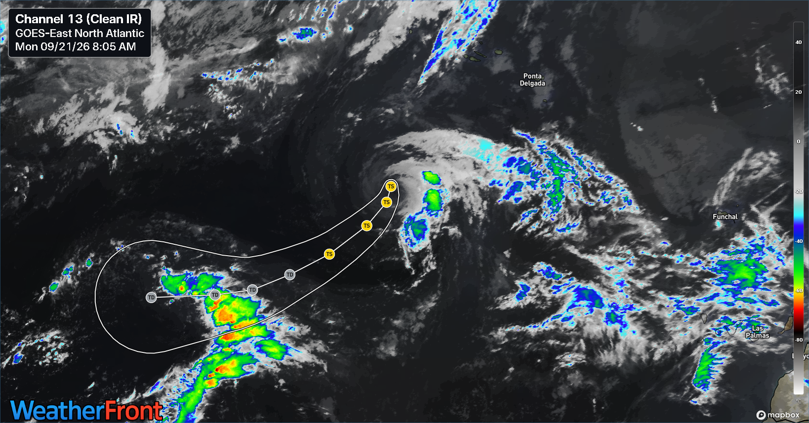
Maximum sustained winds did hit 70 mph (estimated) last night as Fay briefly made a run for hurricane intensity. But that risk is now over with, and we’re going to see Fay fade away as the week moves forward.
Fay will end up as the strongest storm of the 2026 season so far, and it will also add about 1.5 or so unit of ACE to our weak total.
Northeast risk: Nor’easter or hybrid nor’easter/tropical storm?
There’s been a little bit of buzz up here in my new digs in Connecticut about a potential nor’easter this week. This one has a lot of interesting elements to it, and I think it also has the risk to eventually acquire a name. Let’s discuss.
First, the most imminent concern with this system is tidal flooding. Places like New Jersey and Delaware may be most vulnerable to this aspect of things through the week. Onshore flow begins in earnest on Tuesday and continues through Friday.
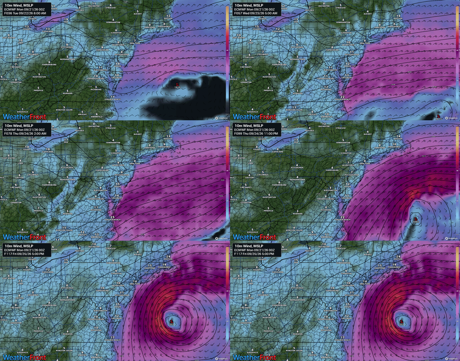
The wind will eventually become more northeasterly in nature as our nor’easter forms this weekend. But in the interim, multiple high tide cycles on building onshore flow will gradually stack up water, especially in the back bays of the Jersey Shore.
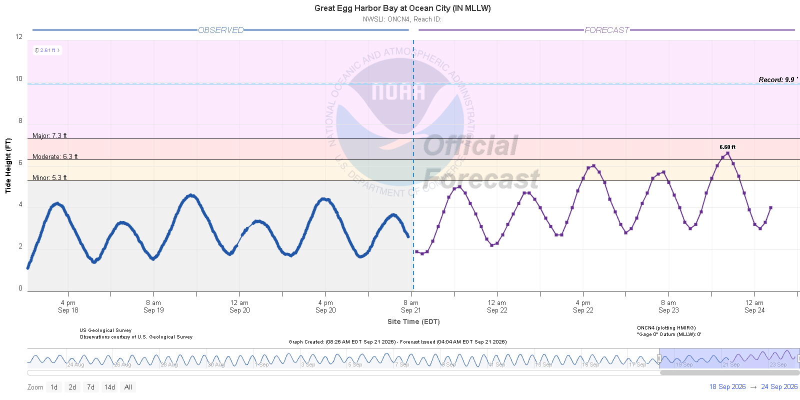
We’ll probably see the typical nuisance tidal flooding, along with some higher tide cycles by Wednesday or Thursday as things stack up.
Then there’s the nor’easter itself. What’s interesting about this is that it forms and then also moves rather slowly, meandering south of Long Island and New England. What’s also interesting about this is that the longer it stays over the water south of Long Island, the more likely it is to transition from a typical cold core nor’easter to a warmer core tropical system or hybrid system. For people on the ground, this definition doesn’t matter a whole lot, as the outcome will be the same either way. For those of us that study weather, this represents a fascinating case of potential tropical transition. We often discuss extratropical transition, where a hurricane or tropical storm devolves into a frontal-driven low pressure. In this case, the frontal-driven low may evolve into a tropical cyclone, potentially taking on enough characteristics to be classified as subtropical. How do we know this? Well, slow moving lows over the ocean always carry that risk in summer and early fall. But also, the models themselves are telling us this.
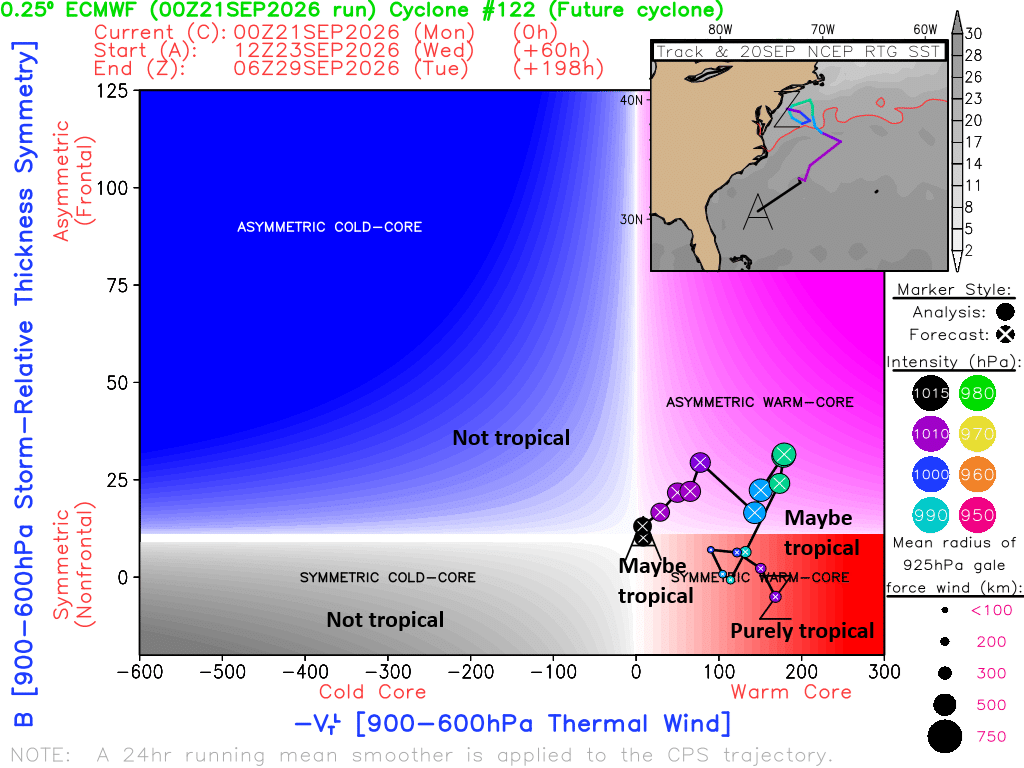
If you look at the map above and the “phase diagram” below, you can see we start the storm off the Southeast coast as probably not tropical. By the time the storm gets to the letter “Z” on the map, the phase diagram has evolved to show the system as almost a symmetric warm-core storm, or what would more than likely be considered at least subtropical, if not purely tropical.

So what does this mean?
In terms of impacts, this means more than likely a raw weekend for southern New England, Long Island, and New Jersey. Windy, cool, and rainy. At this point, the most concerning impacts are from the potential for tidal flooding and/or beach erosion from rough surf. But I would continue to watch the wind risk, as well as the heavy rain risk closely too. As of right now, the potential exists for 1 to 3 inches of rainfall in parts of the region, along with 30 to 50 mph wind gusts on the coast. But it’s important to recognize that there is a high degree of uncertainty in the final storm track, as you can see above, with some models closer to land, and others farther away. This will determine if the risk for wind or heavy rain increases in the days ahead. Folks in southern New England, Long Island, and New Jersey should monitor the forecast this week for changes, especially those that live near the coast, sound, or bays.
More to come.