In brief: Hurricane Lala did quite a number on Hawaii, and we review some of the numbers. Meanwhile, the Atlantic basin remains mostly void of anything interesting, as we officially begin the peak 45 days or so of hurricane season.
Lala wrap-up
I won’t delve too much into the actual impacts to Hawaii, but as of this morning, roughly 115,000 customers remain without power across the islands, which is down a good bit since yesterday. For the latest on impacts across the islands, check the coverage at Honolulu Civil Beat or the Hawaii Tribune-Herald. Meteorologically, what played out was indeed fascinating.
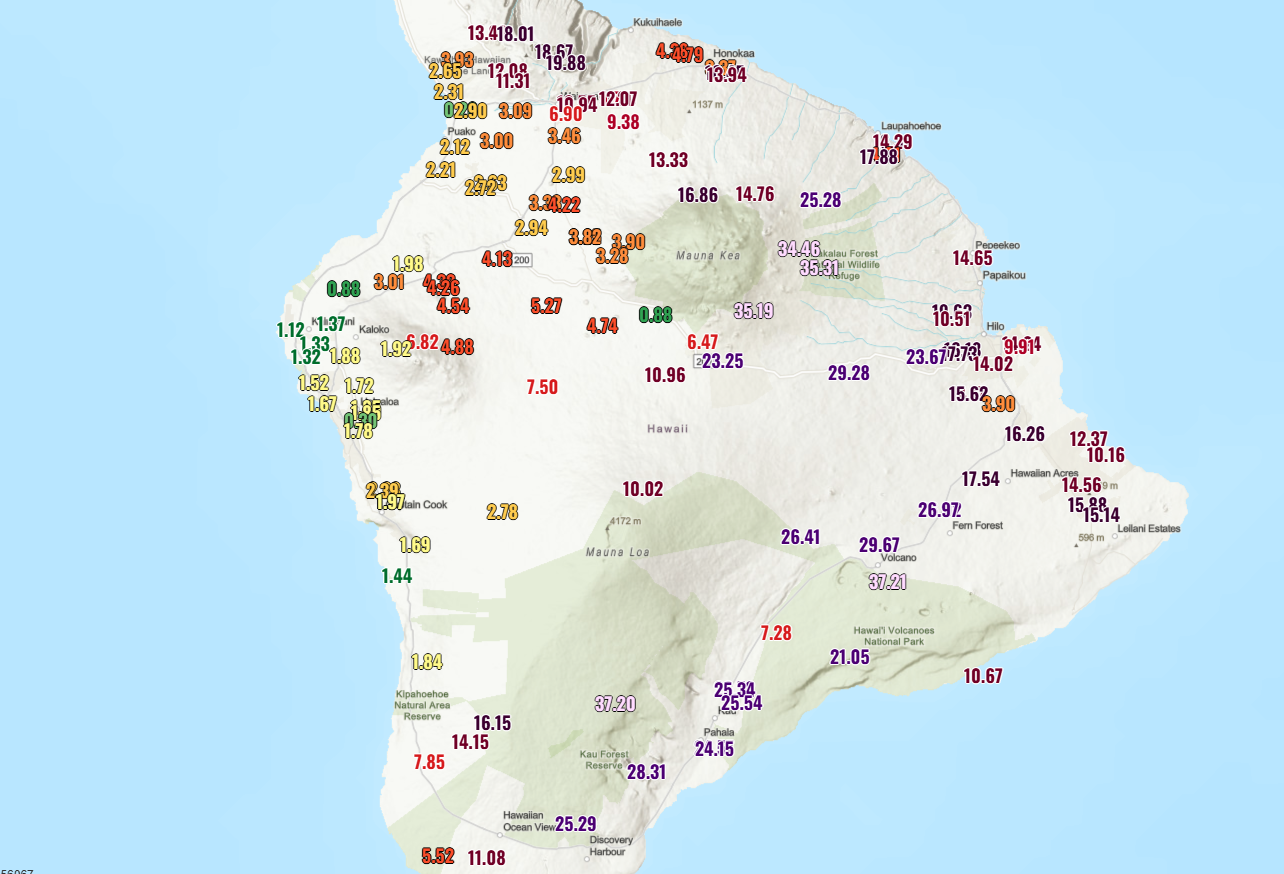
Over 37 inches of rain was reported on the south end of the Big Island, at Nene Cabin, which is on the upslope of Mauna Loa reportedly at over 6,000 feet of elevation. Downwind, in the rain shadow of Mauna Loa? Under 1.5 inches of rain fell near Captain Cook. Incredible rain shadowing. Either way, the totals were impressive. On Maui, on the upslope of Haleakalā, over 24 inches fell at Waikamoi.
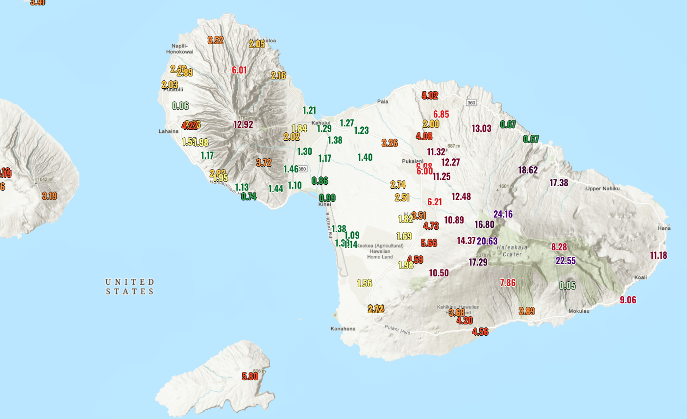
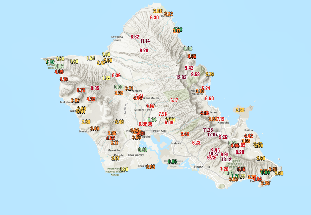
Similar impressive rain shadowing occurred there. Honolulu didn’t see much rain, but the mountains got hammered. Same story on the other islands as well.
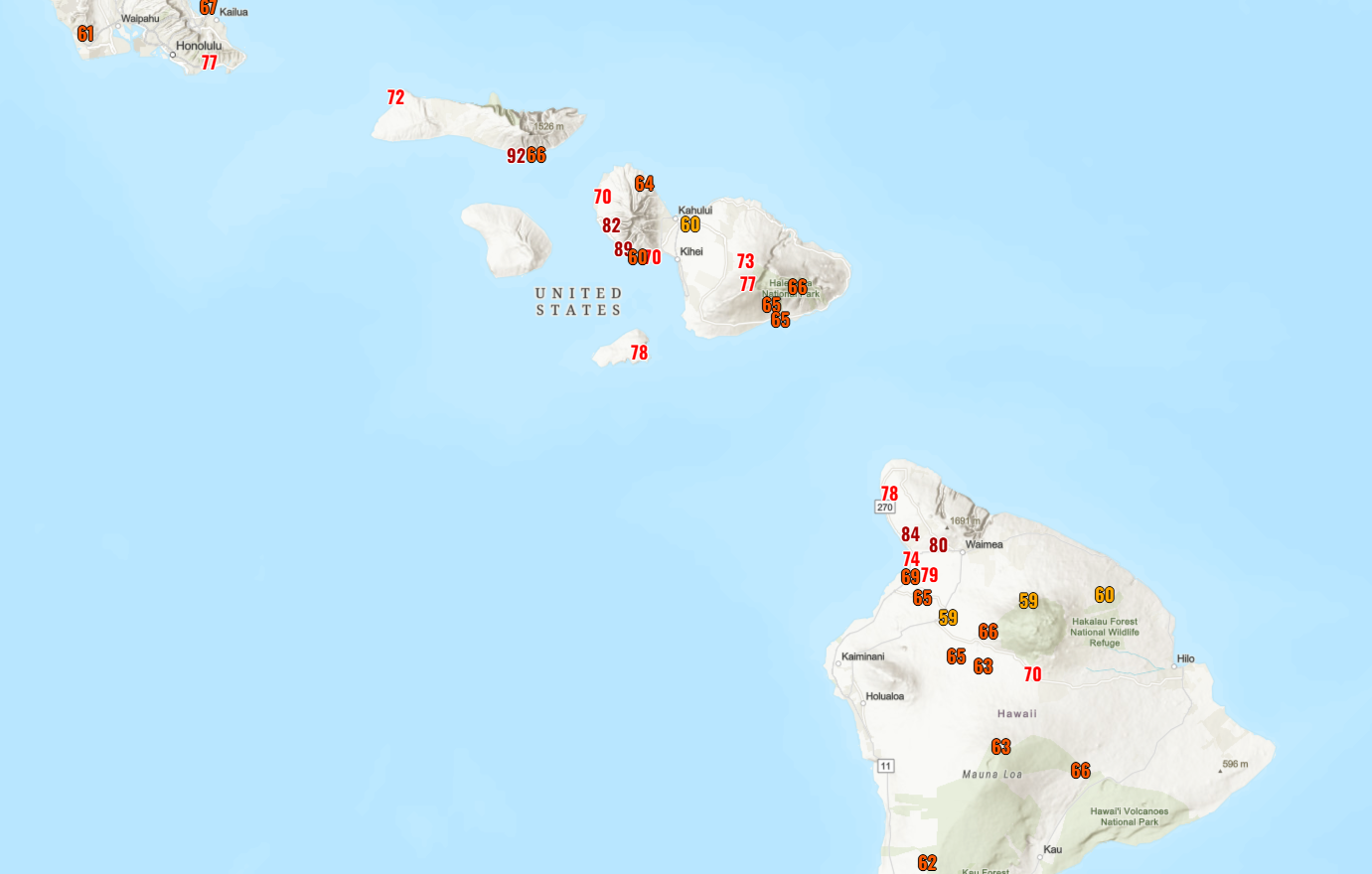
In terms of wind, peak gusts topped out around 70 to 90 mph in the higher terrain from Oahu through the Big Island. A fair bit of wind also occurred at lower elevations, as evidenced by the number of outages, but they were not quite as potent as what we saw in the mountains.
Lala will be a memorable storm for Hawaii, though certainly not the worst they’ve seen.
Atlantic on lockdown
Back in the Atlantic basin, it’s been a little busier this month, with Cristobal and a couple invests, but both of those invests are now off the board. A look at the Atlantic this morning tells us, well, not much. It’s dead quiet, with the exception of the next robust wave emerging off Africa.
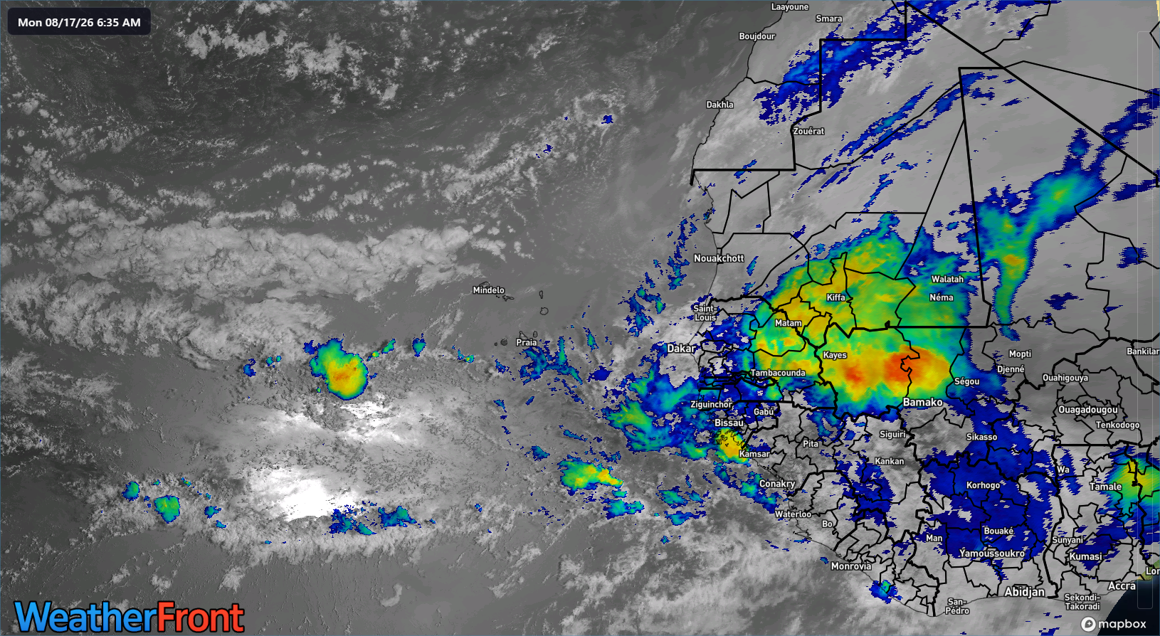
This one is likely to meet the same fate as its predecessors. The one behind it seems destined to reach invest status eventually, but the models are in good disagreement on development, with both the Euro ensemble and Euro AIFS trying to do something with it by late this week. Google’s Deep Mind is unimpressed. I would not be expecting much from these waves. They seem destined to eventually extinguish.
We’re now officially entering the peak of hurricane season. From now through about October 7th, the Atlantic basin climatology adds about 1 unit of ACE (accumulated cyclone energy) per day, taking us from around 15 units of ACE to 102 units. In other words, this is the window you historically see the bulk of hurricane activity in the Atlantic basin.
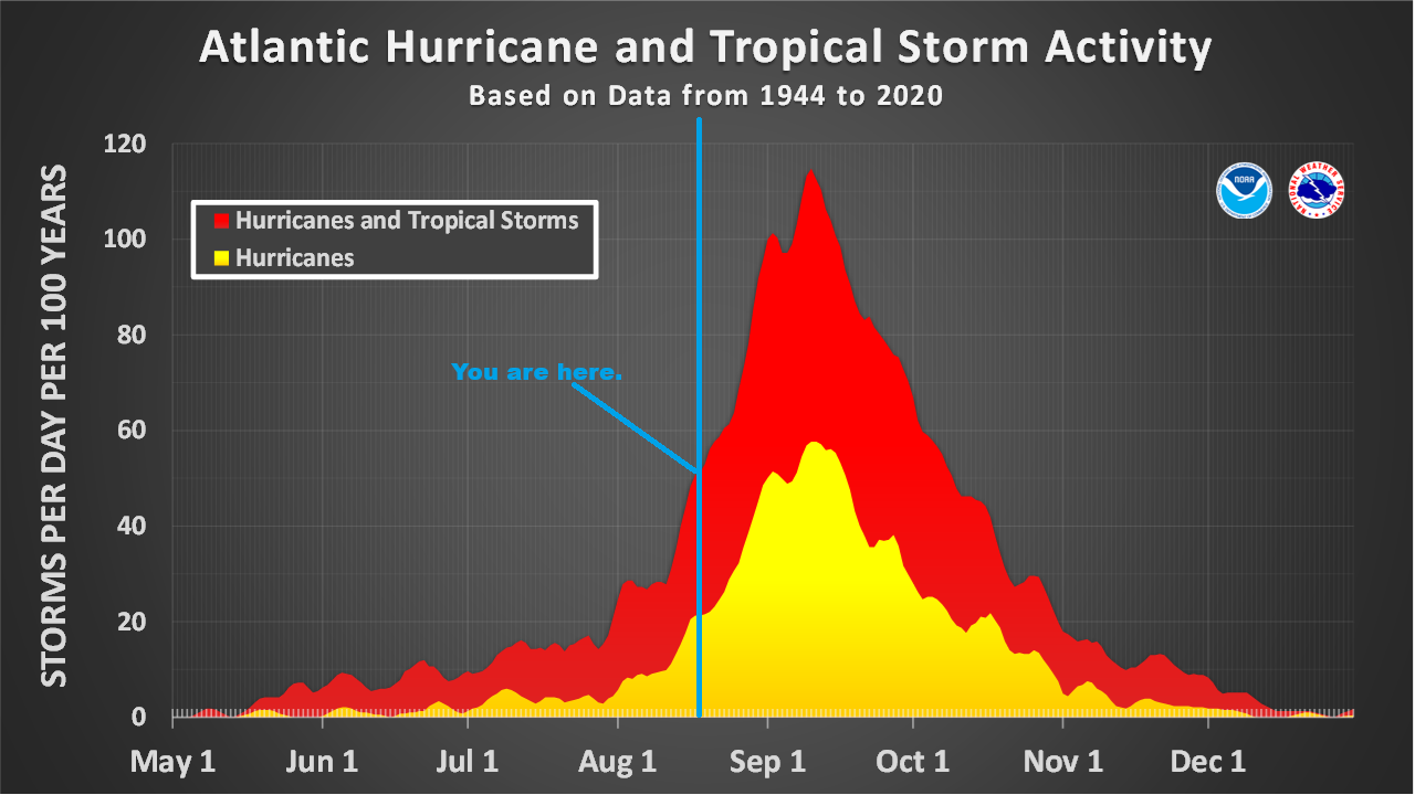
With El Niño, and a near-record one at that, the equation changes and “bulk of hurricane activity” tends to have a different, lower adjusted meaning. We are already seeing plentiful signs that El Niño is influencing hurricane season, and there’s absolutely no reason to expect change. Looking ahead to next week, the European model’s 45-day outlook continues to show below normal Atlantic activity.
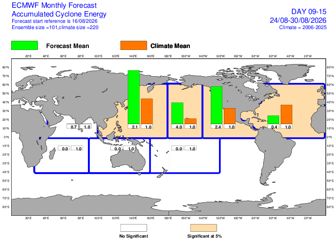
Subsequent weeks? Much the same. And keep in mind that the European model has tended to be a little overzealous with recent tropical waves. So 40 percent of normal ACE the next 2 to 3 weeks may be generous.
Whatever the case, we shall see where this all goes. But for now, calm remains the word across the Atlantic.