In brief: Invest 97L has an imposing satellite image but it has yet to make serious strides toward actually organizing yet. It remains distinctly a heavy rain and flash flooding concern, particularly east of Houston heading into midweek. But folks close to the coast east of Houston should continue to monitor Invest 97L for potential development before it comes ashore tomorrow.
Invest 97L
The good news is that scary looking satellite imagery is not correlated to tropical system intensity. On satellite, Invest 97L looks quite imposing this morning, but it’s notable that almost all the storminess is to the east of the presumed center.
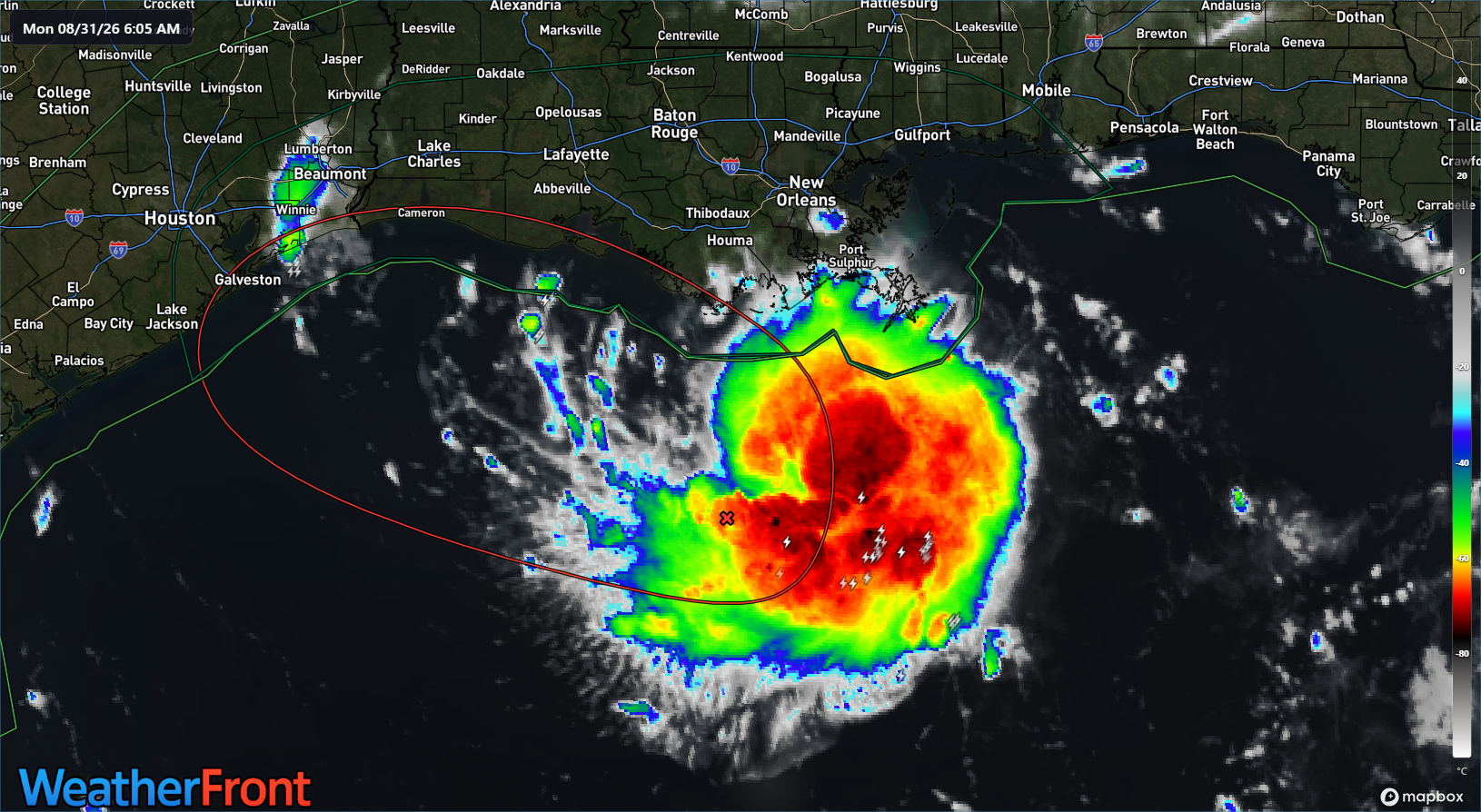
Aside from that, we remain around 70 percent odds of potential development as of the overnight update from NHC. In terms of things that have and have not changed otherwise overnight: The track is mostly unchanged, generally toward the Upper Texas Coast with the center arriving onshore sometime tomorrow afternoon or evening. If there is a slight change in track, it’s that more tropical models are a little farther south and west with 97L, perhaps owing to the fact that it has not developed yet.
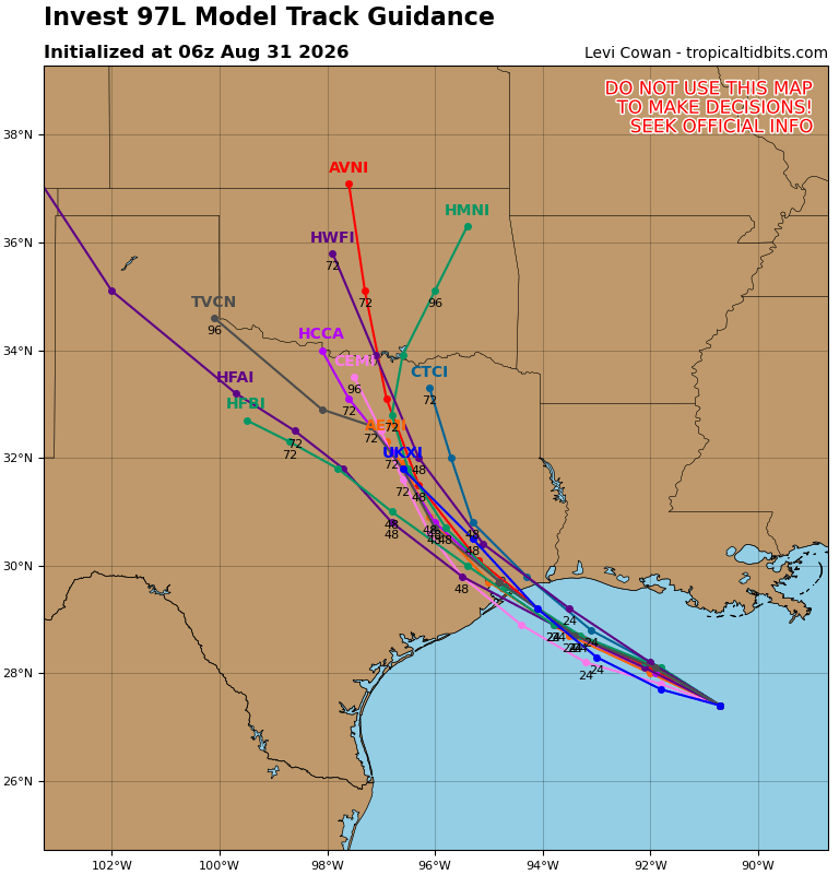
Weaker systems will tend to go a little farther west before turning northward, and that could be what’s at play here. Either way, it’s good news that it has not organized yet. The more time it takes organizing also reduces the amount of time it has to intensify. So in general, we’re still looking at a decent chance at a tropical depression and a moderate chance at a tropical storm by landfall. People on the Texas coast, especially east of Houston should continue to monitor Invest 97L through the day.
What we are likely to see is more rain, however. Rain totals continue to slowly increase in East Texas. We would now expect about 1 to 3 inches, with isolated pockets of 3-5 inches of rain or more east of Houston and west of Beaumont. It’s not out of the question that someone sees close to 10 inches of rain from this before all is said and done, so obviously areas of flash flooding will be a concern, perhaps not in Houston proper, but east of there.
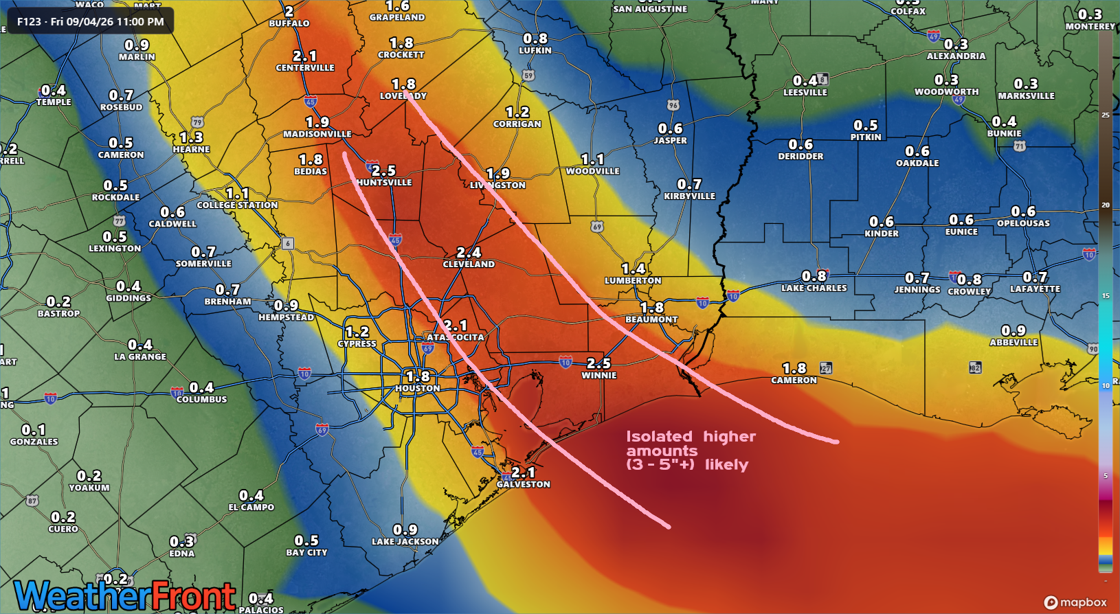
So, bottom line? A tropical storm remains a distinct possibility out of Invest 97L. A depression is a good bet. The main threat will be heavy rain and flooding between Houston and Beaumont and inland from there. But folks east of Houston, between Bolivar and Port Arthur will want to keep an eye on 97L over the next 36 hours before landfall, in case it does try to organize faster.
More later today.