In brief: Significant heavy rain and flash flooding will impact much of the western half of the Gulf Coast through midweek. Areas between Corpus Christi and Lake Charles, as well as in southwest Mississippi are likely to see the heaviest rainfall, with max totals reaching or exceed 15 inches in isolated spots.
We continue to watch the situation on the Gulf Coast, and indeed, we’re beginning to see heavy rainfall chances come to fruition. Rain totals as high as 4 to 6 inches occurred in portions of Texas yesterday and overnight. And additional heavy rain is already occurring this morning.
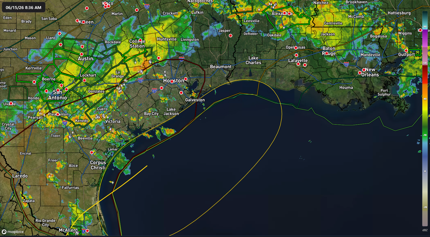
As the day goes on, this heavy rainfall is going to drop south and east some. It will begin to impact coastal areas of Texas, including the Corpus Christi, Houston, and Beaumont areas, as well as much of northern, central, and southwestern Louisiana. Additional heavy rain is likely to bubble up from the Gulf tonight, impacting the coast. Between where the decaying cold front stalls and the tropical moisture hits it will determine who is likely to see the highest rain totals once all is said and done. This would probably be along and southeast of US-59 in Texas and south of I-10 east of Houston into Louisiana.
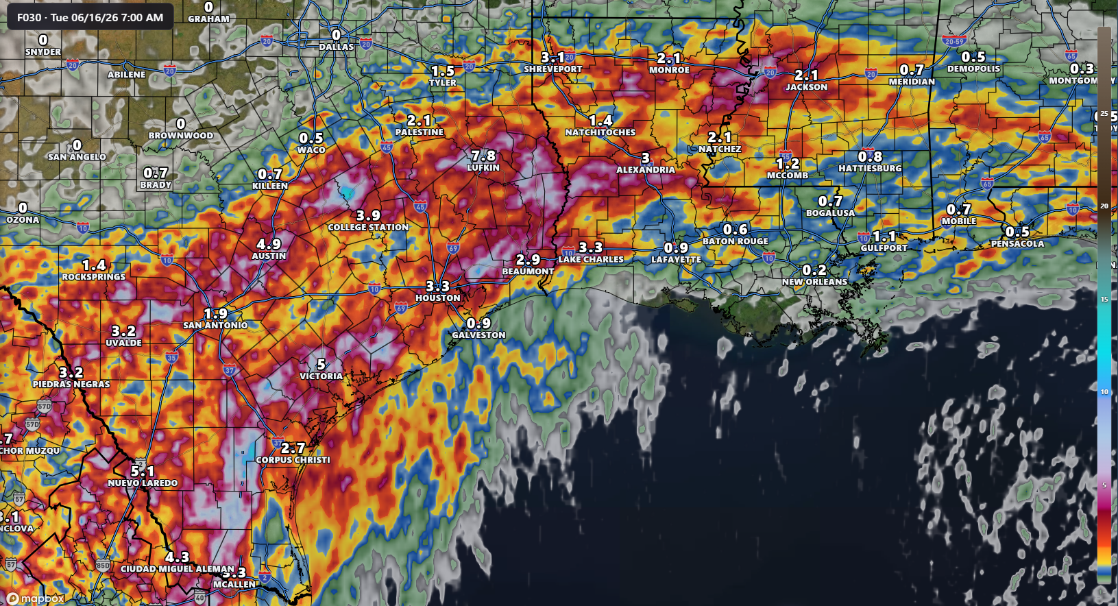
Additional waves of heavy rain are likely tomorrow into Wednesday as well as the tropical disturbance we’ve been watching moves back out over water and back ashore once more. This will lead to a building flooding threat across this region over the next few days.
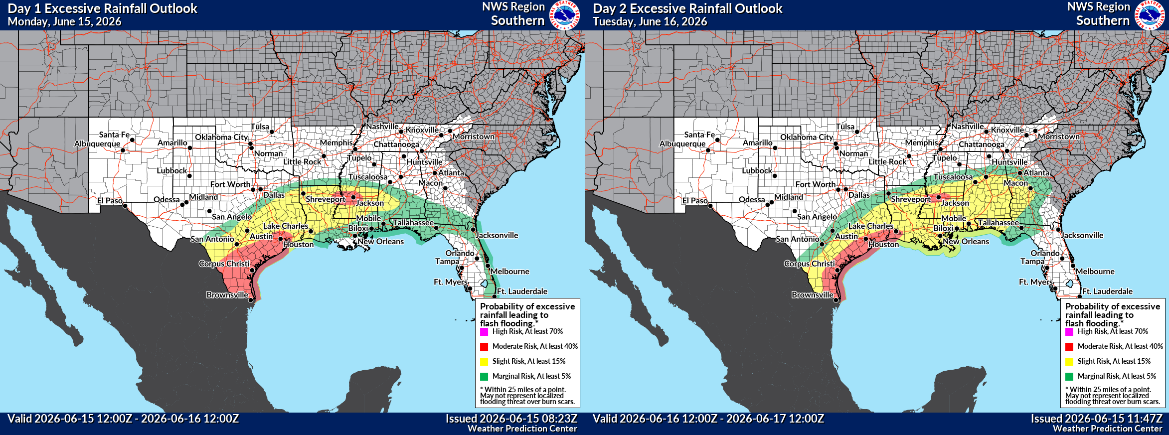
Coastal Texas, southwest Louisiana, and a portion of Mississippi are highlighted in a moderate risk (level 3 of 4) for excessive rainfall today and tomorrow. We could see a portion of this area get upgraded to a high risk if we begin seeing consistent rain in a location. This continues for Wednesday in the Lake Charles, Beaumont, and Houston areas, particularly for the morning hours.
What this means is that while not everyone is going to see significant flooding, there are likely to be pockets of considerable flash flooding across the area, particularly in urban and poor drainage locations. This means streets may become impassable at times, and if you have the ability to reschedule non-urgent travel, it’s recommended. This is the most significant rainfall setup in this area since 2024. As the WPC excessive rainfall discussion put it this morning, “any storms that develop in this environment (will have) an almost unnatural ability to produce heavy rain.
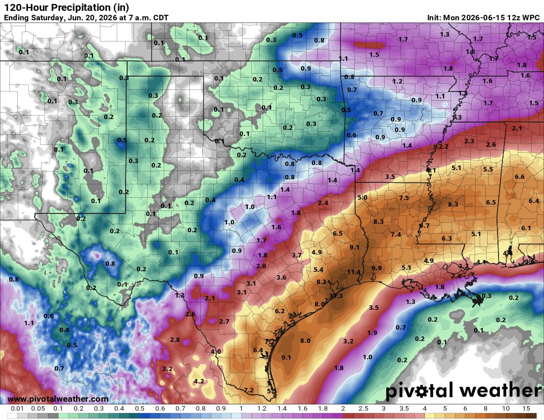
Total rainfall when all is said and done will average 3 to 10 inches across this region. There may be more isolated locations that see as much as 15 inches or even more. An extremely potent rainfall event for the Gulf Coast.
With respect for tropical development, that matters primarily as any storm could try to consolidate heavy rainfall and focus it on a more specific area. It is not likely that any tropical development would extend beyond depression or low-end tropical storm status. You should be thinking of this as predominantly a heavy rainstorm and flash flooding event for the Gulf Coast.
Elsewhere, no other Atlantic concerns at this time.