In brief: The National Hurricane Center has declared Potential Tropical Cyclone One, which will likely become a tropical depression or storm as it parallels the Texas coast later today and tomorrow. The primary impacts from this storm will be flooding rainfall from coastal Texas through Mississippi and Alabama, in many cases, very far from the coast.
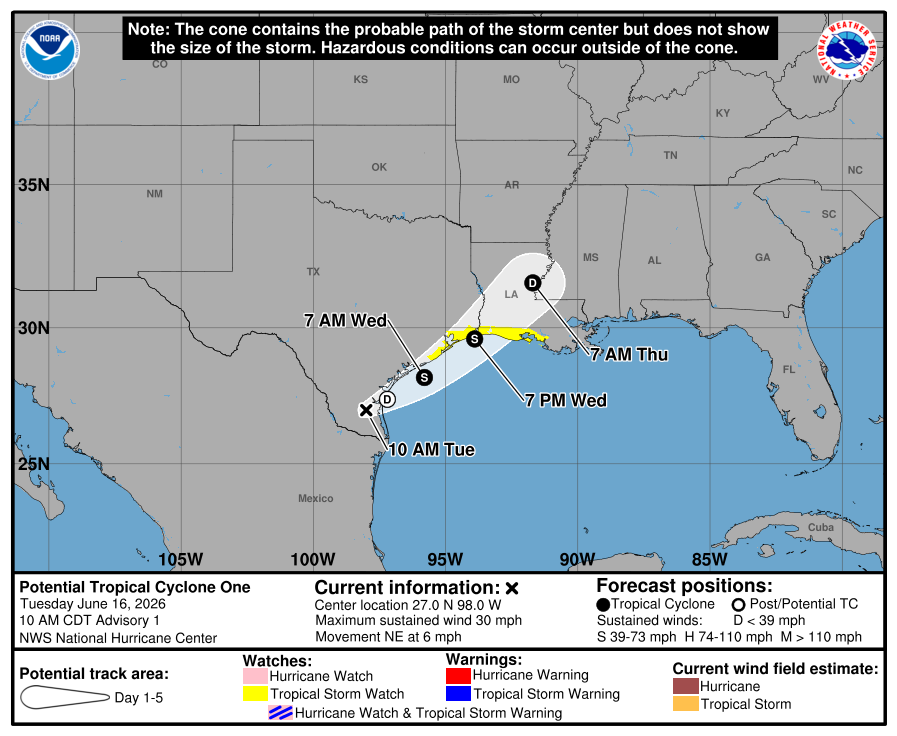
Editor’s Note: The NHC will begin producing advisories on Potential Tropical Cyclone One this morning. I wrote the below section before seeing that news. The map is updated below.
So we have two things to talk about today. Both are directly related. The potential for a tropical depression or storm in the northwest Gulf is increasing. However, the primary, if not only impacts to focus on (unless you are a mariner) with this event will be the rainfall. While this may indeed become a tropical storm or depression, again, this should be thought of as a significant rainstorm with flooding potential.
Let’s talk about the disturbance first because that is going to have a direct impact on exactly where the heaviest rain falls. As of this morning, Invest 90L is located in the Rio Grande Valley inland from Brownsville. A look at satellite certainly tells the story. This is absolutely loaded with moisture.
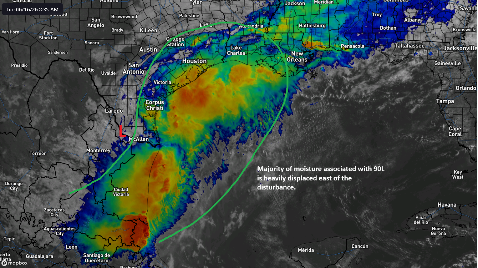
The one big takeaway I have with this? The moisture associated with 90L is heavily displaced east of the center. In other words, this will keep any organization slow, but it will also mean that the track of the disturbance is extremely important in determining who will see the greatest flooding potential.
So where will 90L track? Well, there’s pretty decent agreement this morning that the disturbance will scoot just offshore of South Texas later today and then curl back north northeast toward southwest Louisiana or the Texas Golden Triangle through Thursday.

The residence time over the Gulf is going to be short, maybe 24 hours, and given the general disorganization it currently has, I don’t see how this becomes much more than an isolated 40 mph tropical storm. However, it is the moisture that’s the issue here.
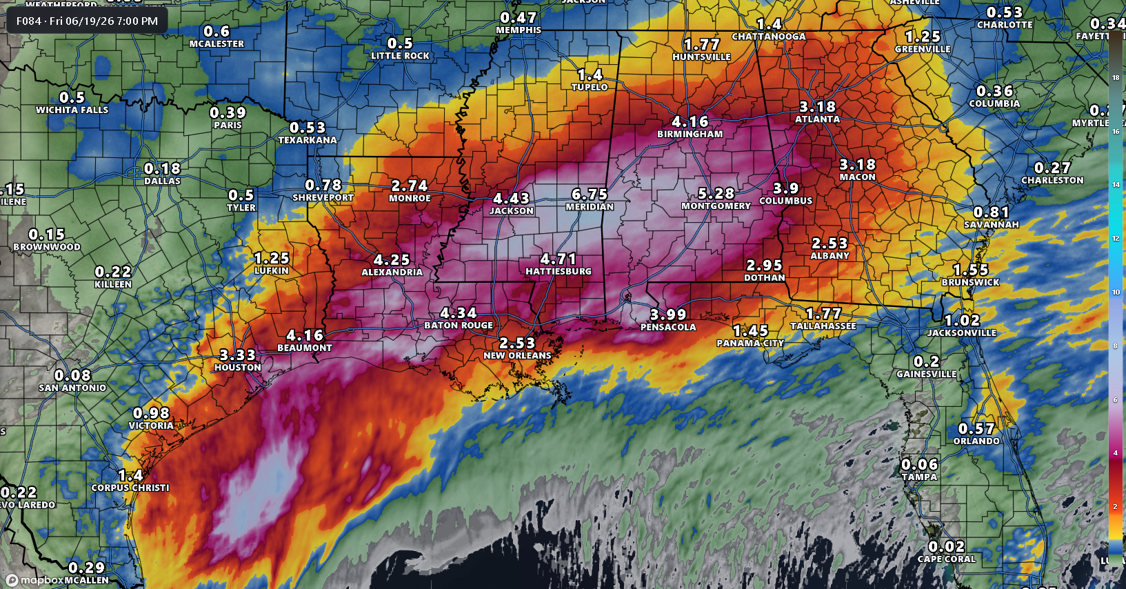
With all this moisture funneling northeastward, you can bet there’s a significant heavy rain risk along and east of the track of PTC 1/Invest 90L.
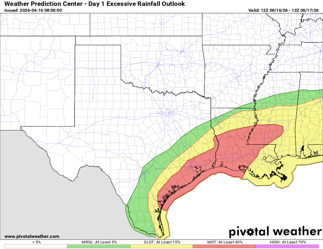
Today’s rainfall will be heaviest in South Texas, at times in the Houston area, and along the immediate coast in Texas and Louisiana and just inland into central Louisiana as well later.
On Wednesday, that risk will hug the coast southeast of Houston, and then end up in southwest Louisiana.
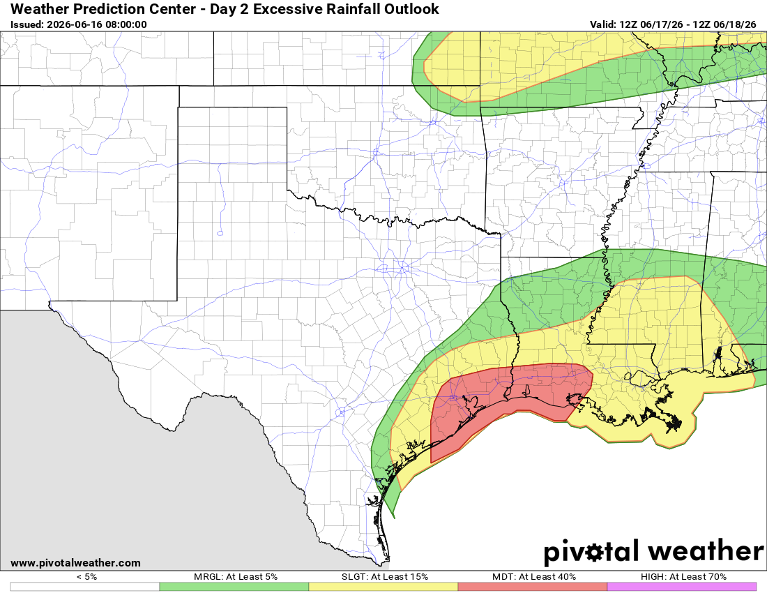
And on Thursday, that risk shifts into Louisiana and Mississippi, maybe Alabama.
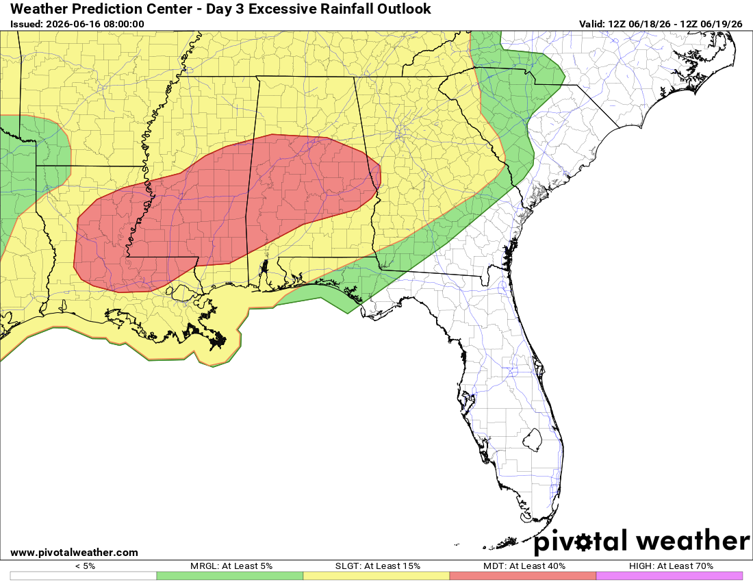
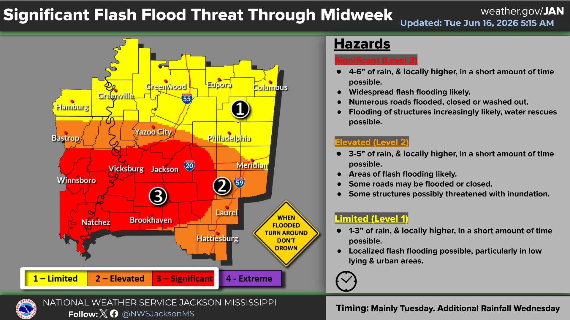
When all is said and done, we are probably looking at an average of 3 to 8 inches along the coast between Galveston and Vermilion Bay, extending inland between Lake Charles and Montgomery, AL. Isolated pockets within this belt are going to see upwards of 10 to 15 inches of rain potentially, and those will be the areas that are at highest risk for flooding. It would not be a shock to see a “high” risk get issued with the excessive rainfall products above before this ends.
Flood watches are posted from Texas through Mississippi, and those will probably expand into Alabama later.
Bottom line: While this will be a tropical storm in all likelihood, the primary impacts and concerns will be from the rainfall, well away from the coast in many cases. Folks from Texas through Georgia should be monitoring local conditions and local information sources for the very latest.