In brief: We continue to watch Potential Tropical Cyclone 1, which now seems unlikely to become Tropical Storm Arthur. It will, however, deliver areas of flash flooding to the Deep South and Gulf Coast. Additionally, we’re watching an abnormally strong severe weather outbreak risk today in the Midwest.
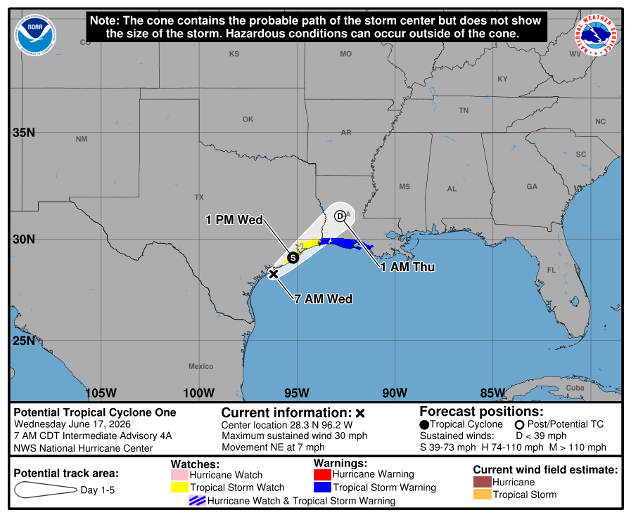
Potential Tropical Cyclone One is struggling to organize this morning for a couple reasons. As we noted yesterday, the center is displaced far west of the most thunderstorm activity, so the system just isn’t exactly healthy to begin with. Secondly, the center of PTC 1 is really just hugging the coast at this point. If the storm can’t get over water, then it can’t really have a chance to become a tropical storm.
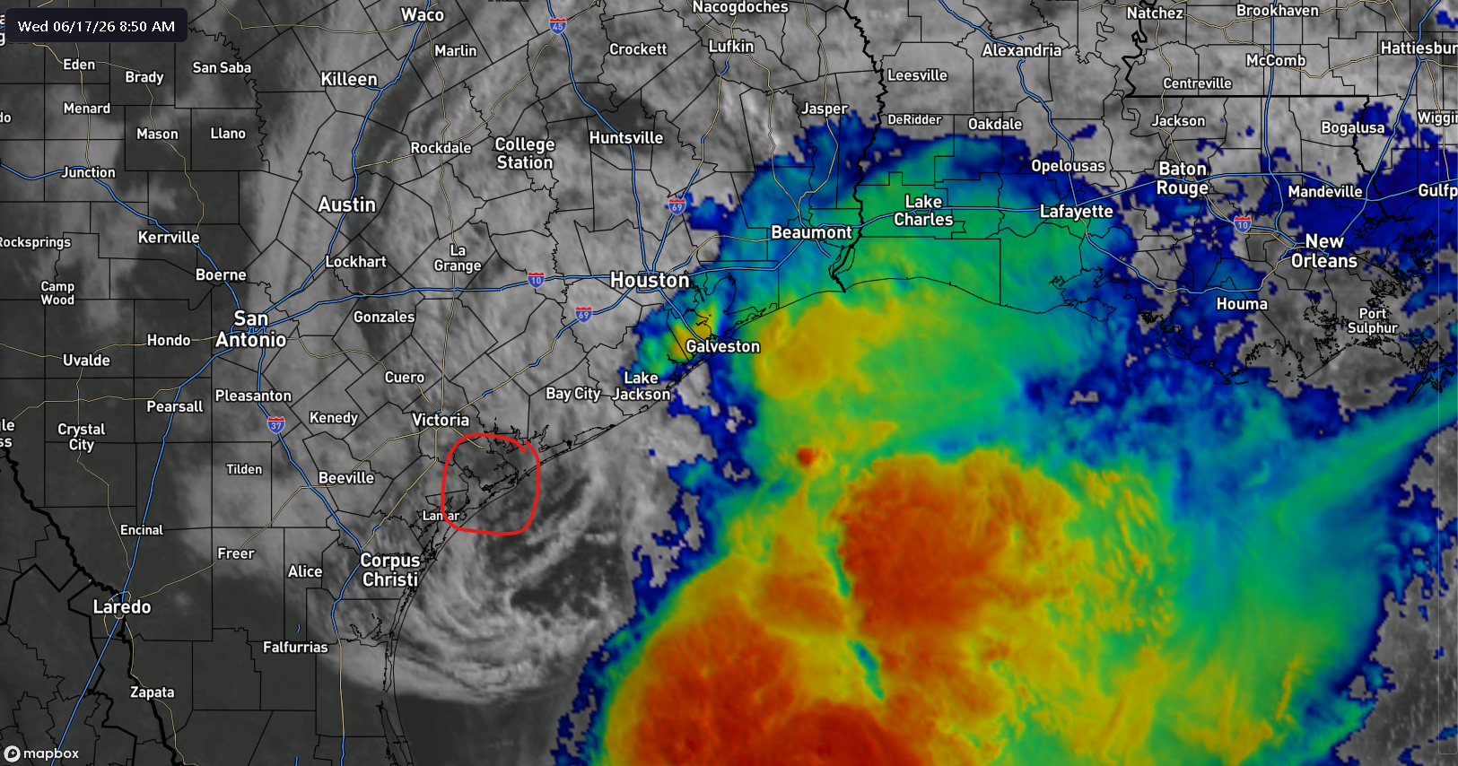
Whatever the case, this remains a rainstorm above all else, and it will likely drift inland even if it ends up over water after a short while.
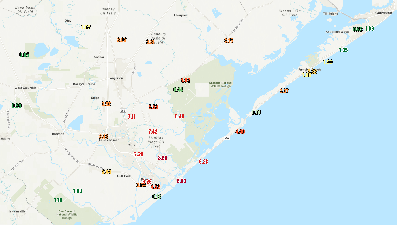
Heavy rains do continue to fall along the Texas coast, where we’ve seen as much as nearly 9 inches of rain so far today near Lake Jackson and Surfside Beach. The overall trend today will be for the rain in Texas to gradually subside by midday or so, tapering back to more scattered showers. For more details specific to the Houston area, please check Space City Weather.
As the day goes on, the heavier rain will likely refocus toward coastal Louisiana. We should then see heavier rain begin to expand into interior portions of Mississippi and Alabama. The moderate risk (level 3 of 4) for heavy rainfall expanded to that area today. That continues over southern Mississippi, Alabama, and Georgia tomorrow, as well as perhaps the Florida Panhandle.
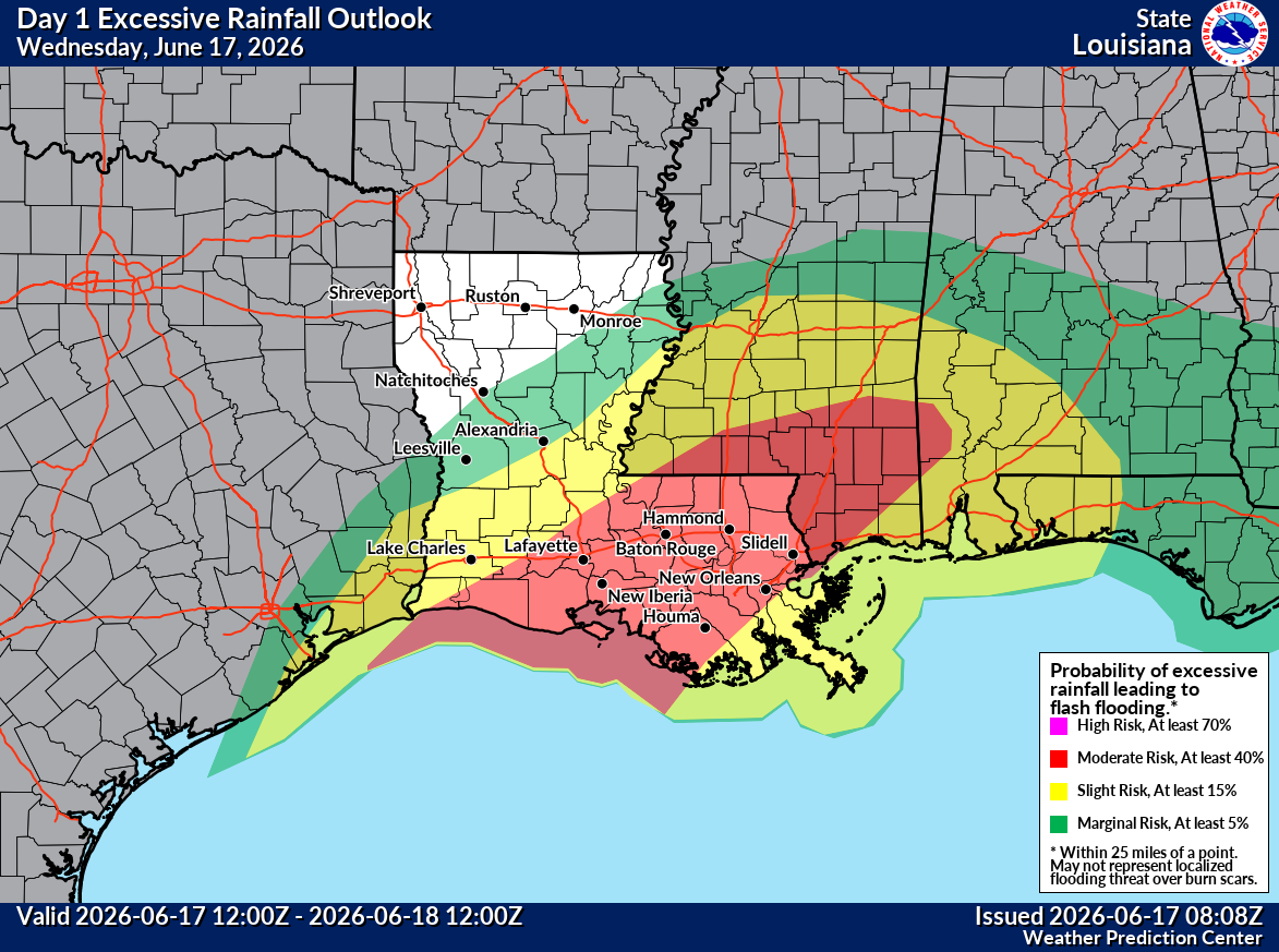
In general, rain totals seem to have backed off a little since yesterday, or at least they’re more focused on Alabama than Mississippi and Louisiana now. Still, upwards of 3 to 6 inches of additional rain, with isolated higher amounts are likely from about Baton Rouge through Auburn. Flood watches have been extended all the way to the Atlanta area now as this heavy rain expands. Those may also be expanded into parts of South Carolina eventually as well, as the system actually tracks pretty much due east across the South. About 1 to 4 inches of rain is possible in portions of north Georgia and South Carolina, especially inland.

Bottom line, the bullseye for flooding risks is in southern Mississippi and Alabama at this time, while more isolated flooding risks exist around those areas.
Once PTC 1 is out of the way, things should begin to calm down and heat up in the Deep South and Texas.
Potent Midwest severe weather outbreak
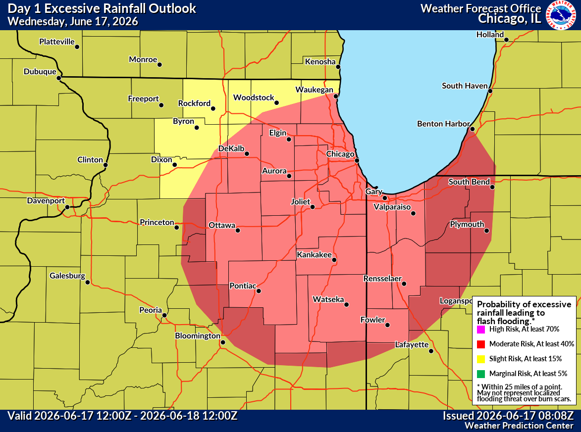
One other note while we have you this morning. There is also flash flooding risk today in the Chicago area, as well as in parts of northwestern Indiana. We could see as much as 2 to 4 inches of rain from storms today.
Additionally, there is likely going to be a rather potent severe weather outbreak today across a chunk of the Midwest. A moderate risk (level 4 of 5) is in place for areas just south of Chicago, north of St. Louis, and northwest of Indianapolis. All modes of severe weather are possible today from large hail to large, long-tracked tornadoes to powerful straight-line winds.
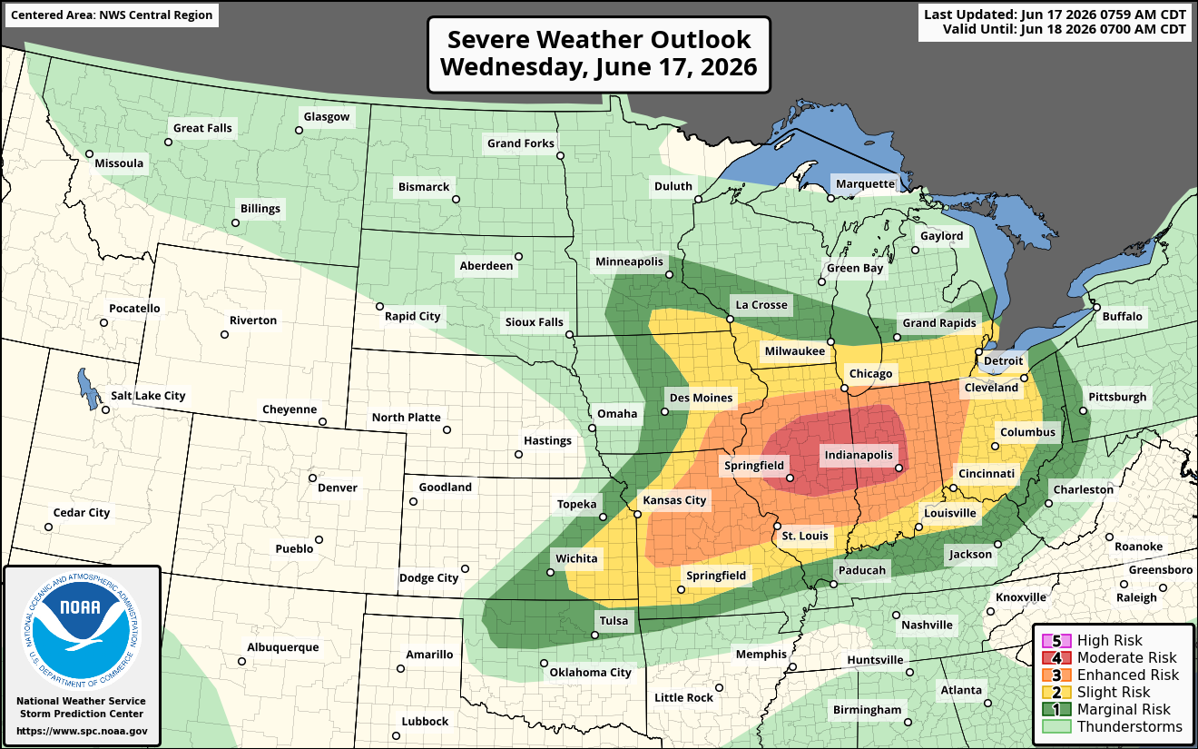
Surrounding the moderate risk is a large enhanced risk (level 3 of 5) that includes those cities noted above and extends from just outside Kansas City through Toledo. Basically, folks in these areas should ensure maximum awareness today around any warnings that are issued, and it’s probably a good day to take those warnings a little extra seriously given the potential that exists. There are already some potent storms impacting places like Peoria, IL this morning with wind gusts of 60 to 80 mph reported northwest of there back into Iowa.