In brief: Tropical Storm Edouard has about 8 to 12 hours left over water to intensify, and it will make an effort to do so. But it will run out of time later, bringing some gusty winds, surge, and heavy rain to parts of Louisiana and Texas. We discuss the situation in detail below.
The good news is that Edouard managed to make it through the night without intensifying much. In fact, maximum sustained winds this morning remain around 40 mph. The less good news is that “under the hood,” Edouard seems poised to try and make a go at intensifying a bit before it makes landfall in about 8 to 12 hours from this writing. Basically, Edouard has what it needs to try and intensify quickly up to landfall but whether its able to put all those things together is an open question and the difference between a sloppy 40 mph tropical storm making landfall and a compact 60 to 70 mph tropical storm making landfall.
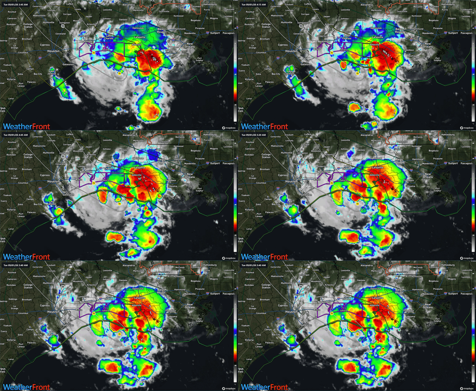
The NHC has taken that latter scenario and applied it to Edouard’s forecast, bringing ashore a 65 mph tropical storm near Sabine Pass later today. The environment around Edouard, other than proximity to land is as optimal as you really need for intensification. I saw a post on social media yesterday from someone that said essentially, “I suspect we’re going to see a lot of ‘good thing this didn’t have 24 more hours over water’ posts tomorrow.” I forget who posted it, but it seems spot on. The biggest limiting factor to Edouard today will be that it has less than 12 more hours over water.
In terms of impacts, Edouard will make landfall sometime this afternoon, likely within 10 miles or so of Sabine Pass, TX. Recall yesterday that we said Edouard’s wind field was likely to be compact when it began intensifying, no more than 30 miles or so across. The current wind radius on Edouard is 25 miles from the center. This means that any wind impacts from Edouard will be very isolated to near where the center comes ashore. The best chance of wind gusts officially reaching tropical storm intensity will be between Cameron, LA and just west of Sabine Pass, perhaps to High Island.
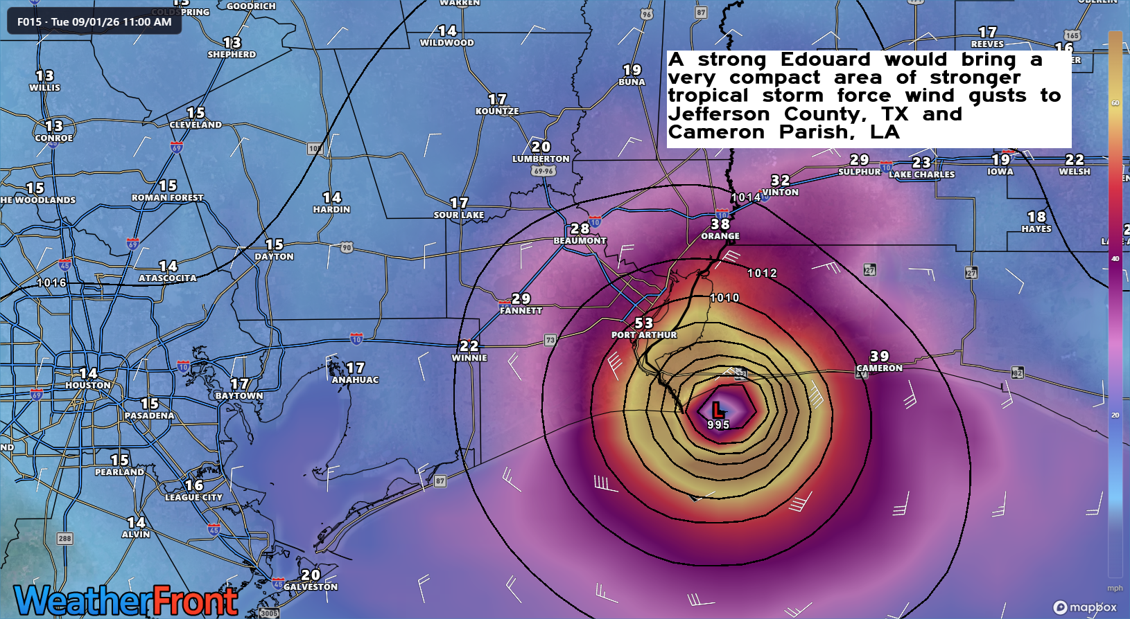
Edouard is going to weaken quickly once inland, and by the time it reaches I-10, it will probably barely be able to hold together tropical storm force wind gusts.
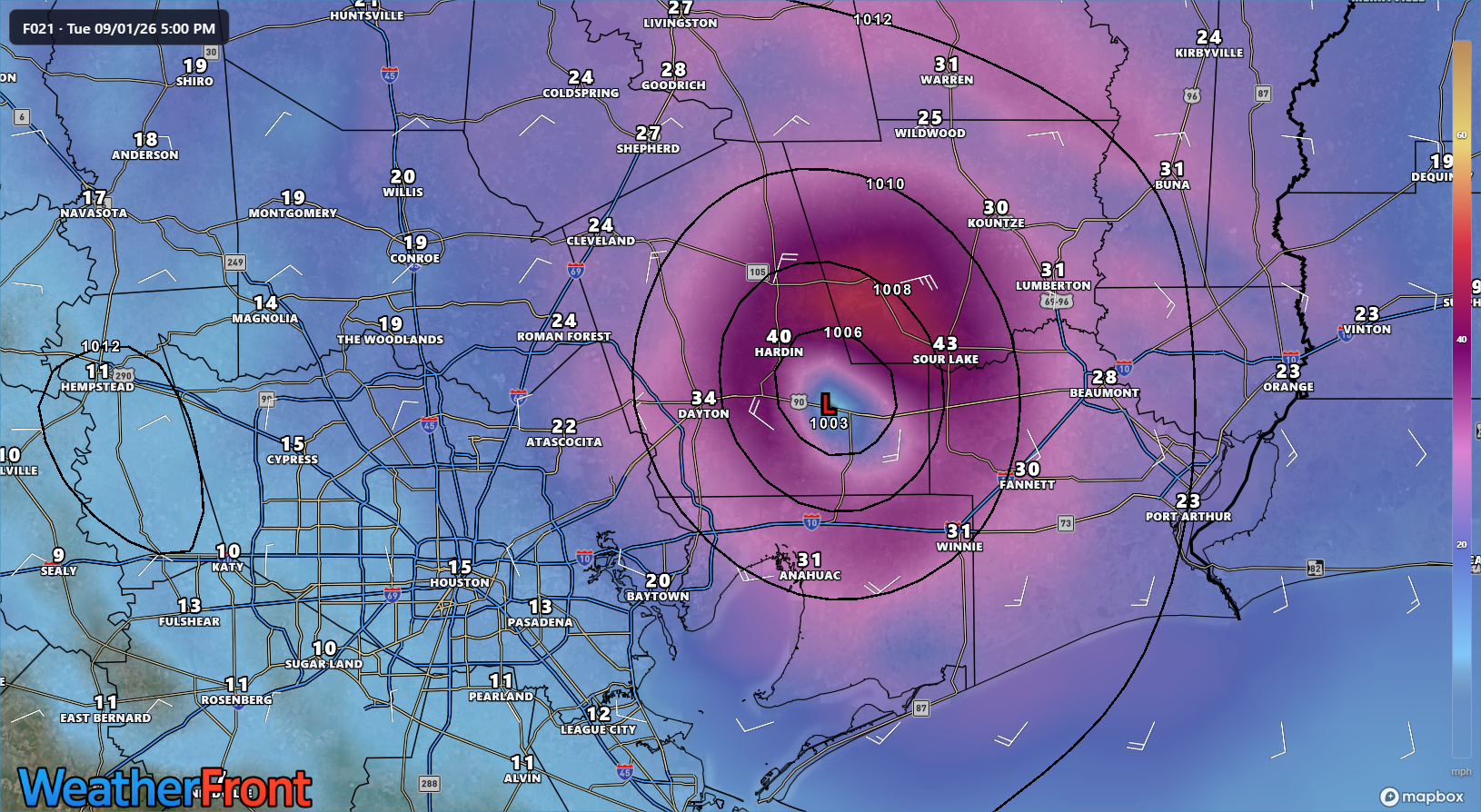
Some residual gusts to tropical storm strength are possible east of Houston, across Liberty, northern Chambers, or Hardin Counties but that would be about it. It seems highly unlikely that Houston itself will see tropical storm conditions at any point.
Obviously, the rain will be another story. It continues to appear that any real flash flooding risk is east of Houston today and tonight. Locally heavy rain may occur across Liberty, Chambers, Hardin, and Jefferson Counties in Southeast Texas and in Calcasieu and Cameron Parishes in Louisiana.
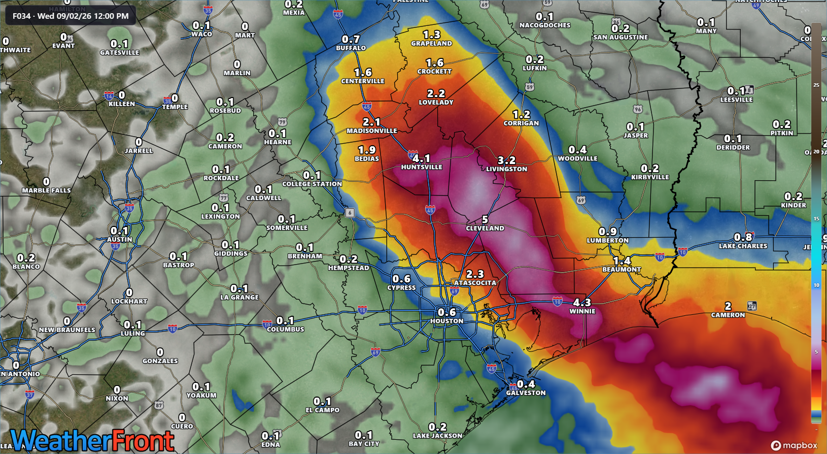
Rain totals are taken from the REFS ensemble system above, and they may be a bit aggressive east of Houston. But you get the idea: 3 to 6 inches of rain in a narrow corridor between Houston and Beaumont.
This is somewhat speculative on my part, but the remnant center of Edouard should be in the Brazos Valley tonight, near Huntsville or Madisonville. We sometimes see the centers of these things try to pop up more numerous thunderstorms than forecast during the diurnal peak in convection overnight (the propensity for tropical systems to peak their thunderstorm activity in the overnight hours). There could be a localized flooding threat somewhere up near Huntsville, Madisonville, or Centerville overnight, so just be aware of that. A flood watch is posted over a wide area of Texas today.
The good news is that a lot of places are rather dry right now, so the rain should be soaked up in a lot of cases. Obviously, you never want too much too fast. But the hope is that this will limit serious flooding.
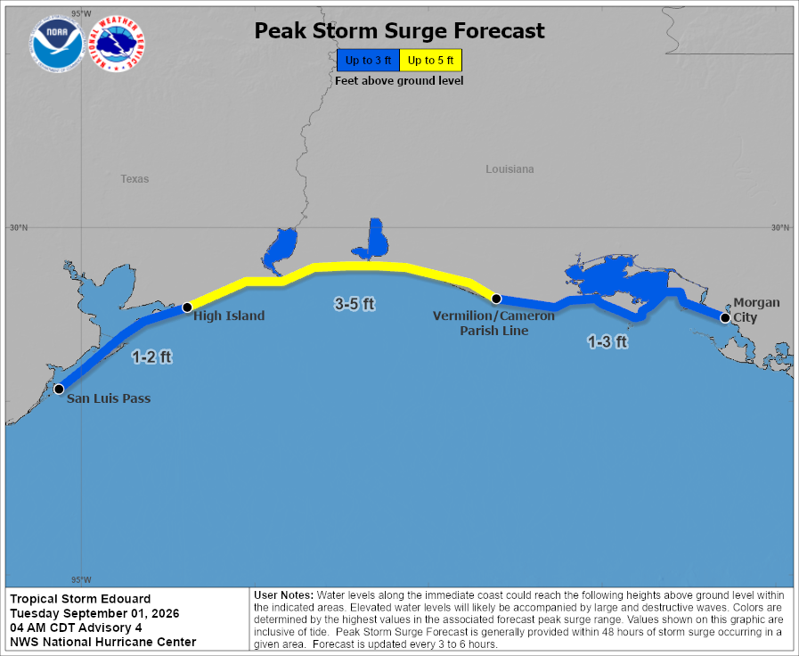
Last point here, storm surge flooding should impact travel on Gulf Beach Highway in Louisiana through the day today, with up to 5 feet of surge possible near and east of where Edouard comes ashore.
Follow Space City Weather for the latest details on Edouard around the Houston area.