In brief: Edouard made landfall as a moderate to strong tropical storm this afternoon, with wind gusts of 60 to 70 mph in the Port Arthur and Sabine Pass areas. Tonight, the focus shifts to heavy rain, and there is a localized significant flooding risk outside the Houston Metro area near Lake Livingston and perhaps parts of the Piney Woods. We explain.
Tropical Storm Edouard gets a tip of the cap this evening. While it did not quite go to the maximum intensity risk we discussed last evening (as a possibility, not a likelihood), it did strengthen into a respectable tropical storm, outdoing all but Bertha this season in terms of accumulated cyclone energy.
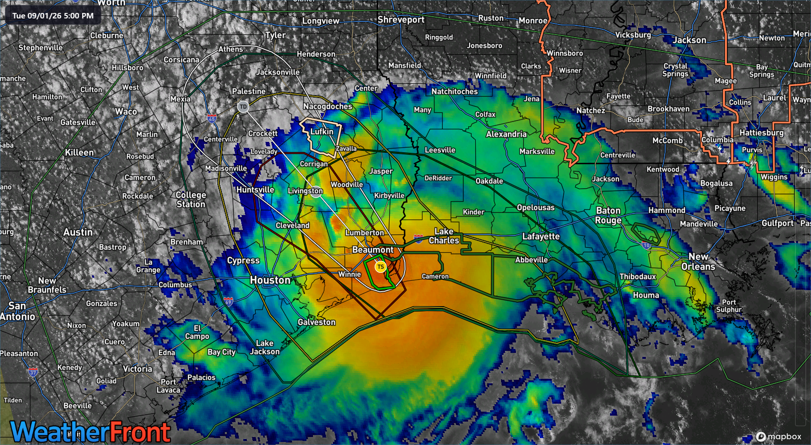
Heavy rain is moving inland with Edouard. Totals have been as high as almost 3.5 inches just west of Port Arthur. Heavy rains continue.
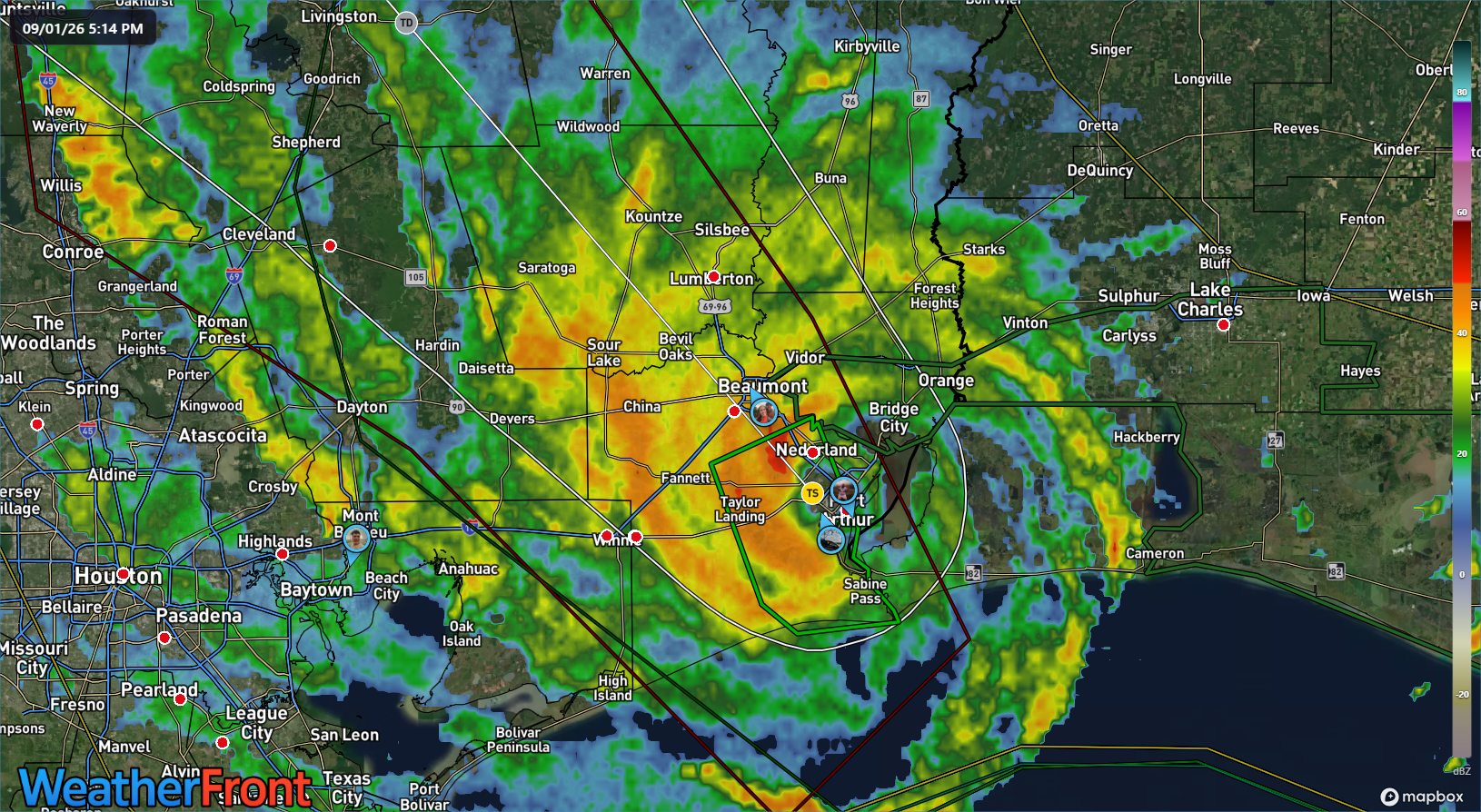
As we go through tonight, the heaviest rain will fall near the track of Edouard inland. That is currently expected to work toward Lake Livingston in southeast Texas and perhaps toward the Huntsville area. Depending on the exact track, we could see a period of torrential rainfall after midnight near the center of Edouard or just to the southeast. I mentioned this earlier this morning as a possibility, but I am more concerned about this now after looking at the latest model data. This does *not* include the Houston metro. This should theoretically line up somewhere between Crockett, Huntsville, and Lake Livingston. This is the area I am most concerned about with regard to flash flooding tonight. Some of the higher resolution modeling we use shows potential for 5 to 10 inches or even more of rain in that area, particularly near Lake Livingston.
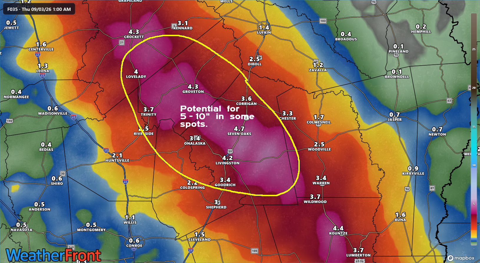
I would encourage any of our readers in that area around Lake Livingston to take special care to pay attention to things overnight as the rain evolves.
After that, while Edouard is done, there may continue to be sporadic bouts of locally heavy rain in interior Texas, particularly between I-35 and I-45 east of Waco tomorrow and perhaps west of Waco on Thursday. Keep an eye on flooding chances in localized areas there. We know all too well how Texas geography sometimes manages with decaying tropical systems.
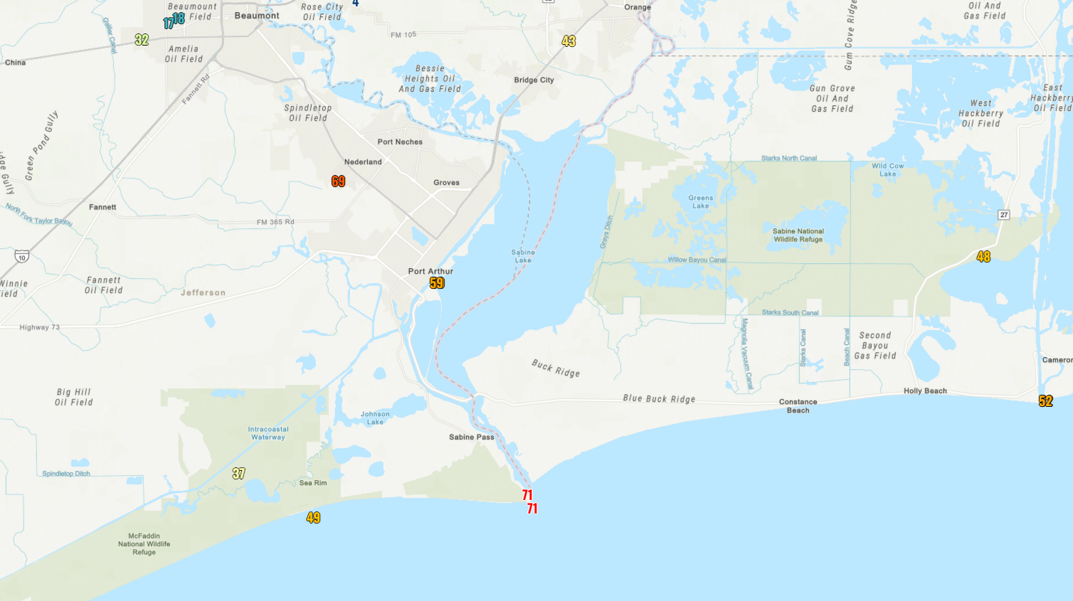
In terms of wind, Edouard will rapidly weaken over the next few hours. Current wind gusts stand around 35 to 45 mph in most spots, but the airport in Nederland just recently gusted to 69 mph and Sabine Pass is still seeing some 50 to 60 mph gusts right on the water. Maximum wind gusts were as high as 71 mph at Sabine Pass, near 60 mph in Port Arthur, and just over 50 mph at Calcasieu Pass.
We’ll continue to watch the progress of Edouard inland. The good news? There’s absolutely nothing else on the Atlantic side of the tropics to worry about over the next 7 to 10 days. We’ll take that at peak season.