In brief: As high moisture and additional moisture from the Gulf and Eastern Pacific converge on the Southern U.S. this weekend, heavy rain chances will nudge up. We also check in on Pacific water temperatures and what they tell us about the next few weeks of hurricane season.
A return to more unsettled, wet weather is coming this weekend for the South. While no organized tropical system is expected to develop in the Gulf, a boost in atmospheric moisture across Texas, parts of the Deep South, and Southern Plains will come courtesy of Tropical Storm Cristina’s remnants from the Pacific.
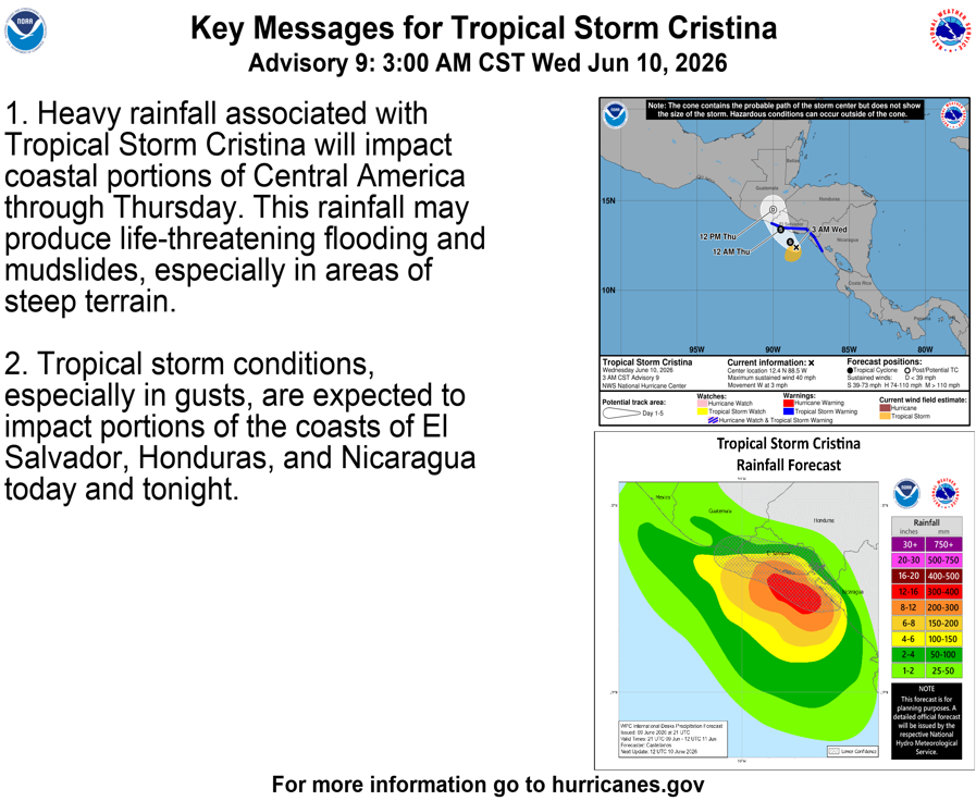
While Cristina is moving slowly toward the coasts of El Salvador and Guatemala, it will begin to pick up a little speed and its remnant moisture will end up in the Bay of Campeche by Friday with additional moisture following behind it.
As all this moisture funnels north and combines with already elevated moisture levels in the Southern Plains and Deep South, we are likely to see areas of heavy rainfall emerge beginning Saturday and continuing into Monday or so. Modeling does not entirely agree on where the heaviest rain will occur with this setup, but it does appear that areas near the Gulf Coast from Texas into Mississippi (as AI modeling thinks), as well as eastern Oklahoma through Arkansas and Missouri will probably be at the highest risk of seeing 2 to 4 inches, with locally higher amounts.
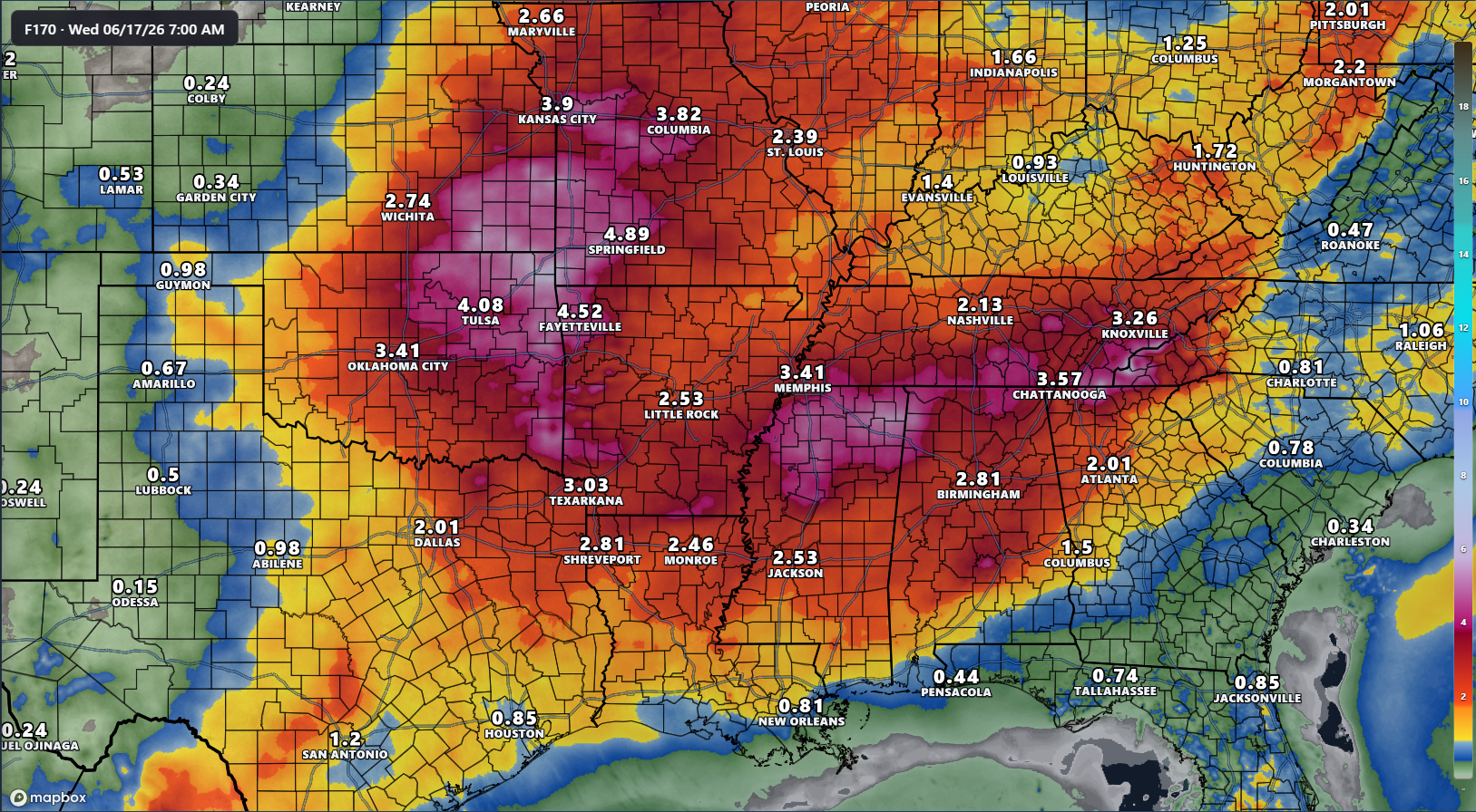
In fact, parts of Oklahoma and Arkansas are already in a slight risk (level 2/4) for excessive rainfall on Saturday, slinking south on Sunday.
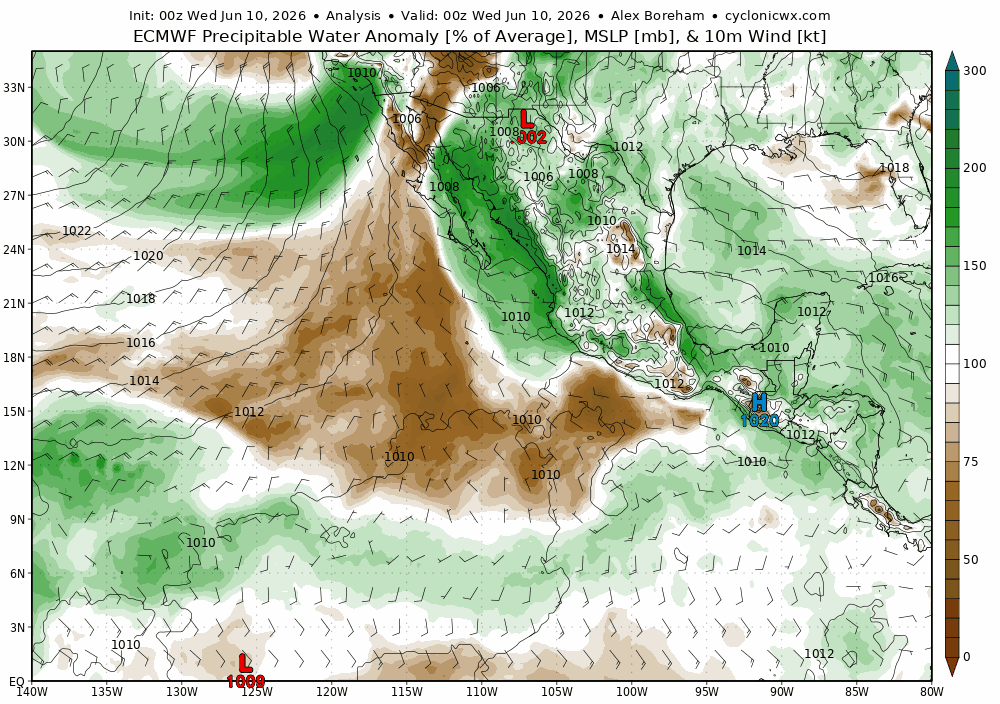
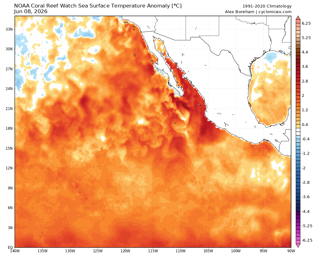
I think it’s notable to point out just how warm the water in the Pacific is, and this is outside the main El Niño regions we watch. Just in general, the Eastern Pacific is extremely warm right now, and that’s likely aiding in some of the locally heavier rains we’ve seen across the Southern U.S. over the last several weeks.
I would expect to see continued tropical activity on the Pacific side of Central America in the days and weeks ahead as well, even if the stronger background support that we’ve seen lately fades a bit. But with a “beginning to rage” El Niño in place, history suggests that’s one place the action will be pretty constant this season.
For folks on the Atlantic side of things, it continues to look fairly uneventful for a bit.