In brief: While formal tropical development seems unlikely from a Gulf disturbance, the combination of surging tropical moisture and elevated moisture pooling ahead of a cold front may setup a pretty significant heavy rain and flash flooding sitWuation from Texas through Alabama later Sunday through Wednesday.
The National Hurricane Center designated an area to watch yesterday morning in the Bay of Campeche. We’ve been talking about this area on again and off again for a little while now, and it’s now firmly in view.
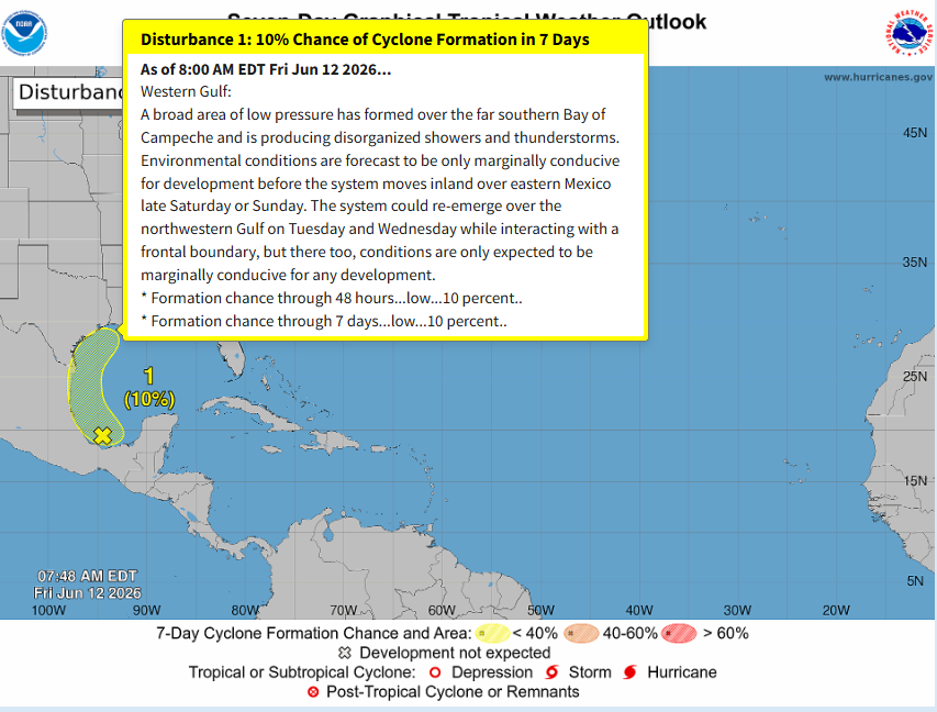
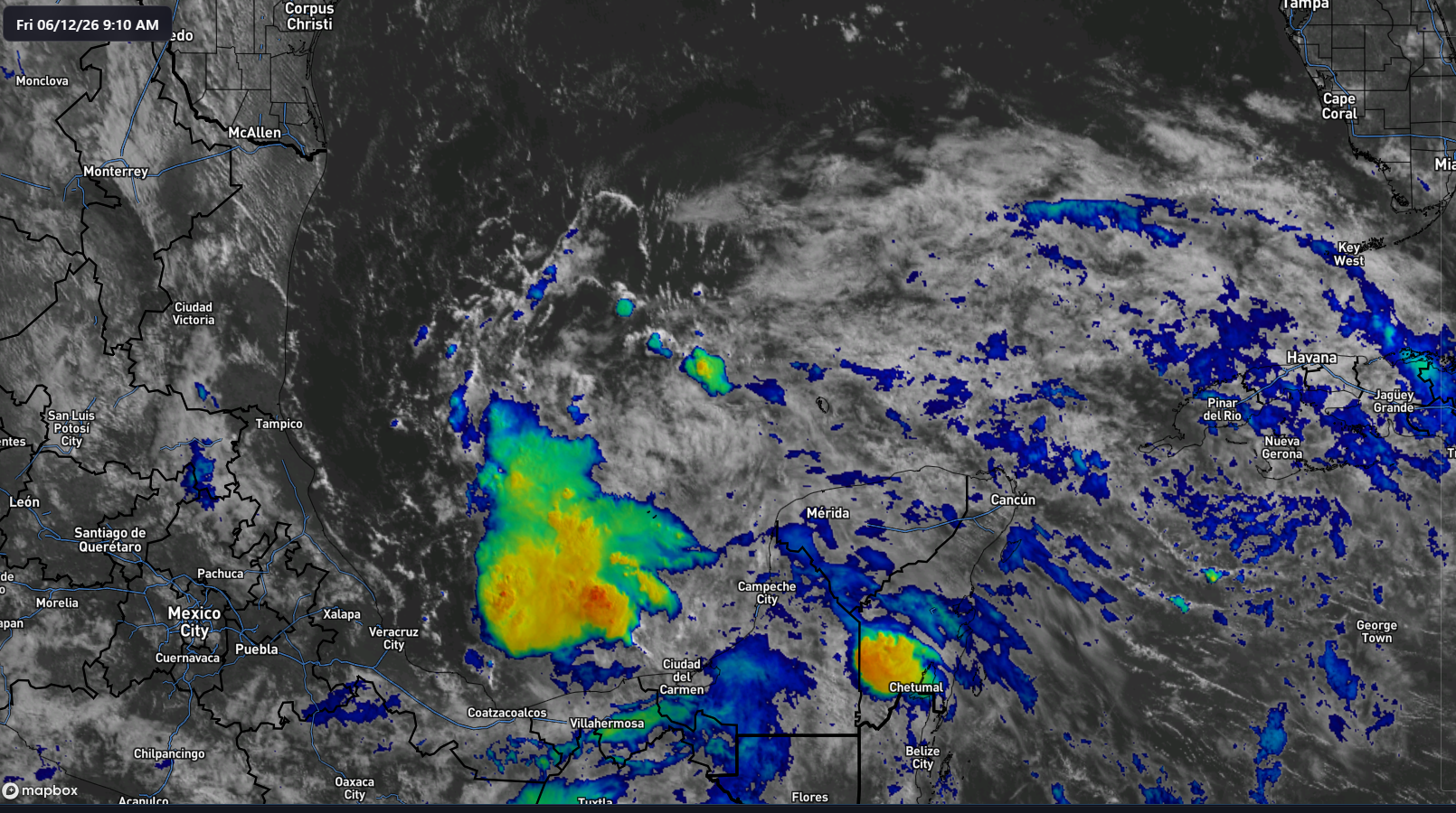
On satellite, there’s definitely a disturbance evident, but what is missing is any sort of surface reflection of this. We’re just dealing with a little too much turbulence in the western Gulf right now to think this has a realistic chance to organize. Wind shear quickly builds to 20 to 30 knots north of the system, so it’ll be entering increasingly hostile territory.
So, we don’t expect much of anything formal from this.
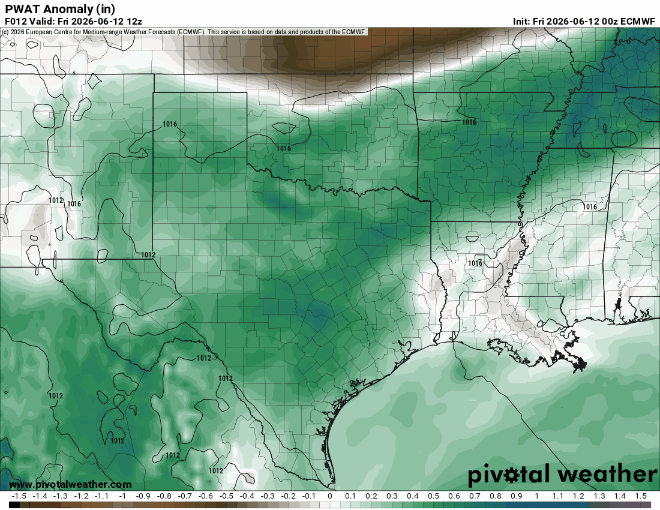
That said, this is going to setup a somewhat interesting situation in the Southern U.S. beginning later Sunday and lingering through Tuesday. As tropical moisture from this disturbance surges northward, it’s likely to interact with a somewhat unusually far south cool front for mid-June. The combination of a slowing/stalling front, already high moisture levels, and a surge of tropical moisture straight out of the Gulf and Caribbean is going to fuel a somewhat potent rainfall setup for a couple days.
It’s still a bit difficult to pin down exactly how much rain is expected and where is likeliest to see the highest totals. However, it seems that we’ll see heavier rain focus on Texas, including the Houston area Sunday night and Monday, spreading east into Louisiana Monday and Tuesday, and then east of there toward southeastern Louisiana, southern Mississippi, Alabama, and parts of the Florida Panhandle by Tuesday and Wednesday.
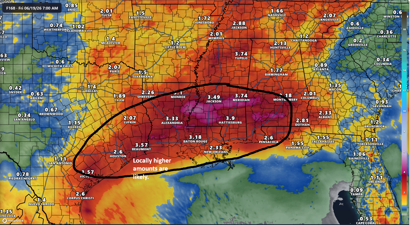
We’re already seeing slight risks (level 2/4) issued for flash flooding risk Sunday through Tuesday. It is possible we see that upgraded to moderate risk (3/4) at some point. I would watch the Houston area and southern Mississippi closest right now for more disruptive flooding risks.
That should clear out by mid to late next week, and then hopefully there will be some time to dry out. These areas will need it. More to come probably on Sunday.