In brief: A quick update late Wednesday morning on Tropical Storm Isaias, which has an improving satellite appearance and could undergo rapid intensification during the next two days before landfall along the northern Gulf coast.
Isaias status
As of 11 am ET on Wednesday, Tropical Storm Isaias has 45 mph sustained winds, and is moving relatively slowly to the east-northeast at 8 mph. It is clear from the storm’s appearance on satellite that Isaias is getting better organized. We should expect significant intensification.
Put another way, in the modern era (post-World War II) the Atlantic basin has never gotten this deep into an Atlantic hurricane season without an actual hurricane forming. But we are likely to break the streak in the next 12 to 24 hours.
Current thinking on track
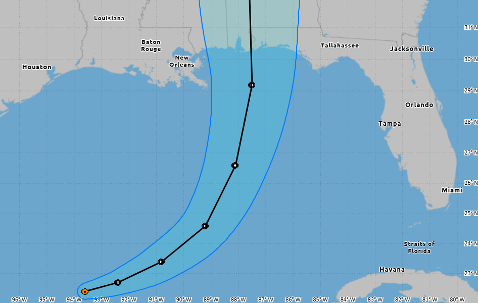
There continues to be a divergence in the physics-based models (i.e. Euro, GFS) and the AI-based model guidance. In terms of a landfall along the northern Gulf coast, the former models are closer to southwestern Louisiana or Mississippi, and the latter are more focused on areas such as Mobile, Alabama or Destin, Florida.
Following a reformation of Isaias’ center, I expect the various suites of models to come into better alignment today, which should allow us to increase our confidence in the track, and where the final landfall location will occur on Friday afternoon, evening, or early Saturday morning. Matt will have a more comprehensive post later today that I suspect will better be able pinpoint Isaias’ track over the next 48 hours.
What about intensity?
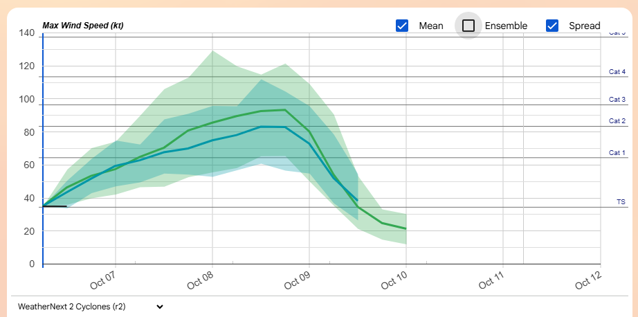
We are definitely concerned about the potential for rapid intensification with Isaias. Although it is early October, seas over the central Gulf are a few degrees Fahrenheit above normal for this time of year, and plenty warm to support strengthening. Isaias will also not encounter much dry air along the forecast track, and should enjoy a relatively low shear environment until later on Friday when it nears the coast.
So what does that mean? The National Hurricane Center presently forecasts that Isaias will reach a maximum of 110 mph winds on Friday morning before weakening slightly ahead of landfall. This makes Isaias a strong Category 2 hurricane, but it could easily be a category stronger or weaker at landfall. This will bring the potential for significant wind damage, and to the right of Isaias’s center, storm surge along the northern Gulf coast.
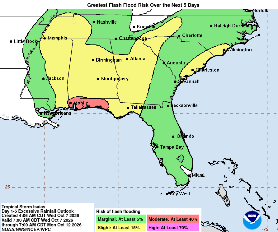
Coastal residents and businesses from Gulfport, Miss., to Apalachicola, Florida, should be paying close attention to Isaias. And inland residents, particularly in Alabama, should keep taps on the storm for winds and heavy rains on Friday and Saturday.
Much more later today.