In brief: Texas Hill Country was battered by heavy rain again this week, culminating in numerous flash flood emergencies this morning. Rain will gradually decrease and pull away tonight and tomorrow. Wildfire smoke is degrading air quality to extremely poor levels in the Great Lakes and parts of the Northeast. And the tropics? Not a whole lot to report.
Hill Country — again
Let’s start in Texas today. On Tuesday and Wednesday it rained heavily in areas west of San Antonio. Overnight and this morning, it rained torrentially. As a result, there is ongoing severe flash flooding in the area, including a flash flood emergency for Uvalde, Kerrville, and the Guadalupe River downstream of Kerrville.
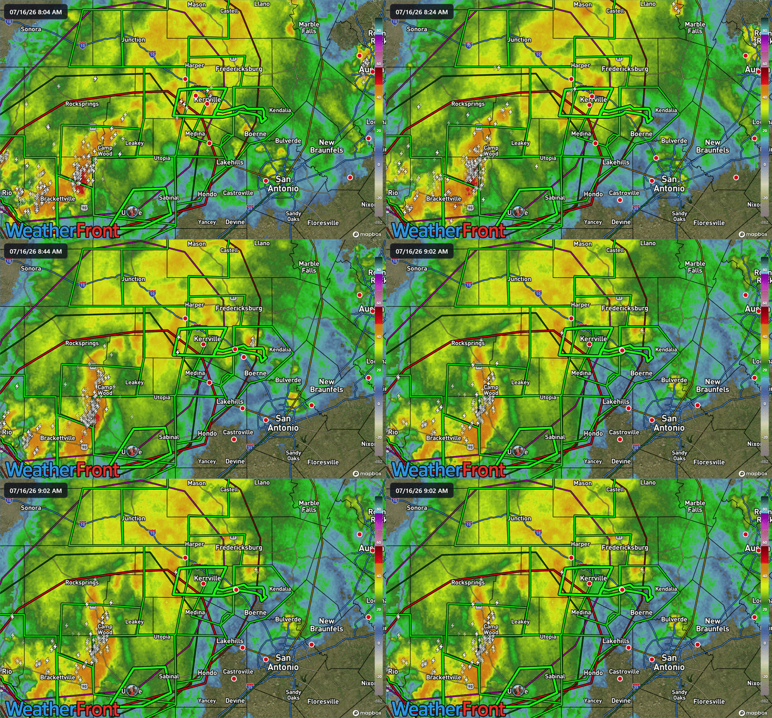
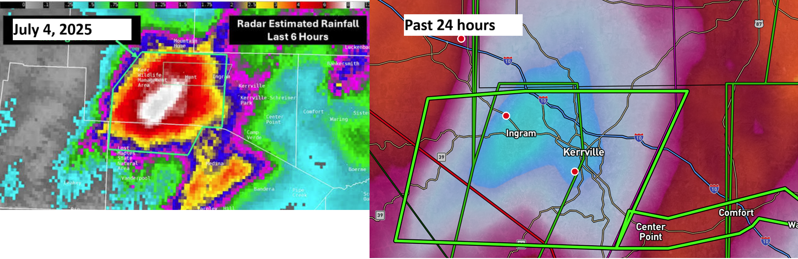
Unfortunately, there is additional heavy rain coming for Uvalde and probably Medina and Kerrville as well. This will move through before lunchtime, and it may deposit another 1 to 3 inches of rain before things settle down this afternoon. During the July 4, 2025 tragedy, the heaviest rainfall fell in the Guadalupe watershed upstream from Kerrville, near or just west of Ingram.
On the Guadalupe River downstream from Kerrville in Comfort, the river rose over 30 feet in a matter of hours.
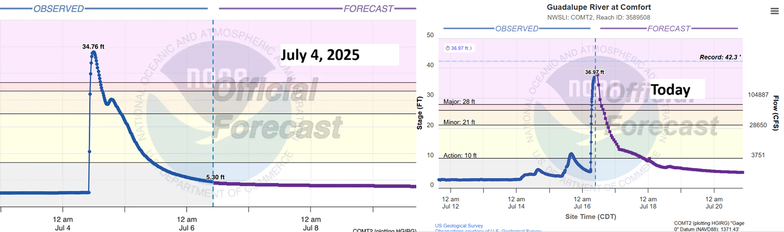
The outcome this time around has some notable differences from July 4th of last year. For one, the river rose higher at Comfort, likely due to the amount of water falling slightly farther downstream from 2025. It also rose “slower.” A 30 foot rise in 3 to 4 hours is incredible. Keep in mind, however, the water in 2025 accomplished a similar feat in 2 hours or less. Not to say this was a “gentle” rise, but it did not have quite the force and suddenness of last year’s. We also had 2 days of flooding leading into this in the area, so it should have been much more on people’s radars.
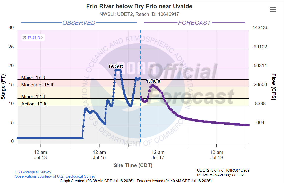
Now, the heaviest rain for this whole event has fallen near and north of Uvalde, more in the Nueces River watershed and Upper Frio River. The Frio below Uvalde right now has been raging. We had one crest yesterday over 19 feet, another this morning over 17 feet, and likely a third one coming.
The amount of rain that has fallen is really remarkable. Gauge corrected estimates are around 27 to 28 inches in areas just north of Uvalde over the last 3 days.
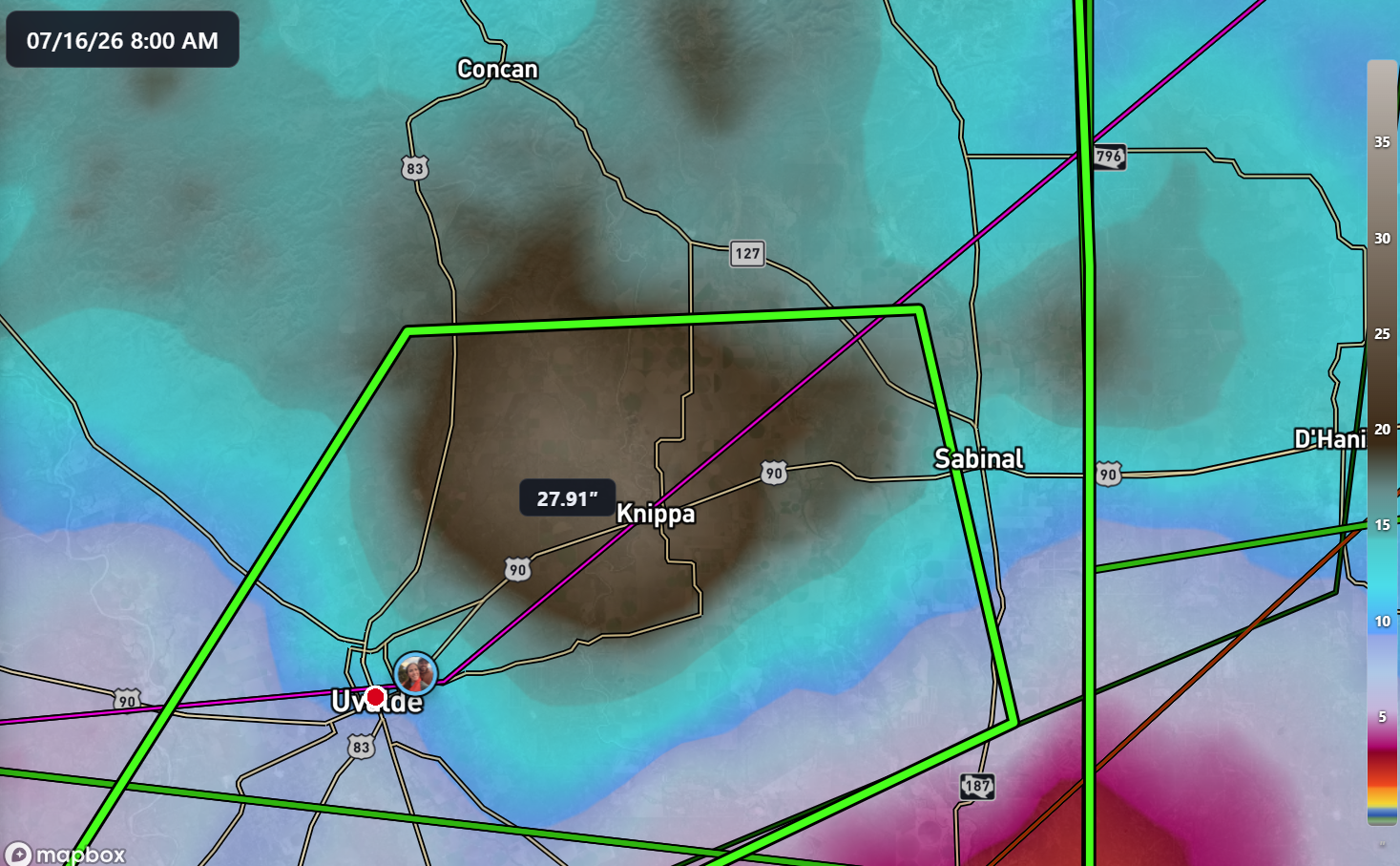
All this water is going to flow into the Nueces River. If you’re looking for some silver lining in all this, at least some of this water should be captured in Choke Canyon and Lake Corpus Christi, which would help further alleviate water supply issues in the Coastal Bend. Either way, the flooding right now is catastrophic near Uvalde and on the Guadalupe downstream from Kerrville. We don’t yet know the toll of this event, but the hope is that it should be less costly in human lives than 2025. Our thoughts are with those impacted areas at this time.
Going forward
Once the rain slows down this afternoon, we’ll get a break into evening in many impacted areas. The upper low that has been helping to drive the storminess in Texas is slowly backing toward New Mexico. This should lead to the focus of rain shifting west too.
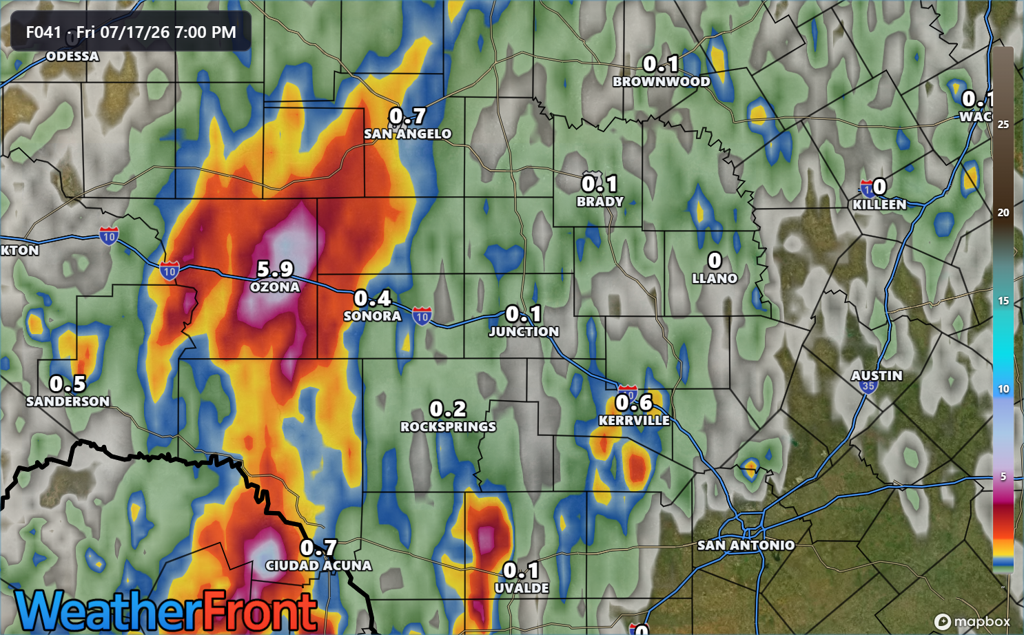
While some isolated heavy downpours are possible once again near Kerrville and Uvalde, the heaviest rain tonight should fall near Ozona north into San Angelo. We’ll need to watch for flooding in those areas overnight, but the good news is that there has been far less preceding rainfall there like we saw in Uvalde and Kerrville the last few days. So hopefully the flooding issues tonight will be more standard flash flooding than this crazier stuff. But we’d strongly advise folks to take these rain forecasts seriously.
Other news: Smoke and tropics
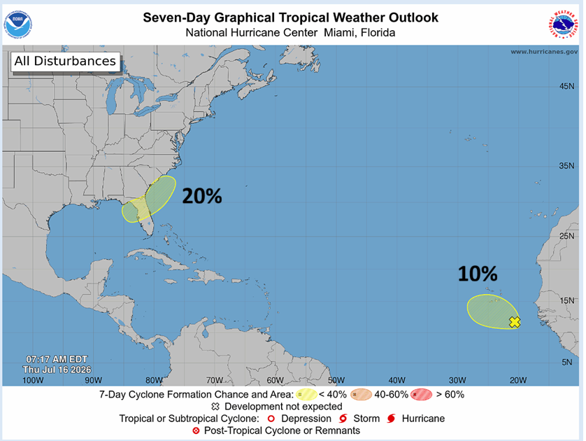
The tropics remain generally quiet. The NHC continues to outline a 20 percent risk of development in the northeast Gulf or off the Southeast coast. We continue to see minimal model support for anything of note there. They’ve also introduced a 10 percent risk off the coast of Africa, but models seem to agree that any disturbance and development risk will be eliminated by Sunday.
Canadian and Minnesota wildfires continue to rage, and all that smoke is being blown toward the Great Lakes, New England, and the Mid-Atlantic.
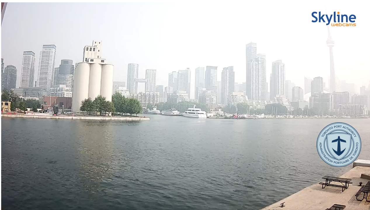
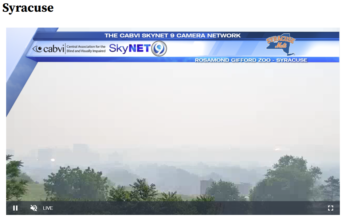
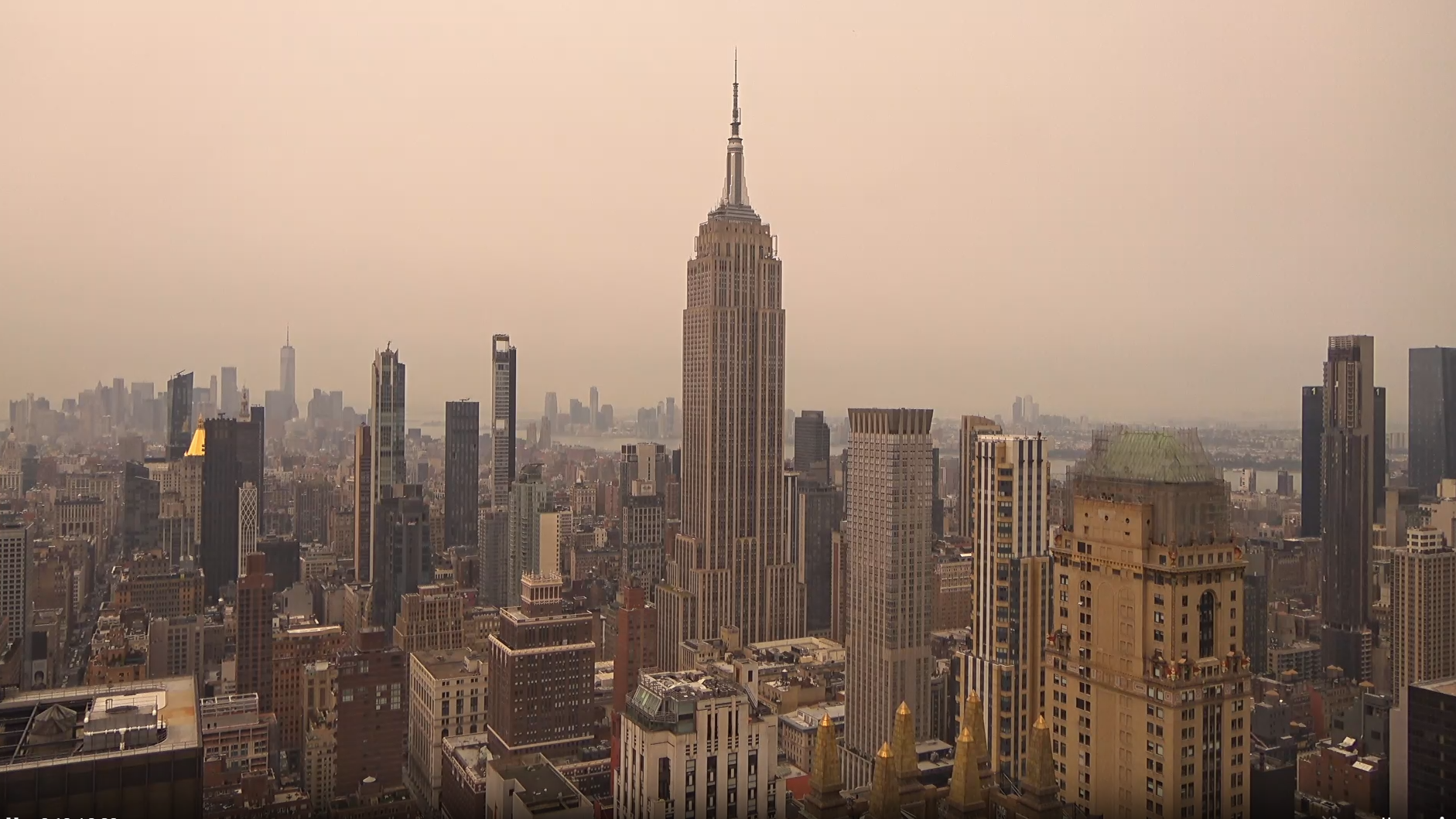
Yes, there will be moments of dystopian looking conditions across the Northeast and Lakes. Air quality is likely to be severely degraded in spots as well.
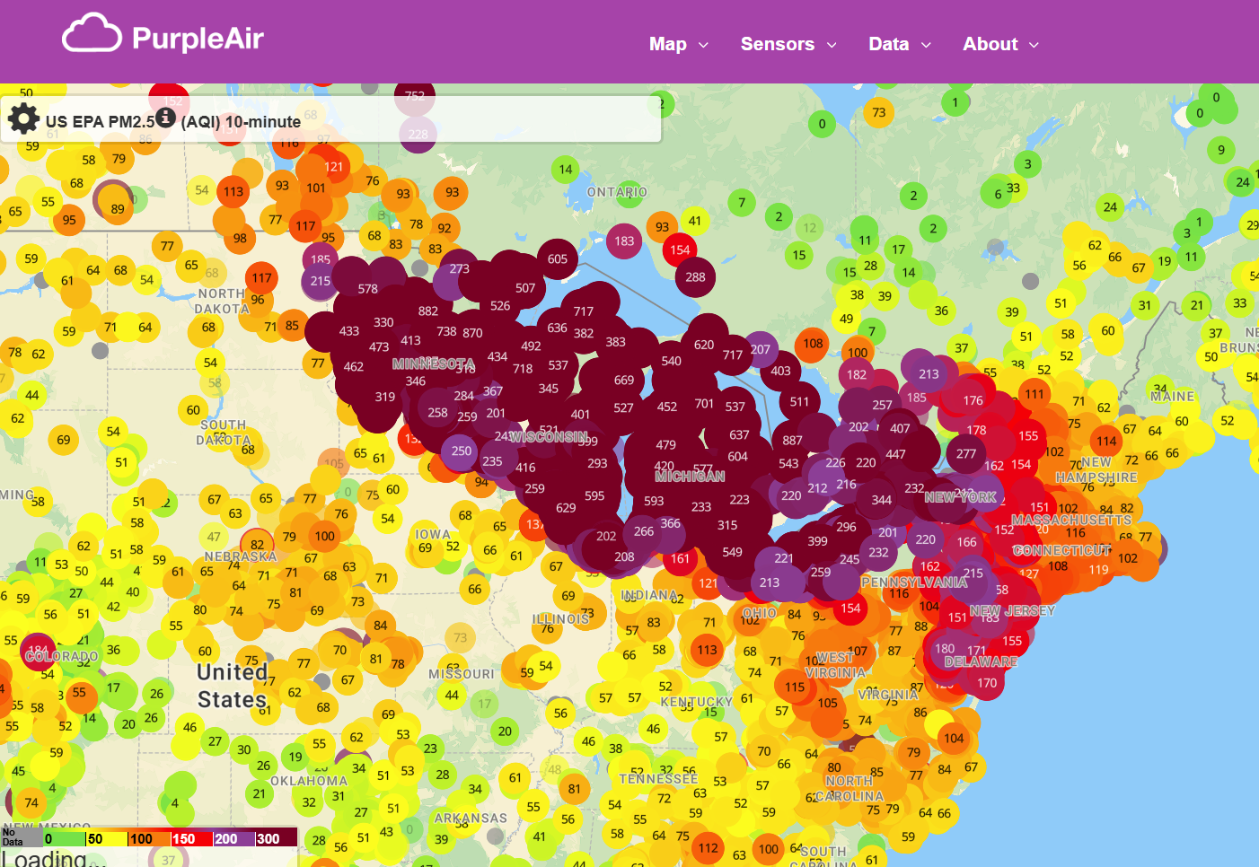
The PM2.5 levels over the Great Lakes are already at their most hazardous. They’ve been there for a couple days now, and it’s important for anyone with sensitivities to air quality to take this seriously.
So, a lot going on, very little of it good. We’ll continue to monitor things in the days ahead.