In brief: Heavy rains continue to pound parts of Texas. Wildfire smoke is choking parts of the Great Lakes, Northeast, and Mid-Atlantic. And the tropics continue to slow burn in the northeast Gulf with lower-end risks over the next few days.
Texas flooding
This morning’s rains mostly ended up where they had been expected, which was between San Angelo and I-10. Unfortunately, that has led to additional flash flood emergencies this morning for both Sonora and Ozona. This is north and west of yesterday’s catastrophic flooding.
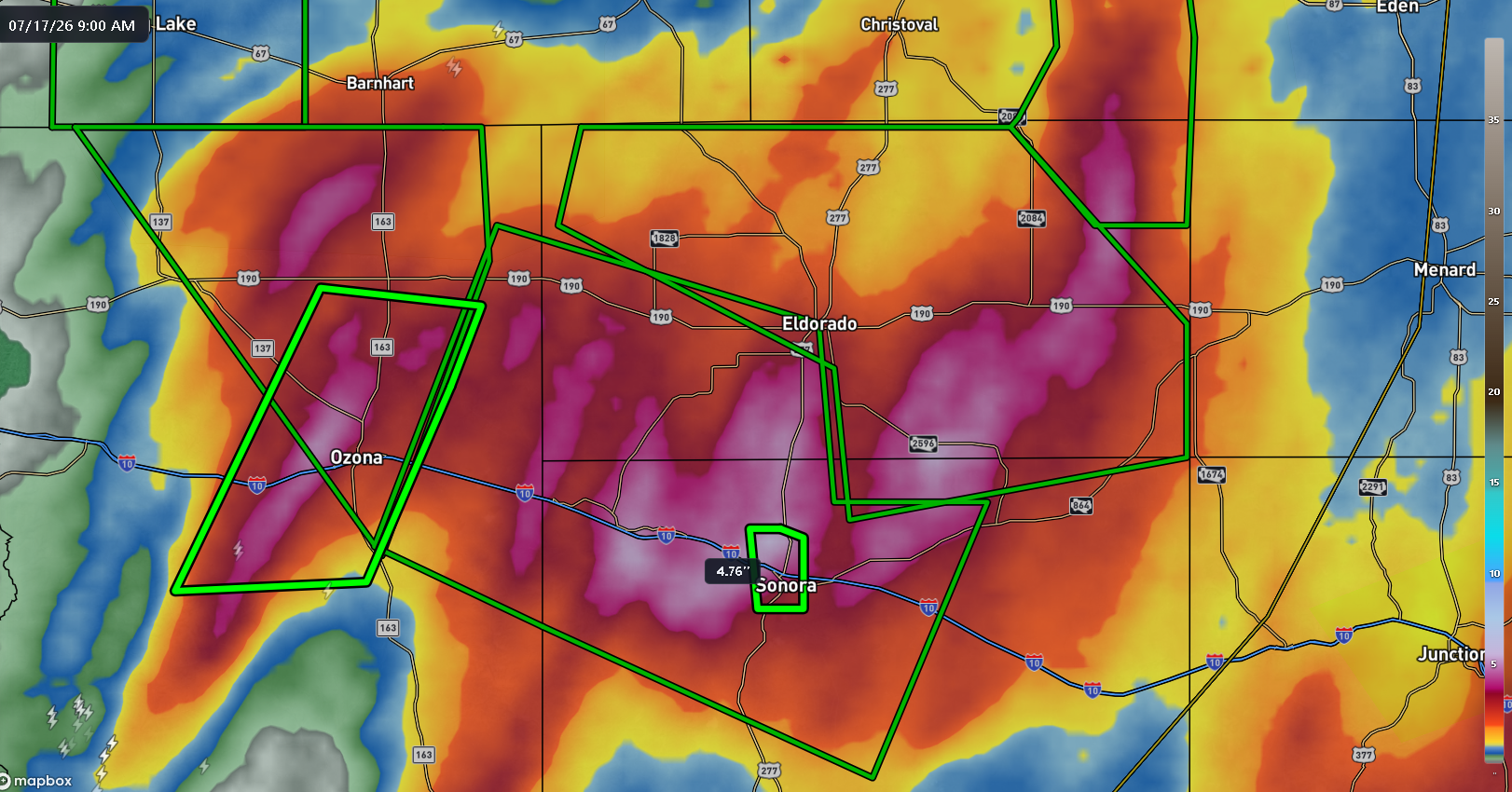
Totals of 3 to 6 inches have been recorded so far. You may be asking why the totals there are so much lower than to the east, yet still prompting flash flood emergencies. As you move toward San Angelo, you get deeper onto the Edwards Plateau, and you run into more of an arid climate. Thus, it takes less rain in some of these areas to generate flash flooding. And 3 to 6 inches of in 12 to 24 hours in a place that averages roughly 20 inches of rain annually can cause major problems. And in both Sonora and Ozona there are reports of water into homes and water rescues ongoing. Eldorado is seeing significant impacts as well. Much like it has the last few days, the rain will need to basically rain itself out over the next few hours. Rainfall tonight is expected to shift even farther north and west as the upper level system gradually loses definition. Whatever the case, this is going to end up being a memorable and very damaging Texas flooding week.
We can start to wrap our minds around what occurred south and east of today’s impacted areas. Here are rain totals for the week.
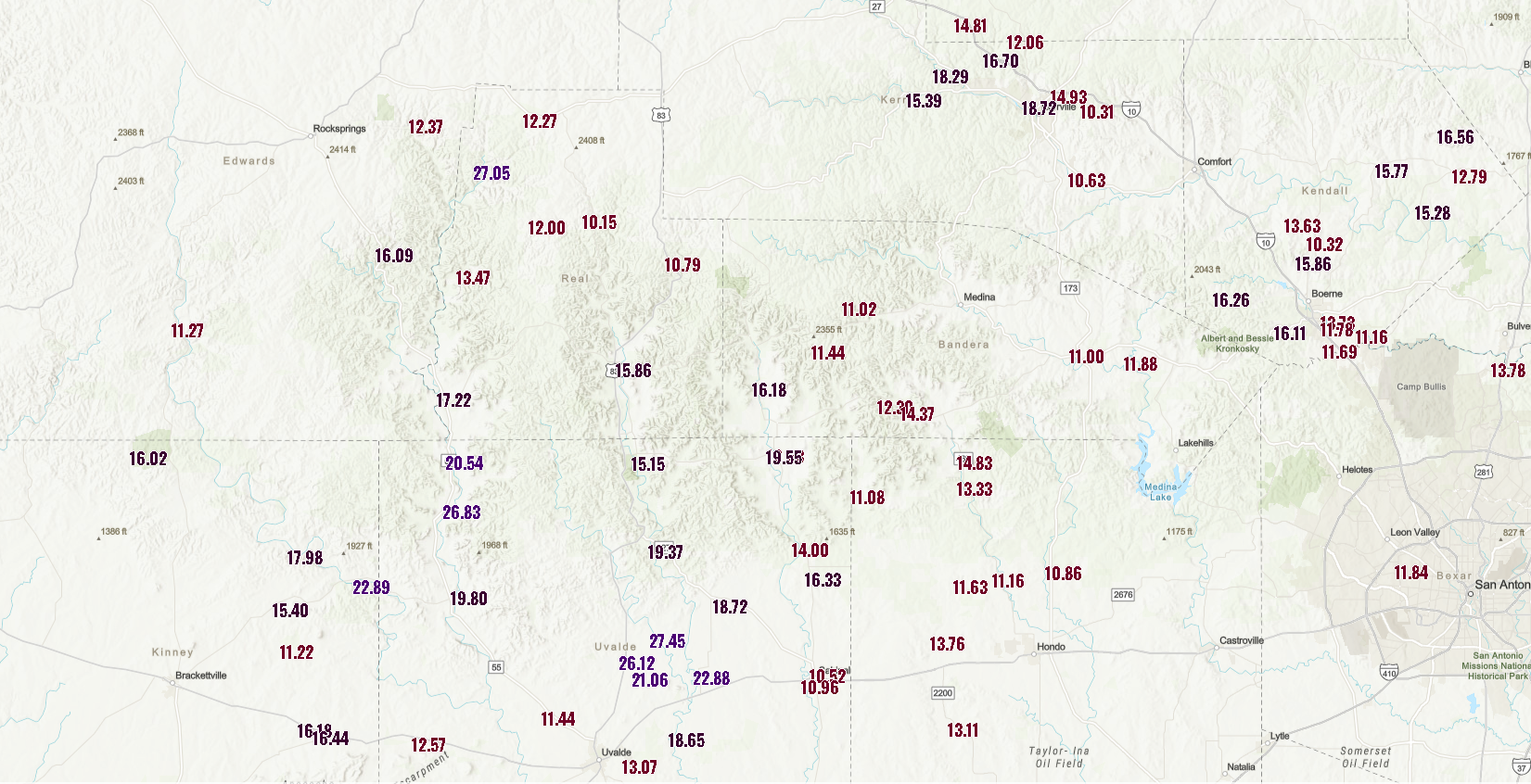
Some places received over 27 inches of rainfall. I want to wrap some context on this. First, for the latest on the impacts of the flooding on people and communities, the Texas Tribune has been all over things. Second, if you want to learn more about the lengthy history of flooding in Texas, you want to pick up a copy of “Flash Floods in Texas,” by Jonathan Burnett. It’s on backorder at bookshop.org. But it’s a fantastic reference on the many, many types of flooding events that have impacted the state.
Two things can and are true. 1.) Texas flooding is a normal part of life in the state. It’s happened forever. It will continue to happen. The response to the 2025 floods was positive, but the state should be doing more to manage and mitigate it. 2.) Flooding is becoming more likely because of climate change. Slow moving upper lows across Texas are fairly common at times. But the amount of moisture available in the region has been excessively high. At least some of that is due to the increasingly warmer Gulf.
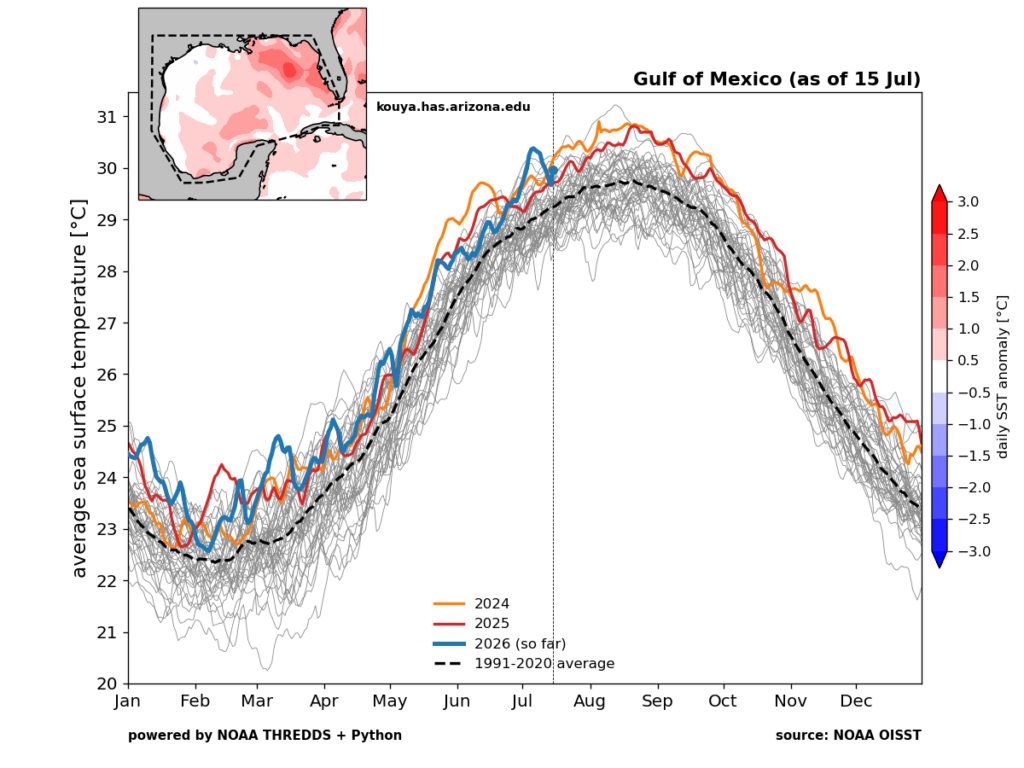
In recent weeks the Gulf has been hovering near all-time record warm levels. It’s still up there. Is the Gulf warm every summer? Yes it is. However, in recent years it has become just a little bit hotter. That is the equivalent of adding icing to an uniced cake. Not sure who would eat an uniced cake, but if you did, you’d still be consuming sugar and calories. But by adding icing, you’ve increased the sugar and calories by a certain percentage. That’s what the warm Gulf means for available atmospheric moisture. In a perfectly stable world, would you have had this flooding event? Probably. But would it have had slightly lower peak rain totals and rain intensities? Yes, probably. Those extra “calories” can mean the difference between a bad flood and a catastrophic one. It’s important to understand this reality in the context of saying “flooding is normal” in Texas. It is, but that’s far from the whole story today.
Wildfires
On the other extreme, rampant wildfires in Ontario continue to choke out parts of the Northeast, Mid-Atlantic, and Great Lakes with smoke today. Air quality? Not great!
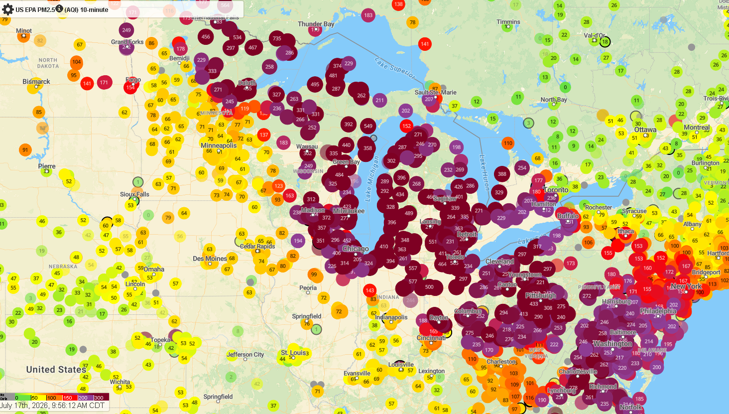
From Duluth through DC, air quality sits at hazardous levels. Kudos to Major League Baseball and ESPN for moving last night’s Phillies vs Mets game up an hour to avoid the worst smoke. It still looked bad visually, but the difference in observed air quality readings was enough to avoid having to delay the game.
The good news is that air quality will dramatically improve tonight and tomorrow as winds shift and move the smoke to more of a north to south trajectory. Unfortunately, this means Minnesota and parts of the Midwest including Milwaukee and Chicago will likely be back in the smoke by tomorrow night.
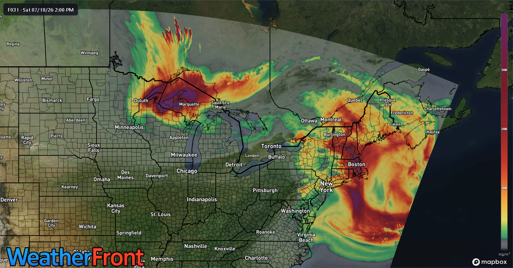
Wildfires continue apace in Ontario. Suppression efforts should be aided by cooler temperatures and rain chances.
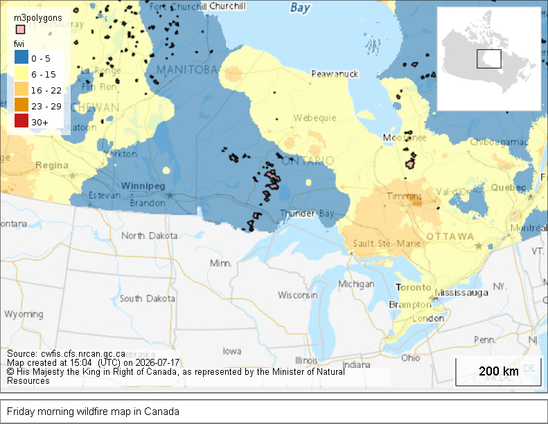
One of the primary causes of the wildfires was exceptionally hot and dry weather, with several locations very far north setting records earlier this week for highest 500 mb height or hottest temperature of all-time. Another situation where several things are simultaneously true: Wildfires are not abnormal in this part of the world, forest management plays a not inconsequential role in size and scope of fires, and climate change adds the icing to the cake increasing the heat, fire intensity, and potential for fire starts.
And don’t look now, but we have new fires going in the West, especially Oregon today as well.
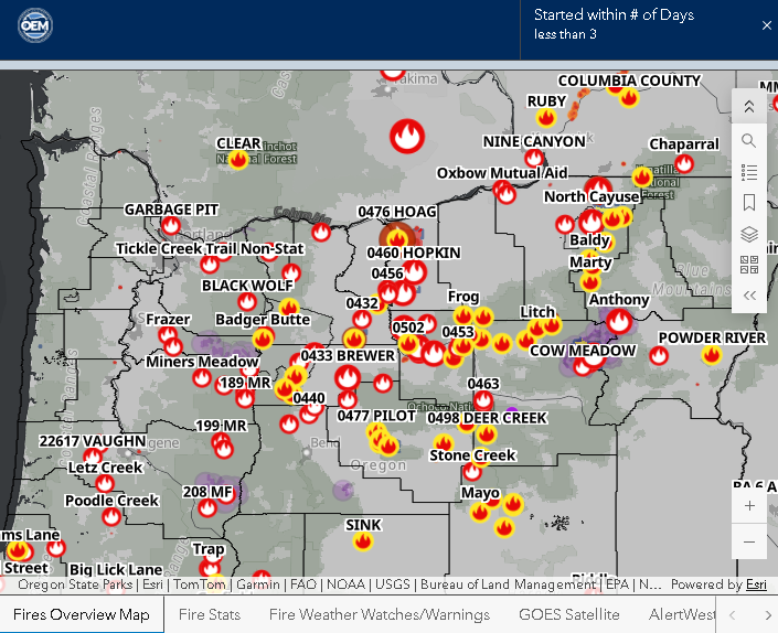
Multiple new fires have started with lightning a culprit in that area. Hotter and drier weather next week may exacerbate some of these fires.
Tropics
The NHC continues with about a 20 percent chance of development in the northeast Gulf over the next few days. This is fine for now. Over the next couple days, about 18 percent of Google’s 1,000 member ensemble develops this system into a low-end one.
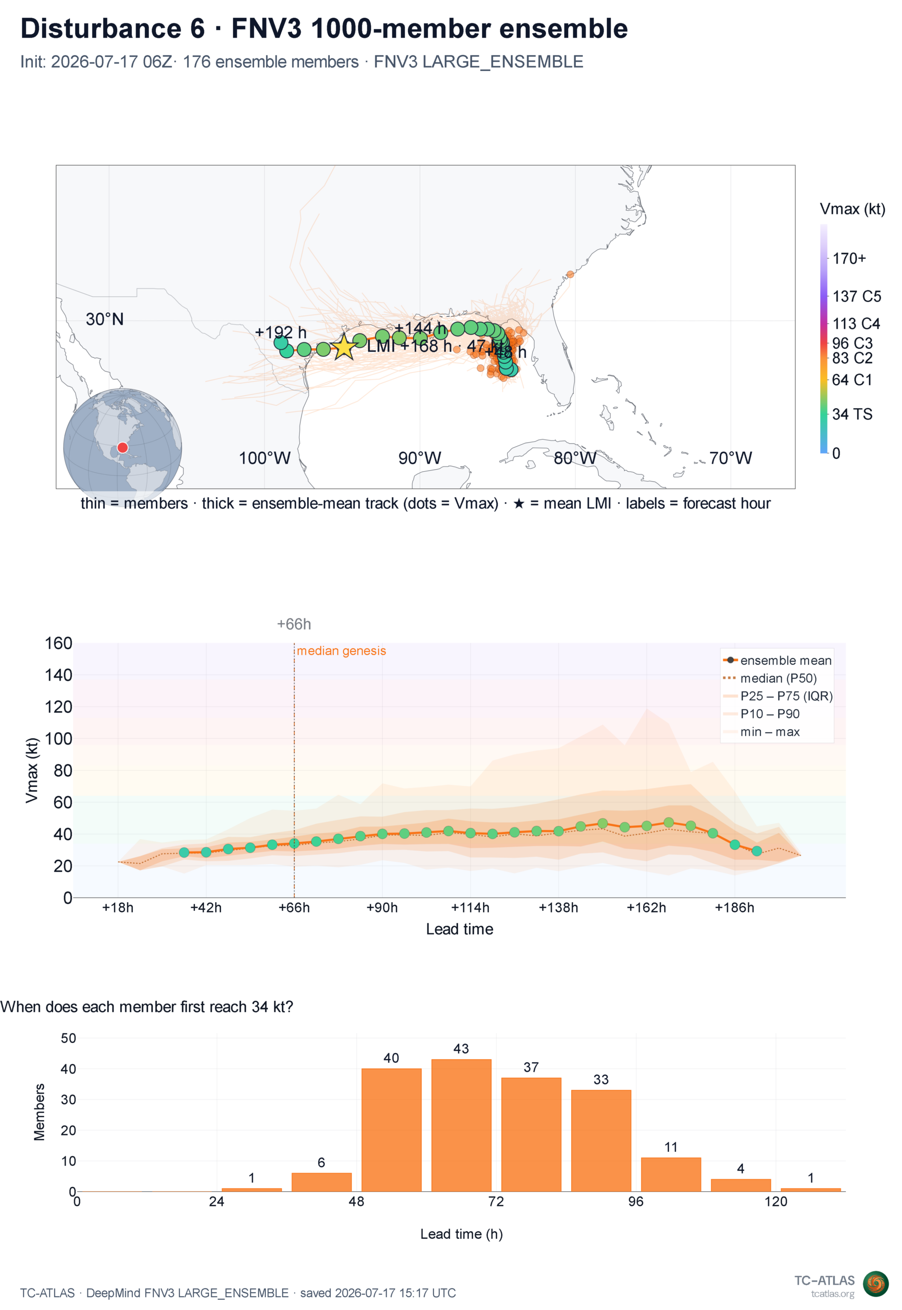
Of the 18 percent of members, most of them go to a strong depression or weak tropical storm at best. And that’s probably a longshot. What’s more likely is that we see a sloppy, rain-laden system over the northeast Gulf that perhaps drifts west and weakens. The NBM blend through Wednesday shows heavy rain off the coast of Florida, with locally heavy rain from Tampa into the Big Bend and Panhandle.
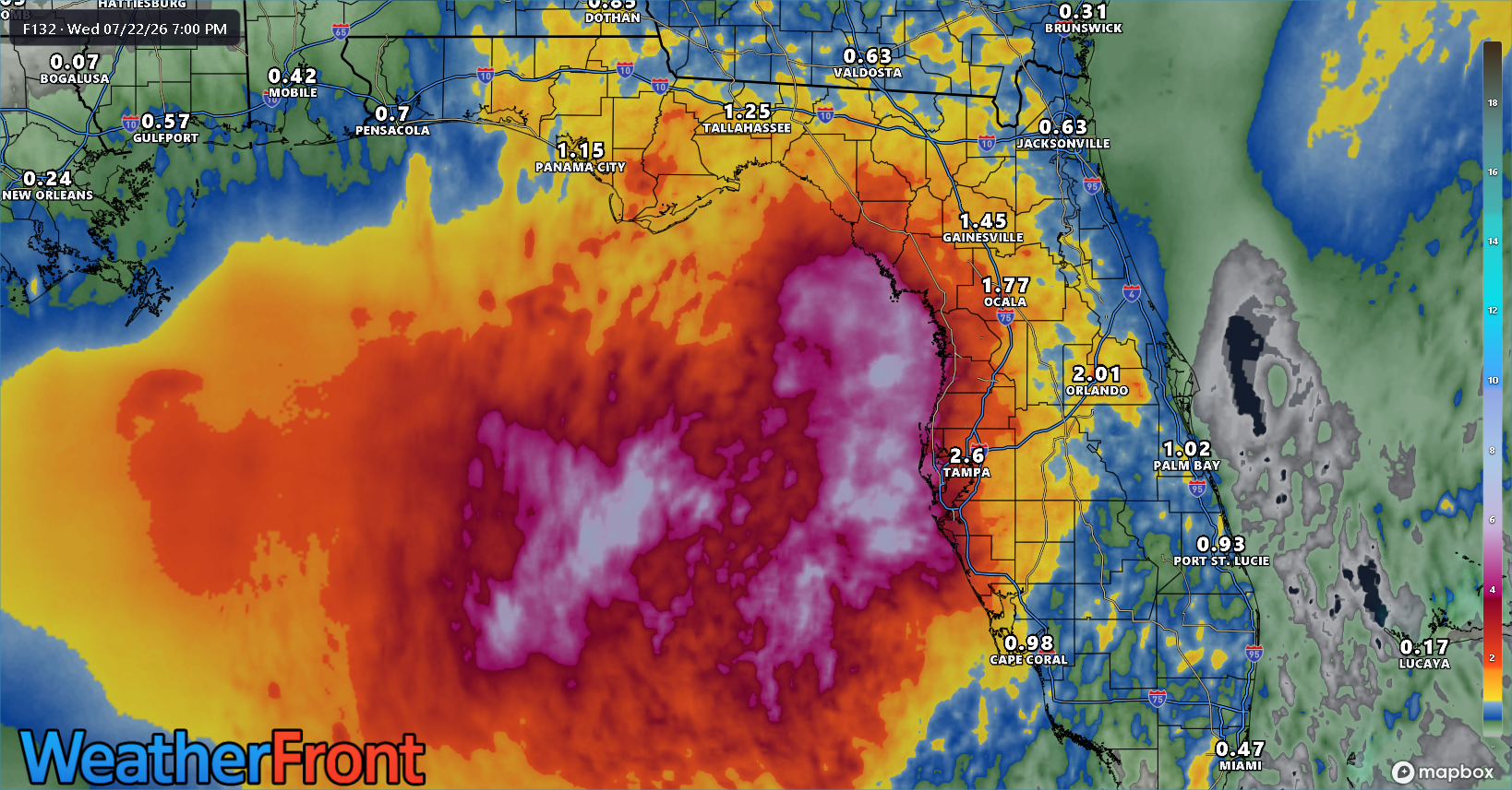
Rain would be generally welcome here, so all in all, this would probably be a good system on net.