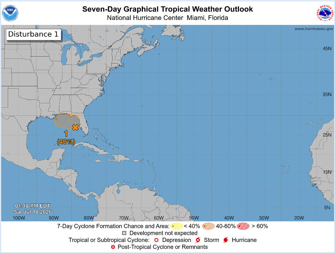
In brief: Odds of development in the northeast Gulf have increased a good bit since yesterday, however the likely intensity of any system still looks to remain low. We update the rain totals and potential impacts on this Saturday afternoon.
I just want to check in this afternoon, as we have seen some changes in the broader evolution of the Gulf disturbance off the coast of Florida. First, the satellite loop shows what may seem like a pretty well-defined circulation.
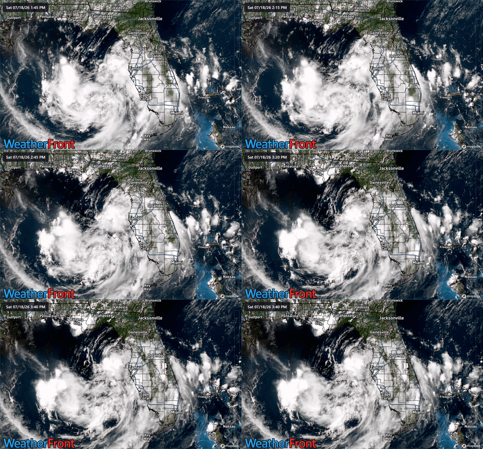
And there is, but the pressures are high, the winds are low, and the circulation is broad. So at this point, it’s not as if development is imminent. That being said, we’ve seen a big jump in development odds from the models since yesterday. What had been about 15 to 20 percent risk is now up to a 50 to 60 percent risk on Google’s Deep Mind 1,000 member ensemble.
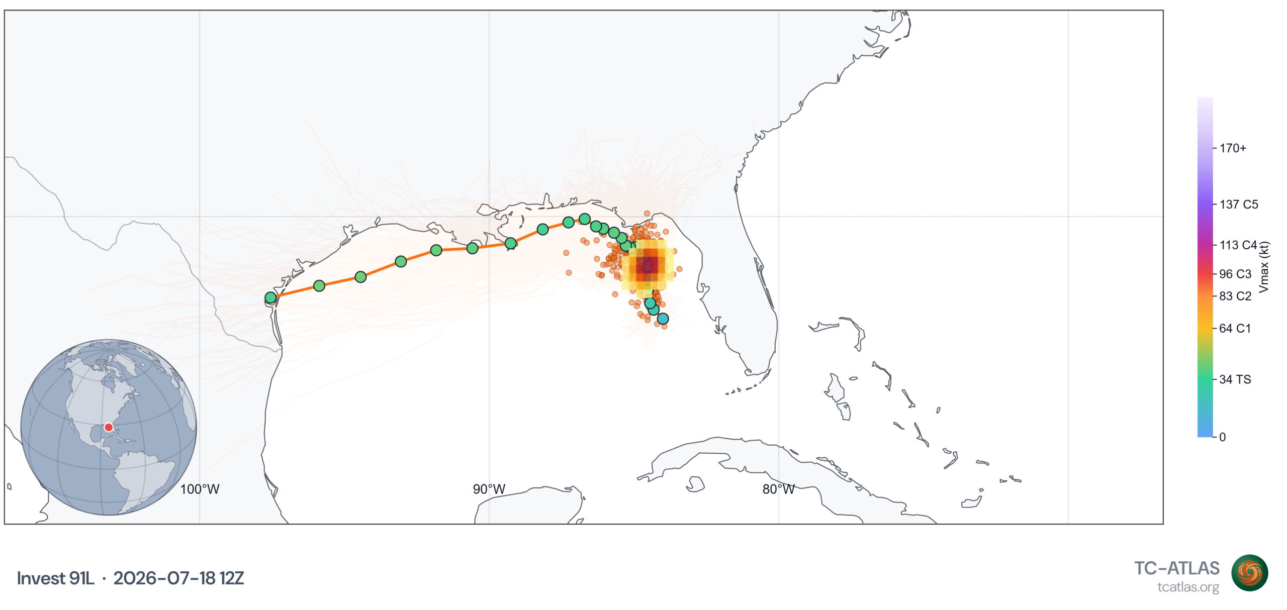
What has not changed since yesterday is that the system, now dubbed Invest 91L is unlikely to gain much strength. At this point, most model guidance keeps this as a depression or low-end tropical storm. What does that mean? The wind and marine threats, while impactful should be mostly nuisance. At this point even the rain looks to be more nuisance than anything as the bulk of it is expected to remain offshore through Wednesday.
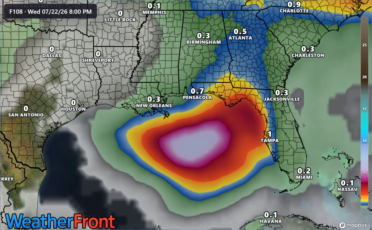
There may be some locally heavy downpours on the immediate Gulf Coast between Sarasota and New Orleans but overall the type of heavy, flooding rain would likely remain over the open Gulf waters.
Beyond midweek, the system is likely to basically fall apart or just nudge inland and dissipate, with some locally heavy rain perhaps in Louisiana or Mississippi as it does so. At this time, it does not appear to be a Texas threat.
Bottom line: Development chances are increasing today, but the ceiling for intensity on this system remains quite low, and the bulk of the rain is likely to fall over the open Gulf. Still, it’s the Gulf Coast in July. Check in with your local weather sources for any updates each day. We’ll keep you posted as well.