In brief: Today we discuss potential tropical mischief in the northeast Gulf next week, flooding in Hill Country in Texas that could worsen through tomorrow, and heat waves on both coasts.
Tropics update
Let’s start today with the tropics, which remain quiet. There have been rumblings on some models in the northeast Gulf this weekend or early next week.
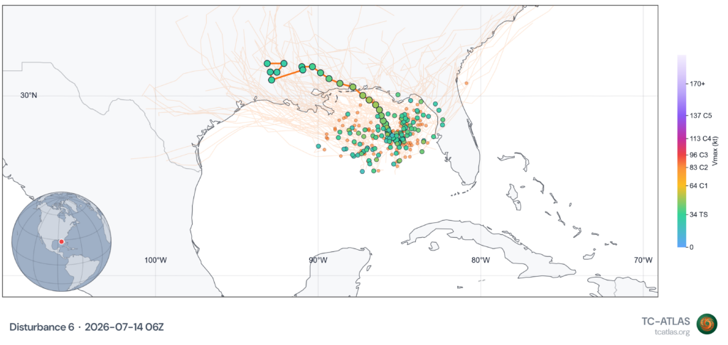
AI modeling has led the way on this, with Google Deep Mind’s 1,000 member ensemble getting up close to the 15 percent chance of development level at times. It seems that most model guidance today backed off things just a bit versus yesterday, which is perfectly reasonable. The culprit would likely be the tail of a decaying cold front. This is a common June and July development pathway, and given the ongoing broad hostility in the Atlantic basin, it may be the type of outcome that’s most likely to produce a tropical system this season. We colloquially call these types of systems “homebrew” ones, not because they form close to home but because sometimes one needs a little beer when forecasting the tropics.
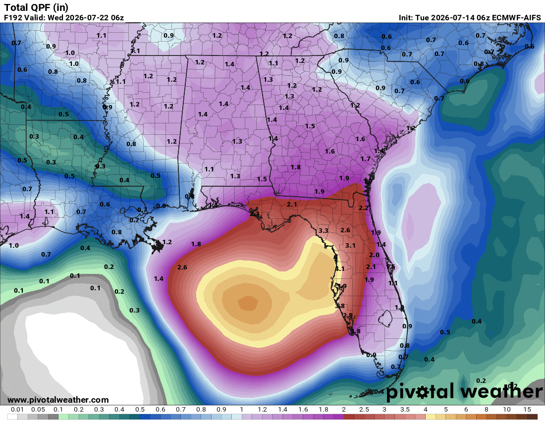
Either way, at this point, it appears this system will not be a major concern, although some heavy rain is possible in the Southeast heading into next week.
Texas flood
We have been covering the heavy rain and flooding potential in the Houston area over at Space City Weather. Meanwhile, the interior part of Texas has been slammed since yesterday.
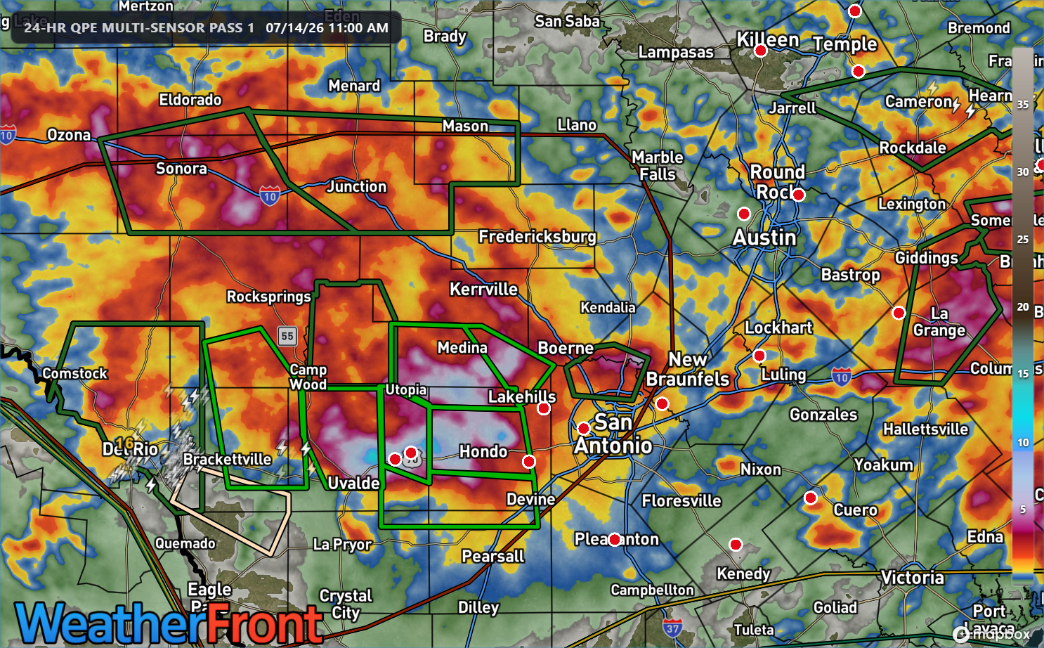
Rain totals so far have exceeded 10 inches in spots west of San Antonio and south of Kerrville. Numerous high water rescues have occurred in these areas. An additional couple inches of rain may fall as the circulation over Hill Country basically rains itself out.
Additional heavy rain is likely tonight and tomorrow. Some models are showing high (> 75%) probabilities of 5 inches of rain or more. Dangerous flash flooding is a possibility in the areas between Del Rio, Uvalde, San Antonio, and perhaps close to I-10 and south near Kerrville. A moderate risk for flash flooding is in place for both today and tomorrow (shown) for these areas.
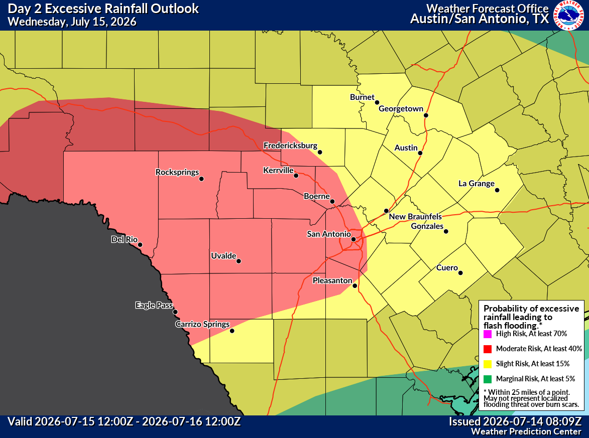
Obviously this area is extremely sensitive to flooding concerns after last year’s tragedy, but unfortunately flooding is a real part of life here and folks will want to pay close attention to how things evolve tonight and ensure they have a way to receive flood warnings in vulnerable areas.
Bring the heat
I am in New Jersey now, and I can assure you it’s going to get quite hot.
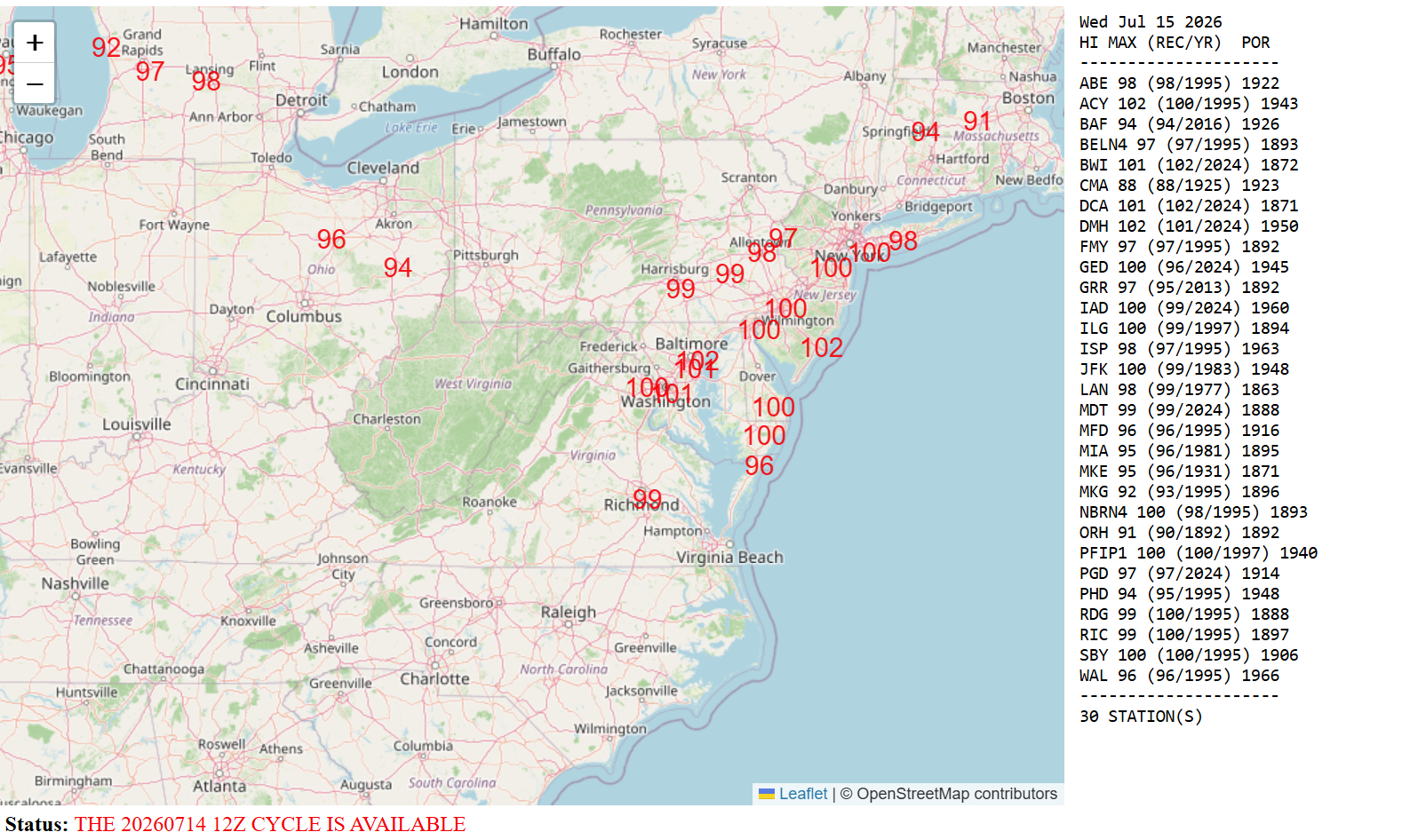
The current forecast high for Atlantic City Airport just inland from the seaside resort is expected to be 102 degrees on Wednesday, threatening a 100 degree record from 1995 (which was a very hot summer if I can recall correctly). Additionally, highs near 100 degrees are expected from Richmond north through New York City. Heat began today and will continue until Friday, another in a string of heat waves this summer in the Eastern U.S.
On the opposite side of the country, the first real intense heat of summer in SoCal kicks off today too. The LA Basin is under an extreme heat warning through Thursday.
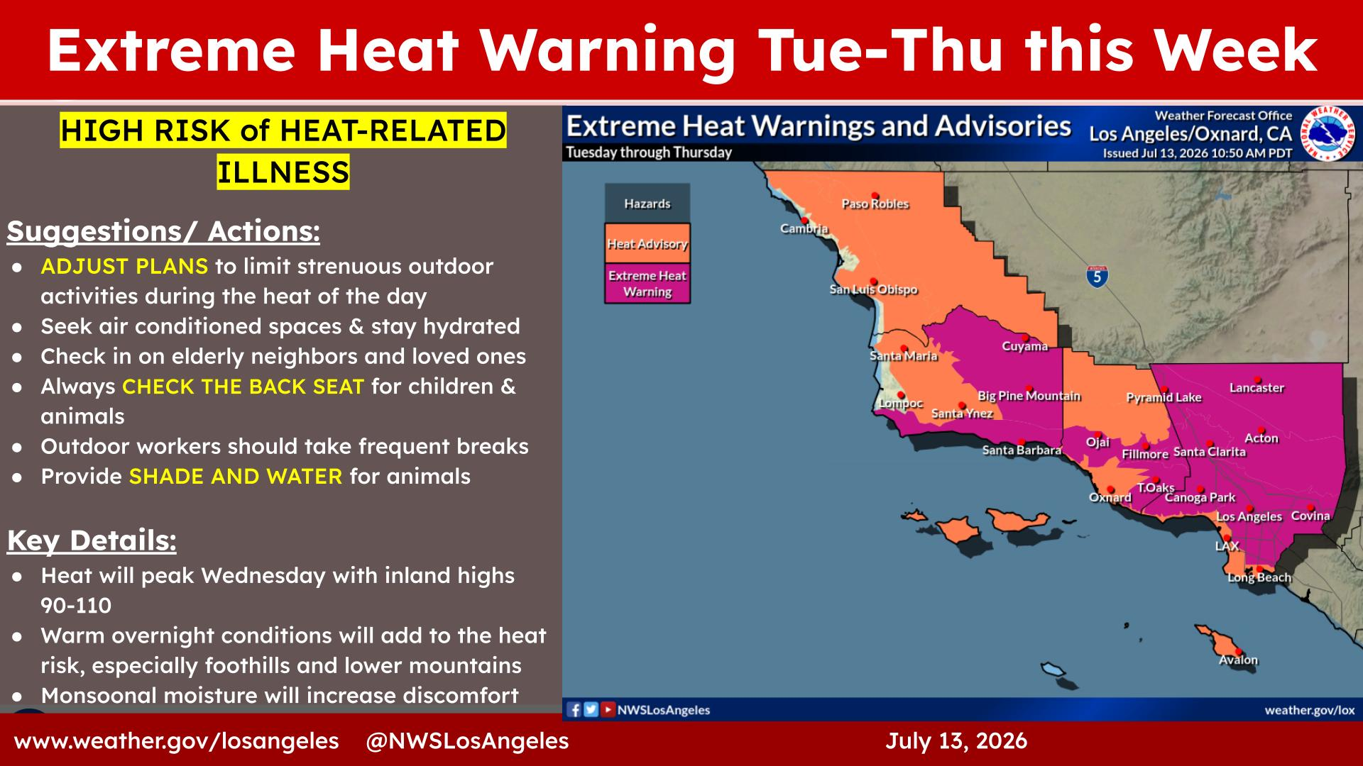
High temperatures will be over 100 degrees in some valleys (including the San Gabriel and San Fernando) and well into the 90s in Los Angeles proper. Much cooler at the coast where heat advisories are posted, with highs into the 80s expected.
Other notes
Monsoon storms have cranked up in the Southwest as expected this week. Some of the gust fronts ahead of these storms can produce massive dust storms, or haboobs that darken the skies over the Southwest. In Phoenix, Arizona State has also even established a rating scale for these events.
Large wildfires are burning in northern Minnesota, and the smoke from those fires will probably impact air quality across the Eastern U.S. and Canada in the coming days.