In brief: The tropics remain quiet, and the season continues to look as if it will be quiet. We take stock of the current situation. Flooding risks will be in the forecast once again for the Ohio Valley, Midwest, and Mid-South. We also check in on our one year anniversary on Substack. Thank you for your support!
Thank you again for your patience as I am mid-relocation from Houston, currently in Chicago where it’s rather hazy. Likely some lingering degree of wildfire smoke and typical “summer haze.” Whatever the case, look for a more typical posting regime to return next week.
Tropics check in
As of this morning, there is nothing doing in the tropics on the Atlantic side.
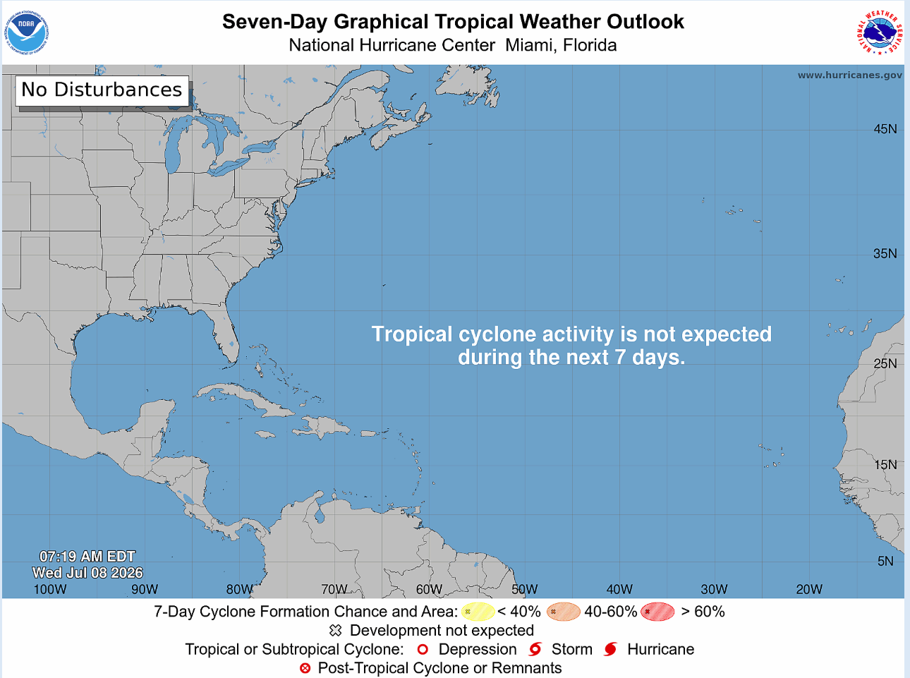
Again, this is not atypical per se for July, but it certainly adds to a body of evidence suggesting that this hurricane season will not be all that and a bag of chips. In fact, as of earlier this morning, the experts at Colorado State University dropped their latest seasonal forecast numbers, indicating 9 named storms (including Arthur), four hurricanes, and only one major hurricane. Their ACE forecast, or that of accumulated cyclone energy, is 50 for the season. If that were to verify, it would be the least active hurricane season since 2013.
All that is and would certainly be welcome news. The usual caveats apply here. First off, I think it’s worth noting that the Gulf is extremely warm for this time of year.
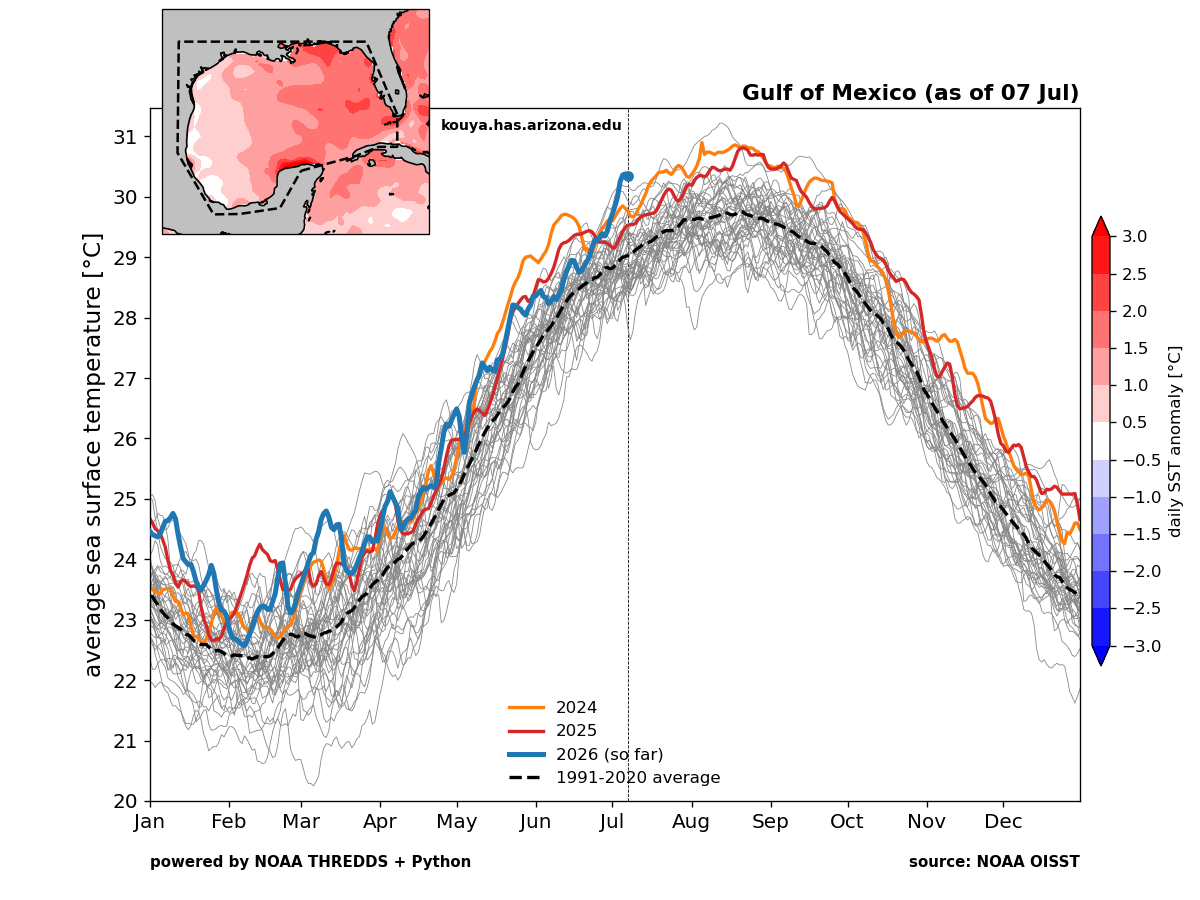
Warm SSTs alone will not generate tropical activity, but if we end up with a period of time where storm activity increases or has a brief window of healthy conditions, well then that could be an issue. Also, it is July 8th, and although we have one full month of hurricane season behind us, in terms of ACE, we still have 96.8 percent of hurricane season in front of us.
So what’s the logical takeaway? Yes, it looks like we’re trending toward a relatively weak season. El Nino is quite bulled up right now, and that will add above average wind shear to the equation. The deep Atlantic is cool, but the Gulf is warm. So it’s a hurricane season you still want to prepare for even if the odds strongly favor a pretty subdued one.
In the meantime, I don’t see anything of note over the next 7 to 10 days. Some models, including Google Deep Mind’s 1,000 member ensemble are showing low-risk of something off the Southeast coast, but as of right now, those odds are less than 10 percent and any system would likely track east out to sea.
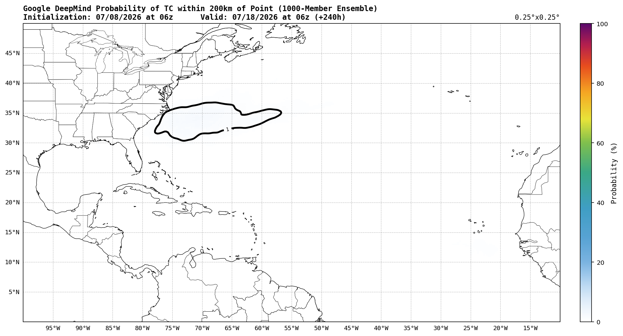
But aside from something lower-end there, I think we’re quiet for a bit longer.
One year on Substack!
First off, we just passed our 1-year anniversary on Substack. I want to thank our readers there, including the several thousand that have subscribed since last summer and the several hundred that have concluded they can also support us financially by subscribing. We sincerely appreciate your generosity and support for our efforts to keep people informed without scaring the daylights out of them. I have read more and more stories of what’s been happening in some other big media corners of the world, and I want to just double down on the fact that we feel an independently-driven site with a niche focus (tropics and extreme weather) is a big part of the equation for helping solve some of what ails the media landscape in 2026. We will continue to commit ourselves to writing our posts by hand, not generating them through AI. We continue to commit to this space being free of AI slop and running against the broader “enshittification” of online media. Above all, thank you for your support.
Flooding risks
There’s always flooding to talk about, but I want to just highlight a Midwest/Mid-South risk over the next few days. Flood watches are already posted for parts of Kentucky and the Ohio Valley, as several rounds of thunderstorms and heavy rain are likely the next few days. By Monday, an average of 2 to 4 inches of rain will likely occur between St. Louis and Knoxville, including Nashville, Evansville, and perhaps Louisville. Locally higher amounts are a safe bet in spots.
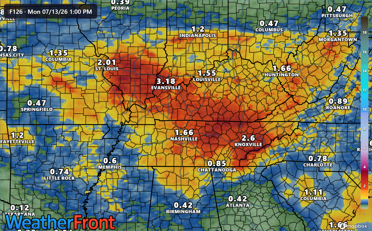
These areas have seen 200 to 300 percent of normal rainfall over the last month, so the combination of already saturated soils and additional heavy rain rates will likely lead to numerous instances of flash flooding. A weather story to be aware of.
After this weekend, the focus will shift to a reloading heat dome over the Northern Plains that should bring back hot weather to parts of the Midwest and Great Lakes, as well as thunderstorm risks on the northern periphery in Canada and perhaps down to New York and New England.